Cof Cymru: National Historic Assets of Wales · Wales
Tai Uncorn
Ffestiniog, Gwynedd, Wales
A Grade II listed building in Blaenau Ffestiniog, Ffestiniog, Gwynedd, designated on 1 February 1996.
The record
- Designation
- Listed building, Grade II
- Broad class
- Domestic
- Date of designation
- 1 February 1996
- Locality
- Blaenau Ffestiniog
- Community
- Ffestiniog
- Unitary authority
- Gwynedd
- Country
- Wales
- Coordinates
- 52.99593, -3.93381
- Cadw reference
- 16854
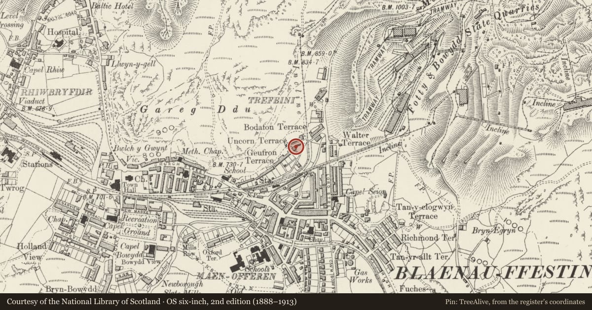
Slide toward Today to fade the historical sheet and see the modern map underneath.
David Rumsey Map Collection, Stanford LibrariesDavid Rumsey Map Collection, Stanford LibrariesDavid Rumsey Map Collection, Stanford LibrariesLlyfrgell Genedlaethol Cymru – The National Library of WalesDavid Rumsey Map Collection, Stanford Libraries
5 historical maps cover this location, the earliest the 1795 map "To Sir Watkin Williams-Wynn Bart ... the map of the six counties of North Wales is most humbly inscribed by his obedient humble servant" (Llyfrgell Genedlaethol Cymru – The National Library of Wales).
Historical maps covering this location
- 1795 · To Sir Watkin Williams-Wynn Bart ... the map of the six counties of North Wales is most… (Llyfrgell Genedlaethol Cymru – The National Library of Wales)
- 1883 · Watershed map England, Wales 3. (David Rumsey Map Collection, Stanford Libraries)
- 1896 · Sheet 7. Ordnance Survey of England and Wales. (David Rumsey Map Collection, Stanford Libraries)
- 1899 · 119 Snowdon (Hills) (David Rumsey Map Collection, Stanford Libraries)
- 1901 · Sheet 9 and 10. (David Rumsey Map Collection, Stanford Libraries)
Cadw's description
Location
Set back behind a low walled garden on a slight rise at the NE end of the street.
History
c1810 centralised domestic block built by Lord Newborough as a complex of 4 quarryman's dwellings built around a shared central stack in the manner of a cluster house. As such this represents probably the earliest surviving domestic building relating to Ffestiniog's famous slate industry. With a later C19 extension to the E and for some time converted into 2 cottages.
Exterior
Square, single-storey building of rubble block construction and with shaved corners; rock foundations to the NE. Pyramidal slate roof with rounded corners and over- sailing eaves; large, squat stack with weather-coursing and cornice; modern cement flaunching. The original entrances were on the S face (2 ) and to the E and W faces (one each). That to the former is obscured by a later C19 single-storey pitched slate roofed extension; modern doors to the remainder. Simple window openings to the side of the entrances with modern glazing.
Interior
The interiors have been modernised, though ladder access to an attic sleeping loft was formerly in evidence (information from the owner).
Reason for designation
A highly individual example of early C19 economic unit planning .
Nearby in the register
- Tai UncornDomesticunder 1 mi
- Former Diffwys Railway Station (now public toilets)Miscellaneousunder 1 mi
- Masonic HallMiscellaneousunder 1 mi
- 59 High StreetDomesticunder 1 mi
Other entries of the same register within about three miles of this one, by straight line.