Cof Cymru: National Historic Assets of Wales · Wales
Craigbach
Ffestiniog, Gwynedd, Wales
A Grade II listed building in Blaenau Ffestiniog, Ffestiniog, Gwynedd, designated on 1 February 1996.
The record
- Designation
- Listed building, Grade II
- Broad class
- Domestic
- Date of designation
- 1 February 1996
- Locality
- Blaenau Ffestiniog
- Community
- Ffestiniog
- Unitary authority
- Gwynedd
- Country
- Wales
- Coordinates
- 52.99539, -3.94084
- Cadw reference
- 16849
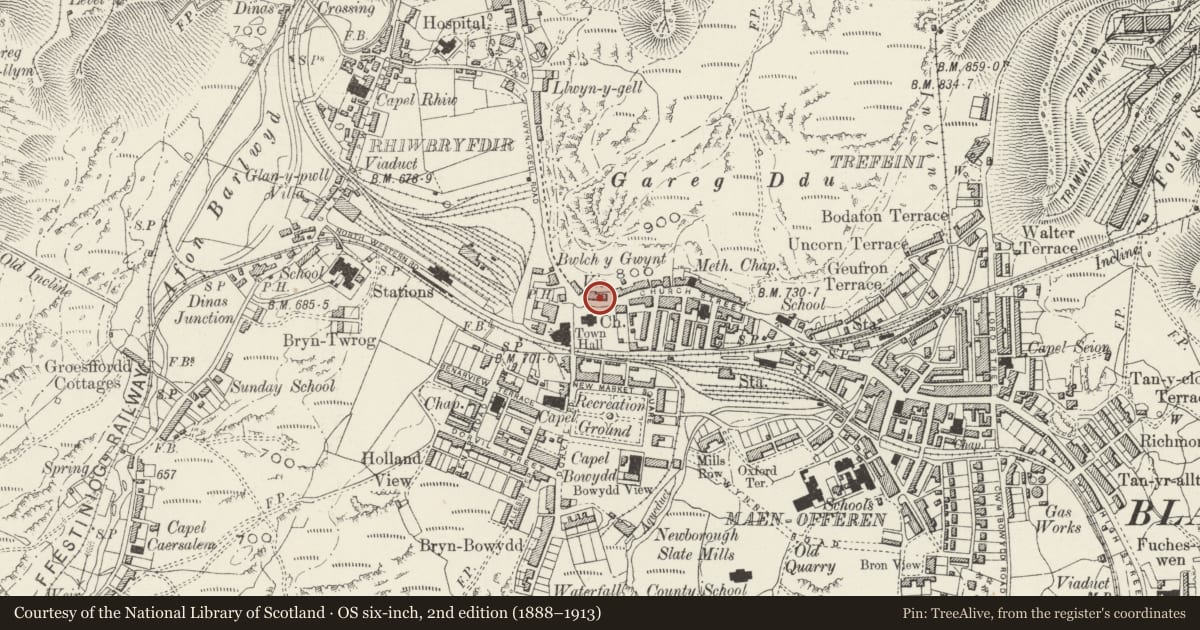
Slide toward Today to fade the historical sheet and see the modern map underneath.
David Rumsey Map Collection, Stanford LibrariesDavid Rumsey Map Collection, Stanford LibrariesDavid Rumsey Map Collection, Stanford LibrariesLlyfrgell Genedlaethol Cymru – The National Library of WalesDavid Rumsey Map Collection, Stanford Libraries
5 historical maps cover this location, the earliest the 1795 map "To Sir Watkin Williams-Wynn Bart ... the map of the six counties of North Wales is most humbly inscribed by his obedient humble servant" (Llyfrgell Genedlaethol Cymru – The National Library of Wales).
Historical maps covering this location
- 1795 · To Sir Watkin Williams-Wynn Bart ... the map of the six counties of North Wales is most… (Llyfrgell Genedlaethol Cymru – The National Library of Wales)
- 1883 · Watershed map England, Wales 3. (David Rumsey Map Collection, Stanford Libraries)
- 1896 · Sheet 7. Ordnance Survey of England and Wales. (David Rumsey Map Collection, Stanford Libraries)
- 1899 · 119 Snowdon (Hills) (David Rumsey Map Collection, Stanford Libraries)
- 1901 · Sheet 9 and 10. (David Rumsey Map Collection, Stanford Libraries)
Cadw's description
Location
On the street line opposite St. David's Church.
Exterior
c1845, extended later C19. 2 storey 3 bay cottage with flush added bay to R. Snecked rubble construction under a slate roof with oversailing eaves. Symmetrical primary section with central entrance, stepped-up; early C20 part-glazed door and 4-pane rectangular fanlight. Wooden pedimented porch canopy on simple brackets. Large flanking sash windows to ground floor with 8-pane glazing above plain lower sashes, the latter replacements; narrow plastered architraves and whitened reveals. Similar, though smaller windows to the first floor, with 6-pane upper sections. The added one-window bay to the R has identical windows. A plain chimney with weather-coursing marks the division between the primary block and the addition; this is further expressed by a masonry break on the facade.
Reason for designation
Included for group value with the former vicarage adjoining.
Nearby in the register
- Former VicarageDomesticunder 1 mi
- Old Market HallCivilunder 1 mi
- Masonic HallMiscellaneousunder 1 mi
- Former Diffwys Railway Station (now public toilets)Miscellaneousunder 1 mi
Other entries of the same register within about three miles of this one, by straight line.