Cof Cymru: National Historic Assets of Wales · Wales
Powis Estate Sawmill with cast-iron launder
Welshpool, Powys, Wales
A Grade II* listed building in Powis Estate Timberyard, Welshpool, Powys, designated on 29 February 1996.
The record
- Designation
- Listed building, Grade II*
- Broad class
- Industrial
- Date of designation
- 29 February 1996
- Locality
- Powis Estate Timberyard
- Community
- Welshpool
- Unitary authority
- Powys
- Country
- Wales
- Coordinates
- 52.64486, -3.15185
- Cadw reference
- 16797
Slide toward Today to fade the historical sheet and see the modern map underneath.
David Rumsey Map Collection, Stanford LibrariesDavid Rumsey Map Collection, Stanford LibrariesDavid Rumsey Map Collection, Stanford LibrariesDavid Rumsey Map Collection, Stanford LibrariesLlyfrgell Genedlaethol Cymru – The National Library of Wales
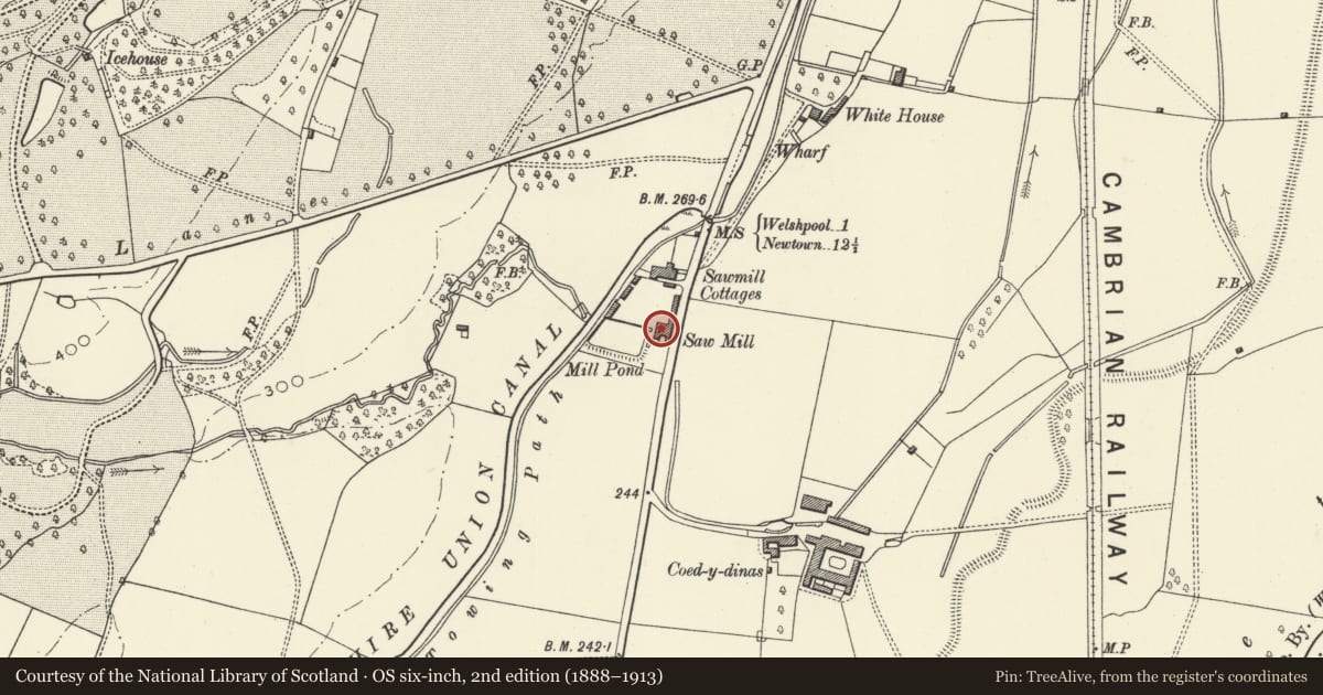
5 historical maps cover this location, the earliest the 1795 map "To Sir Watkin Williams-Wynn Bart ... the map of the six counties of North Wales is most humbly inscribed by his obedient humble servant" (Llyfrgell Genedlaethol Cymru – The National Library of Wales).
Historical maps covering this location
- 1795 · To Sir Watkin Williams-Wynn Bart ... the map of the six counties of North Wales is most… (Llyfrgell Genedlaethol Cymru – The National Library of Wales)
- 1883 · Watershed map England, Wales 3. (David Rumsey Map Collection, Stanford Libraries)
- 1899 · 151 Welshpool (Hills) (David Rumsey Map Collection, Stanford Libraries)
- 1901 · Sheet 9 and 10. (David Rumsey Map Collection, Stanford Libraries)
- 1916 · Sheet 60. Shrewsbury. (David Rumsey Map Collection, Stanford Libraries)
Cadw's description
Location
Alongside the road 1.6km approx. S of Welshpool.
History
The saw-mill was probably built c1820-1830, and was water-powered from a stream taken under the Montgomeryshire Canal by an inverted syphon, and from the canal itself. The cast-iron feed trough was installed in 1844, made by R & W Jones of Ruabon. The mill was re-equipped in the 1890's, and the present horizontal saw was installed at that time (supplied by Robinson's of Rochdale): in order to accommodate it, the mill was extended with a short wing on the S side. Water-power continued to be used at the mill until 1949, when electrical power was introduced.
Exterior
Thin-coursed local sandstone rubble, with slate roof. 3 storeyed (including basement stgorey), 6-window range, aligned at right-angles to the boundary wall. Basement storey entrance towards left in N elevation. Small-paned iron windows with cambered heads throughout. Wide gable-end entrance with wide double doors and loading door over, in heavy wood frames and separated a chamfered lintel. Overshot water wheel (cast-iron and wood) on S side, fed via a cast-iron launder enriched with cast figures of animals, pelple, etc. Gabled wing projects from S side, added to house the horizontal saw installed c1890.
Interior
Although remnants of the original power system (a pit-wheel drive) survive, most of the basement water-power machinery dates from the 1890's re-equipping: two toothed wheels transferred power onto the main belt-drive-shaft with a chain. Late C19 machinery surviving in the upper floors of the mill includes a large horizontal saw with log wagon, and a circular saw-bench.
Reason for designation
A remarkably complete - and very rare - survival of a working C19 saw-mill.
Nearby in the register
- Wagon shed, cement store and boundary wall to timber yardIndustrialunder 1 mi
- No 2 Timber-yard CottagesDomesticunder 1 mi
- Blacksmith's shop, office and stores at Powis Estate Timber Yard, with boundary wall to yard.Industrialunder 1 mi
- No 1 Timber-yard CottagesDomesticunder 1 mi
Other entries of the same register within about three miles of this one, by straight line.