Cof Cymru: National Historic Assets of Wales · Wales
Cabin Lock
Welshpool, Powys, Wales
A Grade II listed building in Pool Quay, Welshpool, Powys, designated on 29 February 1996.
The record
- Designation
- Listed building, Grade II
- Broad class
- Transport
- Date of designation
- 29 February 1996
- Locality
- Pool Quay
- Community
- Welshpool
- Unitary authority
- Powys
- Country
- Wales
- Coordinates
- 52.70455, -3.09972
- Cadw reference
- 16764
Slide toward Today to fade the historical sheet and see the modern map underneath.
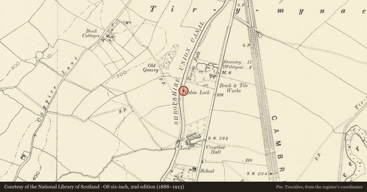
David Rumsey Map Collection, Stanford LibrariesDavid Rumsey Map Collection, Stanford LibrariesDavid Rumsey Map Collection, Stanford LibrariesDavid Rumsey Map Collection, Stanford LibrariesLlyfrgell Genedlaethol Cymru – The National Library of Wales
5 historical maps cover this location, the earliest the 1795 map "To Sir Watkin Williams-Wynn Bart ... the map of the six counties of North Wales is most humbly inscribed by his obedient humble servant" (Llyfrgell Genedlaethol Cymru – The National Library of Wales).
Historical maps covering this location
- 1795 · To Sir Watkin Williams-Wynn Bart ... the map of the six counties of North Wales is most… (Llyfrgell Genedlaethol Cymru – The National Library of Wales)
- 1883 · Watershed map England, Wales 3. (David Rumsey Map Collection, Stanford Libraries)
- 1899 · 151 Welshpool (Hills) (David Rumsey Map Collection, Stanford Libraries)
- 1901 · Sheet 9 and 10. (David Rumsey Map Collection, Stanford Libraries)
- 1916 · Sheet 60. Shrewsbury. (David Rumsey Map Collection, Stanford Libraries)
Cadw's description
Location
On the Montgomeryshire Canal between Crowther Hall and Bank Locks.
Exterior
History: The Eastern Branch of the Montgomeryshire Canal was built between 1794 and 1797, engineered by John and Thomas Dadford. Between 1819 and 1831, G.W.Buck was engineer to the Montgomeryshire Canal Eastern Branch, and introduced a distinctive system of lock ground-sluice control in 1831: these remain in situ at this lock. Subsequent work on the canal included an extensive programme carried out by the Shropshire Union Canal and Railway Company in the 1880's and 1890's, and it is likely that the lock, while part of the original engineering of the canal, was substantially rebuilt or repaired at that time.
Description: Blue brick-lined lock chamber, with stone copings. Timber gates. Cast-iron lock ground-sluice controls, introduced by G.W.Buck.
Listed as an integral part of the engineering of the Montgomeryshire Canal.
Nearby in the register
- Crowther HallDomesticunder 1 mi
- Bridge 110 over the Montgomeryshire CanalTransportunder 1 mi
- Lock Cottage at Crowther Hall LockTransportunder 1 mi
- Crowther Hall LockTransportunder 1 mi
Other entries of the same register within about three miles of this one, by straight line.