Cof Cymru: National Historic Assets of Wales · Wales
Stone building at Coed-y-dinas
Welshpool, Powys, Wales
A Grade II listed building in Coed-y-dinas, Welshpool, Powys, designated on 29 February 1996.
The record
- Designation
- Listed building, Grade II
- Broad class
- Agriculture and Subsistence
- Date of designation
- 29 February 1996
- Locality
- Coed-y-dinas
- Community
- Welshpool
- Unitary authority
- Powys
- Country
- Wales
- Coordinates
- 52.64198, -3.14903
- Cadw reference
- 16758
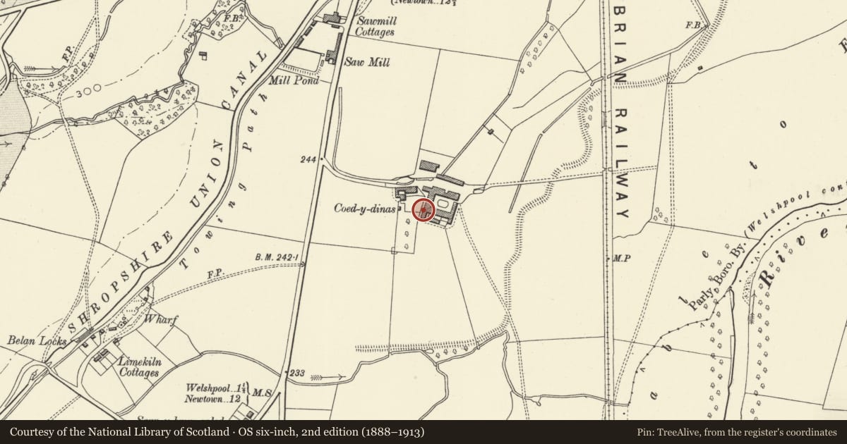
Slide toward Today to fade the historical sheet and see the modern map underneath.
David Rumsey Map Collection, Stanford LibrariesDavid Rumsey Map Collection, Stanford LibrariesDavid Rumsey Map Collection, Stanford LibrariesDavid Rumsey Map Collection, Stanford LibrariesLlyfrgell Genedlaethol Cymru – The National Library of Wales
5 historical maps cover this location, the earliest the 1795 map "To Sir Watkin Williams-Wynn Bart ... the map of the six counties of North Wales is most humbly inscribed by his obedient humble servant" (Llyfrgell Genedlaethol Cymru – The National Library of Wales).
Historical maps covering this location
- 1795 · To Sir Watkin Williams-Wynn Bart ... the map of the six counties of North Wales is most… (Llyfrgell Genedlaethol Cymru – The National Library of Wales)
- 1883 · Watershed map England, Wales 3. (David Rumsey Map Collection, Stanford Libraries)
- 1899 · 151 Welshpool (Hills) (David Rumsey Map Collection, Stanford Libraries)
- 1901 · Sheet 9 and 10. (David Rumsey Map Collection, Stanford Libraries)
- 1916 · Sheet 60. Shrewsbury. (David Rumsey Map Collection, Stanford Libraries)
Cadw's description
Location
Forms a S extension to the main W range of the farmyard.
Exterior
History: Coed-y-dinas was a home-farm of the Powis Estate by the mid C19. This building is probably c1840. Of unusual design, its original purpose is not known.
Exterior: Rough random local sandstone rubble with slate roof. 3 storeys, 6 windows to 2nd floor, 7 to first in W elevation (with simple voussoir heads), with entrance at right-hand end on first floor, via external steps. Ground floor of this elevation largely blind, with a single entrance to left of centre. E elevation has series of 8 low wide segmental-headed arched openings at floor level, with keystones in voussoir heads. 6 windows on each upper floor, with simple voussoir heads. Loading door in S gable of upper storey.
Interior: Intermediate floor has been removed, but upper floor retains king-post trusses with cambered tie-beams; remains of wooden hoist-wheel at gable end loading door.
Nearby in the register
- Cowsheds at Coed-y-dinasAgriculture and Subsistenceunder 1 mi
- Barn and Granary Range at Coed-y-dinasAgriculture and Subsistenceunder 1 mi
- Coed-y-dinas FarmhouseDomesticunder 1 mi
- Eastern Cartshed at Coed-y-dinasAgriculture and Subsistenceunder 1 mi
Other entries of the same register within about three miles of this one, by straight line.