Cof Cymru: National Historic Assets of Wales · Wales
Rose House
Welshpool, Powys, Wales
A Grade II listed building in Belan, Welshpool, Powys, designated on 29 February 1996.
The record
- Designation
- Listed building, Grade II
- Broad class
- Domestic
- Date of designation
- 29 February 1996
- Locality
- Belan
- Community
- Welshpool
- Unitary authority
- Powys
- Country
- Wales
- Coordinates
- 52.63575, -3.16645
- Cadw reference
- 16750
Slide toward Today to fade the historical sheet and see the modern map underneath.
David Rumsey Map Collection, Stanford LibrariesDavid Rumsey Map Collection, Stanford LibrariesDavid Rumsey Map Collection, Stanford LibrariesDavid Rumsey Map Collection, Stanford LibrariesLlyfrgell Genedlaethol Cymru – The National Library of Wales
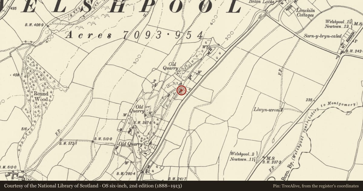
5 historical maps cover this location, the earliest the 1795 map "To Sir Watkin Williams-Wynn Bart ... the map of the six counties of North Wales is most humbly inscribed by his obedient humble servant" (Llyfrgell Genedlaethol Cymru – The National Library of Wales).
Historical maps covering this location
- 1795 · To Sir Watkin Williams-Wynn Bart ... the map of the six counties of North Wales is most… (Llyfrgell Genedlaethol Cymru – The National Library of Wales)
- 1883 · Watershed map England, Wales 3. (David Rumsey Map Collection, Stanford Libraries)
- 1899 · 151 Welshpool (Hills) (David Rumsey Map Collection, Stanford Libraries)
- 1901 · Sheet 9 and 10. (David Rumsey Map Collection, Stanford Libraries)
- 1916 · Sheet 60. Shrewsbury. (David Rumsey Map Collection, Stanford Libraries)
Cadw's description
Location
At the end of the lane, immediately to the rear of Rosebank, above the Montgomeryshire Canal
Exterior
History: The building is reputed to have been dated 1617 on an internal timber (now removed): the tradition of timber framing is consistent with a C17 date.
Exterior: Box framed in square panels with queen post truss to gable; render (possibly over wattle and daub) to panel infil; stone plinth. Corrugated iron roof over thatch some of which survives. Brick axial stack. Single storey and attic, a small 2-unit plan with central entrance. Plank doorway with lean-to porch hood, flanked by horizontally sliding sash windows with small panes. Single dormer in the roof has wide verges to gable, and a 2-light casement window. Small stone outshut to rear.
A remarkable survival of a very small vernacular cottage.
Nearby in the register
- Corner HouseDomesticunder 1 mi
- Bridge 122 over the Montgomeryshire CanalTransportunder 1 mi
- Cursus, Llwyn-Wron (revealed by aerial photography)Cursusunder 1 mi
- Bridge 121 over the Montgomeryshire CanalTransportunder 1 mi
Other entries of the same register within about three miles of this one, by straight line.