Cof Cymru: National Historic Assets of Wales · Wales
7 Union Street
Welshpool, Powys, Wales
A Grade II listed building in Welshpool, Powys, designated on 11 March 1981.
The record
- Designation
- Listed building, Grade II
- Broad class
- Domestic
- Date of designation
- 11 March 1981
- Locality
- Welshpool
- Community
- Welshpool
- Unitary authority
- Powys
- Country
- Wales
- Coordinates
- 52.66105, -3.14761
- Cadw reference
- 16735
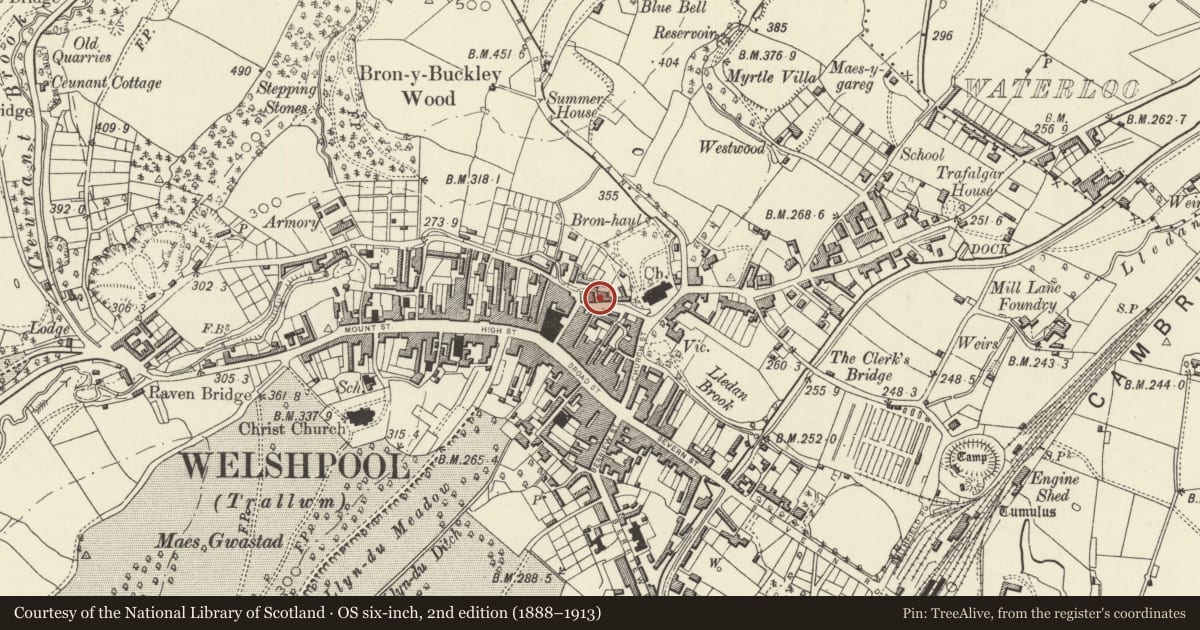
Slide toward Today to fade the historical sheet and see the modern map underneath.
David Rumsey Map Collection, Stanford LibrariesDavid Rumsey Map Collection, Stanford LibrariesDavid Rumsey Map Collection, Stanford LibrariesDavid Rumsey Map Collection, Stanford LibrariesLlyfrgell Genedlaethol Cymru – The National Library of Wales
5 historical maps cover this location, the earliest the 1795 map "To Sir Watkin Williams-Wynn Bart ... the map of the six counties of North Wales is most humbly inscribed by his obedient humble servant" (Llyfrgell Genedlaethol Cymru – The National Library of Wales).
Historical maps covering this location
- 1795 · To Sir Watkin Williams-Wynn Bart ... the map of the six counties of North Wales is most… (Llyfrgell Genedlaethol Cymru – The National Library of Wales)
- 1883 · Watershed map England, Wales 3. (David Rumsey Map Collection, Stanford Libraries)
- 1899 · 151 Welshpool (Hills) (David Rumsey Map Collection, Stanford Libraries)
- 1901 · Sheet 9 and 10. (David Rumsey Map Collection, Stanford Libraries)
- 1916 · Sheet 60. Shrewsbury. (David Rumsey Map Collection, Stanford Libraries)
Cadw's description
Exterior
History: Nos 7-8 are a pair of early C19 houses (a datestone - probably re-sited - on the rear wing of No 7 is dated 1829); No 6 may be an earlier building, and is a single-celled shop, now disused.
Description: Nos 7-8 are brick with slate roof. Axial stack, and side gable stack towards rear to left. 3 storeys, symmetrically planned with outer entrances, each a single window range. 4-panelled doors in shallow wooden porches with elliptical heads. 12-pane sash windows (in a canted bay window to ground floor of No 7) on each floor, 6-pane sashes in second storey. All windows have painted flat-arched heads. No 6 is a single storeyed building set back from No 7: timber framed and rubble, with slate roof, carried forward to form a covered yard, on turned wood posts. Single doorway and shop-window, closed by a panelled shutter.
A simple urban vernacular pair, together with an early shop building of considerable character.
Nearby in the register
- 8 Union StreetDomesticunder 1 mi
- 6 Union StreetDomesticunder 1 mi
- 5 Hall StreetCommercialunder 1 mi
- 6 Hall StreetDomesticunder 1 mi
Other entries of the same register within about three miles of this one, by straight line.