Cof Cymru: National Historic Assets of Wales · Wales
22 Broad Street
Welshpool, Powys, Wales
A Grade II listed building in Welshpool, Powys, designated on 19 November 1963.
The record
- Designation
- Listed building, Grade II
- Broad class
- Domestic
- Date of designation
- 19 November 1963
- Locality
- Welshpool
- Community
- Welshpool
- Unitary authority
- Powys
- Country
- Wales
- Coordinates
- 52.65974, -3.14723
- Cadw reference
- 16616
Slide toward Today to fade the historical sheet and see the modern map underneath.
David Rumsey Map Collection, Stanford LibrariesDavid Rumsey Map Collection, Stanford LibrariesDavid Rumsey Map Collection, Stanford LibrariesDavid Rumsey Map Collection, Stanford LibrariesLlyfrgell Genedlaethol Cymru – The National Library of Wales
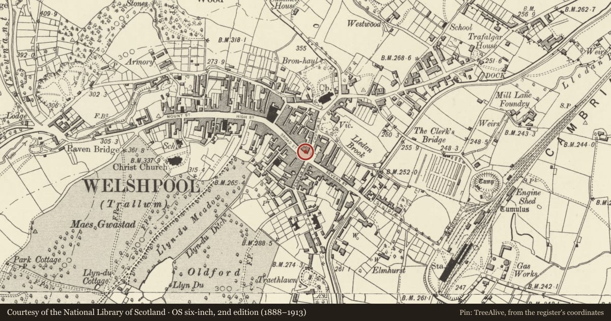
5 historical maps cover this location, the earliest the 1795 map "To Sir Watkin Williams-Wynn Bart ... the map of the six counties of North Wales is most humbly inscribed by his obedient humble servant" (Llyfrgell Genedlaethol Cymru – The National Library of Wales).
Historical maps covering this location
- 1795 · To Sir Watkin Williams-Wynn Bart ... the map of the six counties of North Wales is most… (Llyfrgell Genedlaethol Cymru – The National Library of Wales)
- 1883 · Watershed map England, Wales 3. (David Rumsey Map Collection, Stanford Libraries)
- 1899 · 151 Welshpool (Hills) (David Rumsey Map Collection, Stanford Libraries)
- 1901 · Sheet 9 and 10. (David Rumsey Map Collection, Stanford Libraries)
- 1916 · Sheet 60. Shrewsbury. (David Rumsey Map Collection, Stanford Libraries)
Cadw's description
Location
On the corner with Church Street.
History
The building is dated 1736, and was probably built by a local family, the Lloyds of Henllan. Although a single building, it was occupied as 2 until the late C19. By 1745 No 22 was occupied by a pharmacist, and later in the C18, by a grocer. It remained thereafter in continuous commercial use as a grocers' shop, incorporating No 21 in 1880. The adjacent buildings on Church Street appear to have been associated with it as warehousing from at least the early C19.
Exterior
Render over brick, with hipped slate roof, rear axial and end wall stacks. Late C19 photographs show the building with exposed brickwork and stone dressings including angle quoins - these now form the stressed angle pilasters. 3 storeys with attic, 4-window range, articulated by corner and central pilasters. Late C19 shop front occupying ground floor, with 2 entrances flanked by 3 tall bow windows, with side mirror strips enriched coloured decoration of birds, flowers etc. Continuous moulded fascia. 12-pane sash windows on each floor above, with cambered heads. String course over first floor, and central pilaster, together panelling the facade. Modillion eaves cornice, and 2 hipped dormers with 6-pane sash windows within the roof. 4-window return range to Church Street is also panelled by pilaster strips. It has disused doorway in moulded architrave to ground floor, and similar windows on upper storeys (the corner and third windows blind). 3 hipped dormers in the roof.
Reason for designation
A very fine early C18 town house retaining much of its original external character, which is also of particular interest for the high quality of its late C19 shop front.
Nearby in the register
- 21 Broad StreetDomesticunder 1 mi
- 2 Church StreetDomesticunder 1 mi
- 3 Church StreetCommercialunder 1 mi
- Coach ChambersDomesticunder 1 mi
Other entries of the same register within about three miles of this one, by straight line.