Cof Cymru: National Historic Assets of Wales · Wales
Corn Mill
Castlemartin, Pembrokeshire, Wales
A Grade II listed building in Kings Mill, Castlemartin, Pembrokeshire, designated on 8 December 1995.
The record
- Designation
- Listed building, Grade II
- Broad class
- Industrial
- Date of designation
- 8 December 1995
- Locality
- Kings Mill
- Community
- Castlemartin
- Unitary authority
- Pembrokeshire
- Country
- Wales
- Coordinates
- 51.64843, -5.00159
- Cadw reference
- 16585
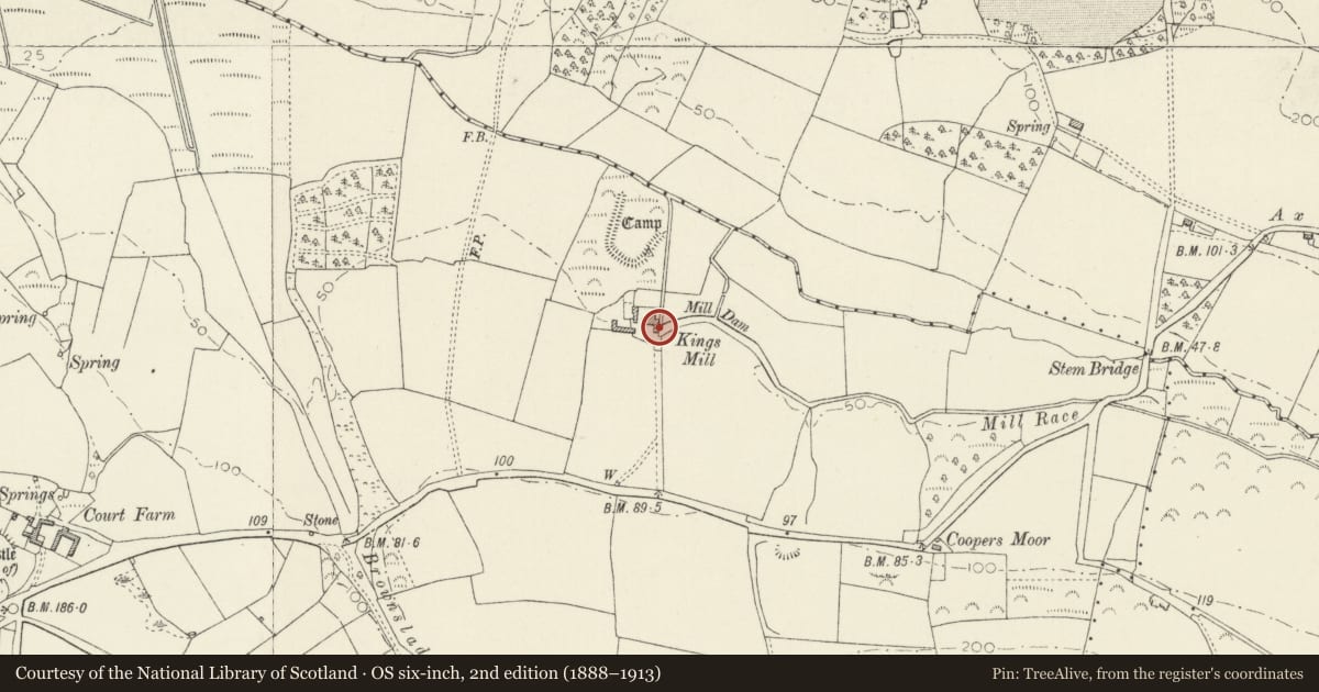
Slide toward Today to fade the historical sheet and see the modern map underneath.
David Rumsey Map Collection, Stanford LibrariesDavid Rumsey Map Collection, Stanford LibrariesDavid Rumsey Map Collection, Stanford LibrariesDavid Rumsey Map Collection, Stanford LibrariesDavid Rumsey Map Collection, Stanford Libraries
5 historical maps cover this location, the earliest the 1636 map "Cornubia : Devonia, Somersetus, Dorcestria, Wiltonia, Glocestria ..." (David Rumsey Map Collection, Stanford Libraries).
Historical maps covering this location
- 1636 · Cornubia : Devonia, Somersetus, Dorcestria, Wiltonia, Glocestria ... (David Rumsey Map Collection, Stanford Libraries)
- 1865 · England and Wales. England No. 6. (David Rumsey Map Collection, Stanford Libraries)
- 1891 · Sheet 10. Ordnance Survey of England and Wales. . (David Rumsey Map Collection, Stanford Libraries)
- 1898 · 245 Pembroke (Hills) (David Rumsey Map Collection, Stanford Libraries)
- 1901 · Sheet 13. (David Rumsey Map Collection, Stanford Libraries)
Cadw's description
Location
700 m E of Stem Bridge.
History
Late C18 or early C19 group consisting of corn mill and house and a mid/late C19 cart shed. There is documentary evidence for mills here from c.1600. The tenant in 1834 also farmed 66 acres. The mill was in operation until c.1910. The house has been derelict since c.1980.
Exterior
At E of house. Local limestone rubble masonry, with decorative cornice. The roof is slightly higher than that of the house. The millwork survives in rotten and fragmentary condition, but has been fully recorded for the Royal Commission. The drive power was provided by a medium sized overshot wheel. Drive gearing in the basement, millstones at ground floor level, hoppers and sack-hoist above. Two millstones and marks on the floor indicative of a third.
Later double cart-shed at front of mill building with large arches of red brick. Large chisel-dressed quoins.
Reason for designation
Listed as fine mill and part of mill and house group.
Nearby in the register
- Corn Mill HouseDomesticunder 1 mi
- Kings Mill CampPromontory Fort - inlandunder 1 mi
- Corston House (Hotel)Domesticunder 1 mi
- Cold ComfortDomesticunder 1 mi
Other entries of the same register within about three miles of this one, by straight line.