Cof Cymru: National Historic Assets of Wales · Wales
Croesfoel Farmhouse
Esclusham, Wrexham, Wales
A Grade II listed building in Rhostyllen, Esclusham, Wrexham, designated on 8 December 1995.
The record
- Designation
- Listed building, Grade II
- Broad class
- Domestic
- Date of designation
- 8 December 1995
- Locality
- Rhostyllen
- Community
- Esclusham
- Unitary authority
- Wrexham
- Country
- Wales
- Coordinates
- 53.02626, -3.03211
- Cadw reference
- 16571
Slide toward Today to fade the historical sheet and see the modern map underneath.
David Rumsey Map Collection, Stanford LibrariesDavid Rumsey Map Collection, Stanford LibrariesDavid Rumsey Map Collection, Stanford LibrariesDavid Rumsey Map Collection, Stanford LibrariesLlyfrgell Genedlaethol Cymru – The National Library of Wales
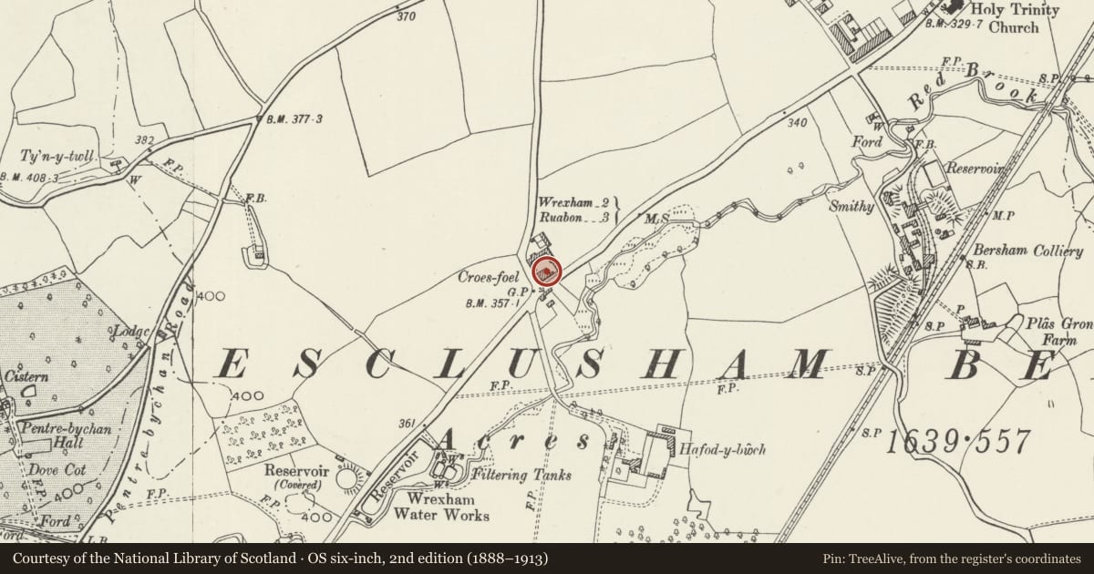
5 historical maps cover this location, the earliest the 1795 map "To Sir Watkin Williams-Wynn Bart ... the map of the six counties of North Wales is most humbly inscribed by his obedient humble servant" (Llyfrgell Genedlaethol Cymru – The National Library of Wales).
Historical maps covering this location
- 1795 · To Sir Watkin Williams-Wynn Bart ... the map of the six counties of North Wales is most… (Llyfrgell Genedlaethol Cymru – The National Library of Wales)
- 1883 · Watershed map England, Wales 3. (David Rumsey Map Collection, Stanford Libraries)
- 1898 · 121 Wrexham (Hills) (David Rumsey Map Collection, Stanford Libraries)
- 1898 · 121 Wrexham (Outline) (David Rumsey Map Collection, Stanford Libraries)
- 1901 · Sheet 9 and 10. (David Rumsey Map Collection, Stanford Libraries)
Cadw's description
Location
Prominently sited on the roundabout at the W end of Rhostyllen, and between the A483, the B5605 and the B5098.
History
The house was built in 1781 by William Lloyd of Plas Power (the dates of 1812 on rainwater heads are thought to be later). Croesfoel was the home of the Davies brothers, gatesmiths, in the late C17- early C18, and their smithy survived adjacent to the present house, until it was demolished for road widening in 1967
Exterior
Brick with slate roof and gable end stacks. 3 storeys, 3 window range with central entrance. Doorway with blind traceried fanlight in pedimented case, flanked by wide wood mullioned and transomed windows with cambered heads.
Reason for designation
A good example of a Georgian vernacular farmhouse retaining much of its original character, and on a site of considerable historical significance for its association with the Davies brothers.
Nearby in the register
- Timber-framed building in yard at Croesfoel FarmAgriculture and Subsistenceunder 1 mi
- Gate Piers at Hafod-y-Bwch HallAgriculture and Subsistenceunder 1 mi
- Croes-Foel Round BarrowRound Barrowunder 1 mi
- Timber-framed Barn in Yard at Hafod-y-Bwch HallAgriculture and Subsistenceunder 1 mi
Other entries of the same register within about three miles of this one, by straight line.