Cof Cymru: National Historic Assets of Wales · Wales
Gates to Cemetary
Offa, Wrexham, Wales
A Grade II listed building in Offa, Wrexham, designated on 31 January 1994.
The record
- Designation
- Listed building, Grade II
- Broad class
- Religious, Ritual and Funerary
- Date of designation
- 31 January 1994
- Community
- Offa
- Unitary authority
- Wrexham
- Country
- Wales
- Coordinates
- 53.03873, -3.00476
- Cadw reference
- 16485
Slide toward Today to fade the historical sheet and see the modern map underneath.
David Rumsey Map Collection, Stanford LibrariesDavid Rumsey Map Collection, Stanford LibrariesDavid Rumsey Map Collection, Stanford LibrariesDavid Rumsey Map Collection, Stanford LibrariesLlyfrgell Genedlaethol Cymru – The National Library of Wales
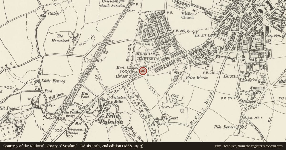
5 historical maps cover this location, the earliest the 1795 map "To Sir Watkin Williams-Wynn Bart ... the map of the six counties of North Wales is most humbly inscribed by his obedient humble servant" (Llyfrgell Genedlaethol Cymru – The National Library of Wales).
Historical maps covering this location
- 1795 · To Sir Watkin Williams-Wynn Bart ... the map of the six counties of North Wales is most… (Llyfrgell Genedlaethol Cymru – The National Library of Wales)
- 1883 · Watershed map England, Wales 3. (David Rumsey Map Collection, Stanford Libraries)
- 1898 · 121 Wrexham (Hills) (David Rumsey Map Collection, Stanford Libraries)
- 1898 · 121 Wrexham (Outline) (David Rumsey Map Collection, Stanford Libraries)
- 1901 · Sheet 9 and 10. (David Rumsey Map Collection, Stanford Libraries)
Cadw's description
Location
Gate piers and gates sited towards centre of cemetery on Ruabon Road:
History
The gates align with the principal axis of the cemetery chapels, and the original railings enclose the cemetery to the east of the gates, and along the return boundary to Empress Road.
The cemetery was established 1874-6 and the railings and gates are to the designs of either Yeaman Strachan (responsible for the layout), or William Turner (architect of the lodge and chapels).
Exterior
Ashlar gate piers and rusticated stone plinth wall, with cast iron gates and railings. Main gates with pedestrian gates each side and quadrant flanking railings with terminal piers. Outer piers have recessed panels and raking copings, enriched with trefoiled spandrels. Gate piers are similar, but with trefoiled panels. Cast iron railings have trefoiled heads and quatrefoil bands to top and bottom. Plainer terminal pier at angle with Empress Road, and intermittent stone piers and plain railings with scrolled panels set at intervals on Empress Road boundary.
Reason for designation
Group value with cemetery chapels and lodge to cemetery.
Nearby in the register
- Gate Piers to CemetaryReligious, Ritual and Funeraryunder 1 mi
- Lodge to CemetaryDomesticunder 1 mi
- Cemetey ChapelsReligious, Ritual and Funeraryunder 1 mi
- Mortuary at Wrexham CemeteryNo class recordedunder 1 mi
Other entries of the same register within about three miles of this one, by straight line.