Cof Cymru: National Historic Assets of Wales · Wales
Kingsmills Bridge over River Gwenfro
Offa, Wrexham, Wales
A Grade II listed building in Offa, Wrexham, designated on 16 June 1980.
The record
- Designation
- Listed building, Grade II
- Broad class
- Transport
- Date of designation
- 16 June 1980
- Community
- Offa
- Unitary authority
- Wrexham
- Country
- Wales
- Coordinates
- 53.03562, -2.97487
- Cadw reference
- 16475
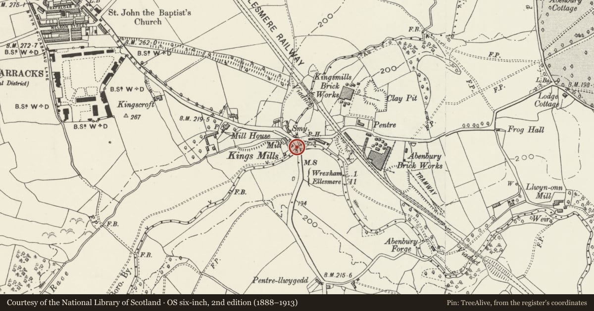
Slide toward Today to fade the historical sheet and see the modern map underneath.
David Rumsey Map Collection, Stanford LibrariesDavid Rumsey Map Collection, Stanford LibrariesDavid Rumsey Map Collection, Stanford LibrariesDavid Rumsey Map Collection, Stanford LibrariesDavid Rumsey Map Collection, Stanford Libraries
5 historical maps cover this location, the earliest the 1608 map "(13) Cambriae Typus." (David Rumsey Map Collection, Stanford Libraries).
Historical maps covering this location
- 1608 · (13) Cambriae Typus. (David Rumsey Map Collection, Stanford Libraries)
- 1883 · Watershed map England, Wales 3. (David Rumsey Map Collection, Stanford Libraries)
- 1898 · 121 Wrexham (Hills) (David Rumsey Map Collection, Stanford Libraries)
- 1898 · 121 Wrexham (Outline) (David Rumsey Map Collection, Stanford Libraries)
- 1901 · Sheet 9 and 10. (David Rumsey Map Collection, Stanford Libraries)
Cadw's description
Location
Partly in the Communities of Offa and Marchwiel.
History
The two bridges are sited at the confluence of the Rivers Clywedog and Gwenfro, and carry the Kingsmill and Abenbury Roads.
Pair of bridges. Robert Jones of Nantglyn, a mason, contracted for the construction of Kingsmill Bridge in 1782, and the bridge over the Gwenfro is dated 1829.
Exterior
Kingsmill Bridge is the principal bridge: Coursed and squared yellow sandstone, with moulded cornice over single arch, which has channelled voussoirs and heavy keystone. Stepped abutments each side terminating in square-section outer piers. Shallow coppings to parapet. A curved wall links this bridge to the subordinate bridge over the River Gwenfro at right angles to it and immediatly to the E: rougher corsed and squared stone to linking wall, well coursed and squared stone to its parapet and the masonry of the second bridge. This bridge is also a single span, and is built on a shallow concave curve, with plain string course over archway inscribed with date, and with heavy stone blocks to parapet which has shallow copings.
Nearby in the register
- Kingsmills Bridge over River ClywedogTransportunder 1 mi
- The Red Lion Public HouseCommercialunder 1 mi
- Bryn-y-Grog HallDomesticunder 1 mi
- Pavilion including attached Skittle Alley at Cefn ParkDomesticunder 1 mi
Other entries of the same register within about three miles of this one, by straight line.