Cof Cymru: National Historic Assets of Wales · Wales
Former Navigation Colliery Middle Revetment Wall
Crumlin, Caerphilly, Wales
A Grade II listed building in Navigation Colliery Crumlin, Crumlin, Caerphilly, designated on 28 September 1994.
The record
- Designation
- Listed building, Grade II
- Broad class
- Industrial
- Date of designation
- 28 September 1994
- Locality
- Navigation Colliery Crumlin
- Community
- Crumlin
- Unitary authority
- Caerphilly
- Country
- Wales
- Coordinates
- 51.68317, -3.14280
- Cadw reference
- 16427
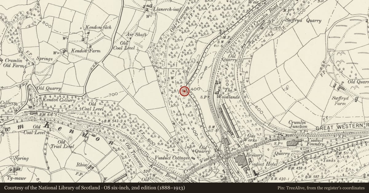
Slide toward Today to fade the historical sheet and see the modern map underneath.
David Rumsey Map Collection, Stanford LibrariesDavid Rumsey Map Collection, Stanford LibrariesDavid Rumsey Map Collection, Stanford LibrariesDavid Rumsey Map Collection, Stanford LibrariesDavid Rumsey Map Collection, Stanford Libraries
5 historical maps cover this location, the earliest the 1636 map "Cornubia : Devonia, Somersetus, Dorcestria, Wiltonia, Glocestria ..." (David Rumsey Map Collection, Stanford Libraries).
Historical maps covering this location
- 1636 · Cornubia : Devonia, Somersetus, Dorcestria, Wiltonia, Glocestria ... (David Rumsey Map Collection, Stanford Libraries)
- 1637 · The fourth table of England. Cornub. Devonia, Somerset etc. (David Rumsey Map Collection, Stanford Libraries)
- 1895 · Sheet 11. Ordnance Survey of England and Wales. (David Rumsey Map Collection, Stanford Libraries)
- 1906 · 249 Newport (Hills) (David Rumsey Map Collection, Stanford Libraries)
- 1913 · Sheet 102. Newport. (David Rumsey Map Collection, Stanford Libraries)
Cadw's description
Location
Extends from S of the former Baths which lie N of the colliery complex, in front of the Powder Store, to N of the N Winding Engine House.
History
Navigation Colliery Crumlin was built by the firm of Partridge Jones and Company between 1907 and 1911. The firm was one of the largest coal combines in S Wales, owning 9 collieries in the Gwent valleys. Navigation Colliery was a show-pit of the period with high quality buildings and up-to-date machinery. One of the earliest collieries in S Wales to be built in brick rather than local stone with brick dressings. Closed 1967 and disused since.
Exterior
Revetment wall of rubble sandstone increasing in height from S to N as the sloping road to the lower level of the colliery falls beside it. It has the remains of pulleys and fittings and is surmounted by a fence of standard rails with winding cables passed between them, no longer intact.
Reason for designation
Included for group value with other listed former colliery buildings in this important colliery complex.
Nearby in the register
- Former Navigation Colliery Powder Store and adjoining N Rear Revetment WallIndustrialunder 1 mi
- Former Navigation Colliery Electrical OutbuildingIndustrialunder 1 mi
- Former Navigation Colliery Heapstead and Main Revetment WallIndustrialunder 1 mi
- Former Navigation Colliery Power House and Pump HouseIndustrialunder 1 mi
Other entries of the same register within about three miles of this one, by straight line.