Cof Cymru: National Historic Assets of Wales · Wales
Cefn Garthmyl Farmhouse
Berriew, Powys, Wales
A Grade II listed building in Garthmyl, Berriew, Powys, designated on 21 August 1995.
The record
- Designation
- Listed building, Grade II
- Broad class
- Domestic
- Date of designation
- 21 August 1995
- Locality
- Garthmyl
- Community
- Berriew
- Unitary authority
- Powys
- Country
- Wales
- Coordinates
- 52.58705, -3.20615
- Cadw reference
- 16383
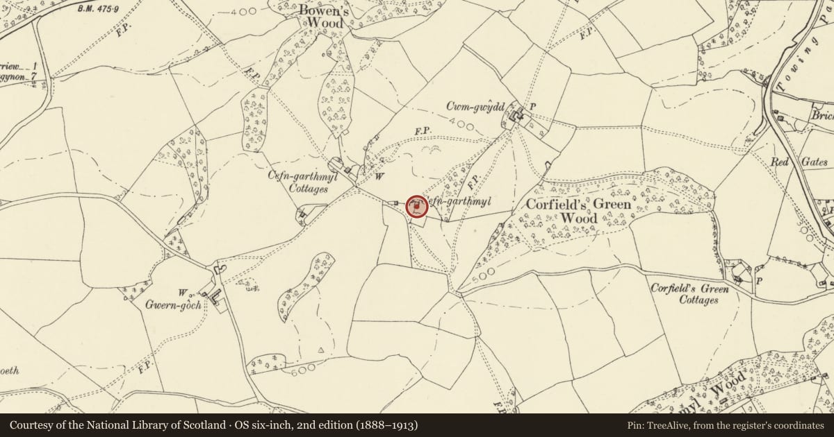
Slide toward Today to fade the historical sheet and see the modern map underneath.
David Rumsey Map Collection, Stanford LibrariesDavid Rumsey Map Collection, Stanford LibrariesDavid Rumsey Map Collection, Stanford LibrariesDavid Rumsey Map Collection, Stanford LibrariesLlyfrgell Genedlaethol Cymru – The National Library of Wales
5 historical maps cover this location, the earliest the 1795 map "To Sir Watkin Williams-Wynn Bart ... the map of the six counties of North Wales is most humbly inscribed by his obedient humble servant" (Llyfrgell Genedlaethol Cymru – The National Library of Wales).
Historical maps covering this location
- 1795 · To Sir Watkin Williams-Wynn Bart ... the map of the six counties of North Wales is most… (Llyfrgell Genedlaethol Cymru – The National Library of Wales)
- 1883 · Watershed map England, Wales 3. (David Rumsey Map Collection, Stanford Libraries)
- 1899 · 151 Welshpool (Hills) (David Rumsey Map Collection, Stanford Libraries)
- 1901 · Sheet 9 and 10. (David Rumsey Map Collection, Stanford Libraries)
- 1916 · Sheet 60. Shrewsbury. (David Rumsey Map Collection, Stanford Libraries)
Cadw's description
Location
Approx 1km NW of Garthmyl approached via a track from a by-road connecting the Berriew-Bettws Cedewain road and the A483 S of Garthmyl.
Exterior
Probably a late C17 timber framed small farmhouse: box framing rendered to main elevations but exposed in one gable end; slate roof. Square panelled framing with collar-strut roof. One and a half storeyed, 2-unit baffle entry plan with stack towards centre. Gabled porch (probably a C19 addition), flanked by 3-light casement windows, and 2-light casements in framed gabled dormers in the roof offset slightly. Continuous outshut to rear may be partially an original feature, and houses the staircase at the back of the stack. Rear wing is painted brick and is probably mid C19. Principal room has bressumer to recessed fireplace, and paired chamfered spine beams, with heavy joists to ceiling.
Reason for designation
Listed as a C17 vernacular farmhouse, which retains much of its early character, especially in its internal arrangement and detail: the plan-form, with the staircase in the outshut, is particularly notable.
Nearby in the register
- Gwern GochDomesticunder 1 mi
- Pied HouseDomesticunder 1 mi
- Llifior MillIndustrialunder 1 mi
- Northern Lime-Kiln at GarthmylIndustrialunder 1 mi
Other entries of the same register within about three miles of this one, by straight line.