Cof Cymru: National Historic Assets of Wales · Wales
Wayside
Berriew, Powys, Wales
A Grade II listed building in Garthmyl, Berriew, Powys, designated on 26 October 1953.
The record
- Designation
- Listed building, Grade II
- Broad class
- Communications
- Date of designation
- 26 October 1953
- Locality
- Garthmyl
- Community
- Berriew
- Unitary authority
- Powys
- Country
- Wales
- Coordinates
- 52.58285, -3.19135
- Cadw reference
- 16373
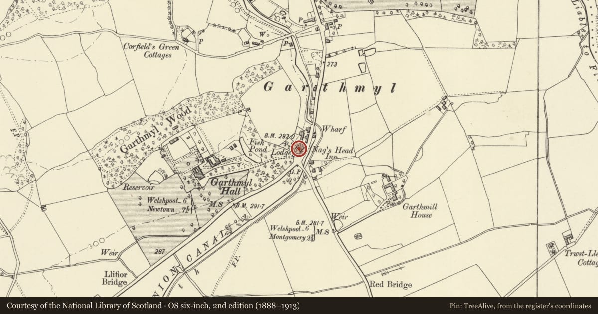
Slide toward Today to fade the historical sheet and see the modern map underneath.
David Rumsey Map Collection, Stanford LibrariesDavid Rumsey Map Collection, Stanford LibrariesDavid Rumsey Map Collection, Stanford LibrariesDavid Rumsey Map Collection, Stanford LibrariesLlyfrgell Genedlaethol Cymru – The National Library of Wales
5 historical maps cover this location, the earliest the 1795 map "To Sir Watkin Williams-Wynn Bart ... the map of the six counties of North Wales is most humbly inscribed by his obedient humble servant" (Llyfrgell Genedlaethol Cymru – The National Library of Wales).
Historical maps covering this location
- 1795 · To Sir Watkin Williams-Wynn Bart ... the map of the six counties of North Wales is most… (Llyfrgell Genedlaethol Cymru – The National Library of Wales)
- 1883 · Watershed map England, Wales 3. (David Rumsey Map Collection, Stanford Libraries)
- 1899 · 151 Welshpool (Hills) (David Rumsey Map Collection, Stanford Libraries)
- 1901 · Sheet 9 and 10. (David Rumsey Map Collection, Stanford Libraries)
- 1916 · Sheet 60. Shrewsbury. (David Rumsey Map Collection, Stanford Libraries)
Cadw's description
Location
On the A483, almost opposite the junction with the B4385 Montgomery Road.
History
There was a building on the site before the construction of the Montgomeryshire Canal but this was rebuilt c1820, and probably altered c1860 (note the blue brickwork in the upper window of the pedimented gable, in the dormer windows of the flanking blocks and the chimneys). The SW wing was formerly a post office, but is now a private house.
Exterior
Brick with slate roofs. Gable end stacks have stone copings, and blue brick bands. 2 storeyed, symmetrically planned with a central 3-window range, and slightly recessed flanking gabled wings (that to SW in separate occupation as Wayside). Central gabled bay advanced, with entrance in triple arched timber porch: the inner doorway has been renewed, but retains an overlight with marginal glazing and some coloured glass. Flanking windows of 3-lights, with a 2-light window over the doorway, and a similar attic window (with blue and red brick arched head) and 2-light windows on each floor in the outer gabled wings. All windows are small-paned iron casements with transoms and 'gothick' glazing bars in the upper lights. Windows in central range have segmentally arched heads, as do the lower windows in the flanking wings. The similar heads of the upper windows in the wings have alternate red and blue brick segmental arches, and the kneelers of their dormer gables are blue brick and stone. Similar corbels to central gable.
Reason for designation
A fine grouping retaining much of its original character.
Nearby in the register
- Telephone Call-box in front of Nag's Head PHCommunicationsunder 1 mi
- Nags Head PHCommercialunder 1 mi
- Former Nags Head MaltingsIndustrialunder 1 mi
- Bridge 131 over The Montgomeryshire CanalTransportunder 1 mi
Other entries of the same register within about three miles of this one, by straight line.