Cof Cymru: National Historic Assets of Wales · Wales
Bridge 139 over The Montgomeryshire Canal
Berriew, Powys, Wales
A Grade II listed building in Fron, Berriew, Powys, designated on 21 August 1995.
The record
- Designation
- Listed building, Grade II
- Broad class
- Transport
- Date of designation
- 21 August 1995
- Locality
- Fron
- Community
- Berriew
- Unitary authority
- Powys
- Country
- Wales
- Coordinates
- 52.56813, -3.21554
- Cadw reference
- 16368
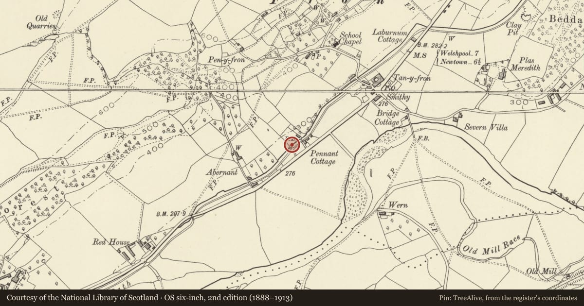
Slide toward Today to fade the historical sheet and see the modern map underneath.
David Rumsey Map Collection, Stanford LibrariesDavid Rumsey Map Collection, Stanford LibrariesLlyfrgell Genedlaethol Cymru – The National Library of WalesDavid Rumsey Map Collection, Stanford LibrariesDavid Rumsey Map Collection, Stanford Libraries
5 historical maps cover this location, the earliest the 1608 map "(13) Cambriae Typus." (David Rumsey Map Collection, Stanford Libraries).
Historical maps covering this location
- 1608 · (13) Cambriae Typus. (David Rumsey Map Collection, Stanford Libraries)
- 1637 · Particular description of Wales. Cambria seu Wallia (David Rumsey Map Collection, Stanford Libraries)
- 1795 · To Sir Watkin Williams-Wynn Bart ... the map of the six counties of North Wales is most… (Llyfrgell Genedlaethol Cymru – The National Library of Wales)
- 1883 · Watershed map England, Wales 3. (David Rumsey Map Collection, Stanford Libraries)
- 1899 · 165 Montgomery (Hills) (David Rumsey Map Collection, Stanford Libraries)
Cadw's description
Exterior
16368
Carries a drive-way over the canal on the W side of the A483 immediately SW of Maes Fron, 0.3km approx. S of Fron Post Office Stores.
History: The Shropshire Union Railways and Canal Company purchased the western branch of the Montgomeryshire Canal in 1850, and carried out a programme of engineering work, including the replacement of several early bridges. This swing bridge is built to a design associated with the Company, and is likely to be late C19.
Description: Bellied cast-iron girders carry the decking of the bridge, which swings into a blue brick turning circle on the W bank of the canal. Rails to either side probably later additions or renewals.
An interesting example of an iron-girder swing bridge, and one of a very small number of such bridges dating from the later C19 engineering work on the canal.
Nearby in the register
- Maes FronDomesticunder 1 mi
- Brick Shed alongside Bridge 140 over The CanalAgriculture and Subsistenceunder 1 mi
- Bridge 140 over The CanalTransportunder 1 mi
- Bridge 137 over the Montgomeryshire CanalTransportunder 1 mi
Other entries of the same register within about three miles of this one, by straight line.