Cof Cymru: National Historic Assets of Wales · Wales
Pen y Parc
Berriew, Powys, Wales
A Grade II listed building in Cefn Vaynor, Berriew, Powys, designated on 21 August 1995.
The record
- Designation
- Listed building, Grade II
- Broad class
- Domestic
- Date of designation
- 21 August 1995
- Locality
- Cefn Vaynor
- Community
- Berriew
- Unitary authority
- Powys
- Country
- Wales
- Coordinates
- 52.59399, -3.23173
- Cadw reference
- 16362
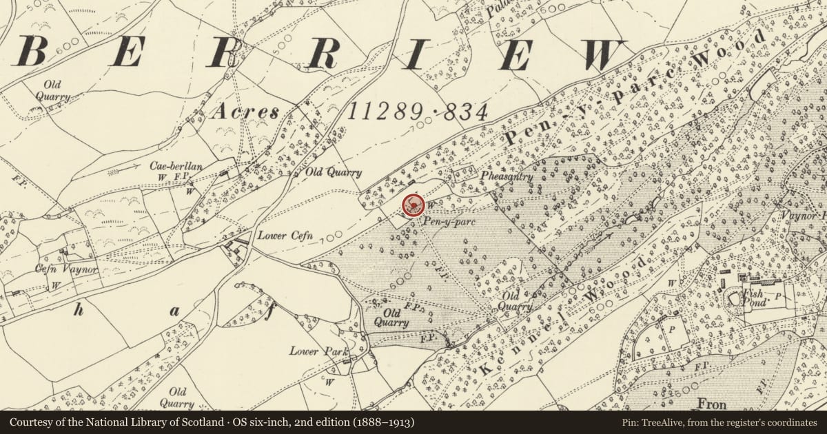
Slide toward Today to fade the historical sheet and see the modern map underneath.
David Rumsey Map Collection, Stanford LibrariesDavid Rumsey Map Collection, Stanford LibrariesDavid Rumsey Map Collection, Stanford LibrariesDavid Rumsey Map Collection, Stanford LibrariesLlyfrgell Genedlaethol Cymru – The National Library of Wales
5 historical maps cover this location, the earliest the 1795 map "To Sir Watkin Williams-Wynn Bart ... the map of the six counties of North Wales is most humbly inscribed by his obedient humble servant" (Llyfrgell Genedlaethol Cymru – The National Library of Wales).
Historical maps covering this location
- 1795 · To Sir Watkin Williams-Wynn Bart ... the map of the six counties of North Wales is most… (Llyfrgell Genedlaethol Cymru – The National Library of Wales)
- 1883 · Watershed map England, Wales 3. (David Rumsey Map Collection, Stanford Libraries)
- 1899 · 151 Welshpool (Hills) (David Rumsey Map Collection, Stanford Libraries)
- 1901 · Sheet 9 and 10. (David Rumsey Map Collection, Stanford Libraries)
- 1916 · Sheet 60. Shrewsbury. (David Rumsey Map Collection, Stanford Libraries)
Cadw's description
Location
An isolated cottage on the edge of woodland within Vaynor Park. Approached via a field track which leaves the by-road to Cefn Vaynor at Lower Cefn Farm.
History
Originally C17, with remodelling work carried out by the Vaynor Estate c1850 (a drawing of proposed alterations is dated 1846).
Exterior
Timber framed in square panels with tension braces at angles, and painted brick plinth and nogging. Slate roof. Compact 2-unit plan, with central baffle entrance in timber gabled porch (c1850), with chamfered archway, and battened plank inner door. 2-light casement windows to either side, with bracketed hoods (a Vaynor Estate design). Framed dormers with similar windows aligned above. Axial brick stack, with square base and clustered octagonal flues. Small rubble stone outshut to rear.
Reason for designation
An excellent example of a small C17 timber framed cottage re-worked in the mid C19 to form a picturesque estate cottage.
Nearby in the register
- Upper Pandy Farmhouse and BarnDomesticunder 1 mi
- Ty'n-y-Coed FarmhouseDomesticunder 1 mi
- Coach House, Gate Piers, Gated and Flanking Wall at Vaynor ParkDomesticunder 1 mi
- Stable Block at Vaynor ParkDomesticunder 1 mi
Other entries of the same register within about three miles of this one, by straight line.