Cof Cymru: National Historic Assets of Wales · Wales
The Sign
Berriew, Powys, Wales
A Grade II listed building in Berriew, Powys, designated on 21 August 1995.
The record
- Designation
- Listed building, Grade II
- Broad class
- Domestic
- Date of designation
- 21 August 1995
- Community
- Berriew
- Unitary authority
- Powys
- Country
- Wales
- Coordinates
- 52.59932, -3.20186
- Cadw reference
- 16348
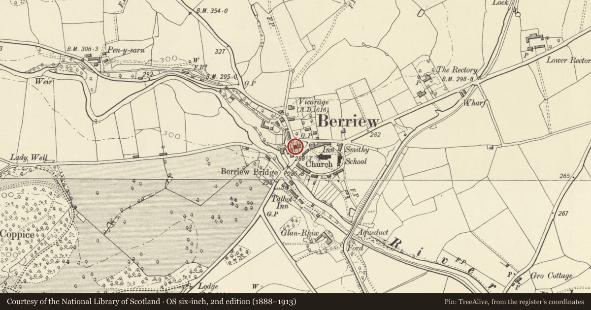
Slide toward Today to fade the historical sheet and see the modern map underneath.
David Rumsey Map Collection, Stanford LibrariesDavid Rumsey Map Collection, Stanford LibrariesDavid Rumsey Map Collection, Stanford LibrariesDavid Rumsey Map Collection, Stanford LibrariesLlyfrgell Genedlaethol Cymru – The National Library of Wales
5 historical maps cover this location, the earliest the 1795 map "To Sir Watkin Williams-Wynn Bart ... the map of the six counties of North Wales is most humbly inscribed by his obedient humble servant" (Llyfrgell Genedlaethol Cymru – The National Library of Wales).
Historical maps covering this location
- 1795 · To Sir Watkin Williams-Wynn Bart ... the map of the six counties of North Wales is most… (Llyfrgell Genedlaethol Cymru – The National Library of Wales)
- 1883 · Watershed map England, Wales 3. (David Rumsey Map Collection, Stanford Libraries)
- 1899 · 151 Welshpool (Hills) (David Rumsey Map Collection, Stanford Libraries)
- 1901 · Sheet 9 and 10. (David Rumsey Map Collection, Stanford Libraries)
- 1916 · Sheet 60. Shrewsbury. (David Rumsey Map Collection, Stanford Libraries)
Cadw's description
Location
On an 'island site' in the centre of the village.
History
In 1764, The Sign House was described as 'a large one built of timber, nogged or plaster walls and thatched at the end of which are 6 bays in a ruinous condition to be taken down'. The present row of three houses shows some evidence consistent with this, since the westernmost end (No 3) has interior detail suggesting a C17 date, while the exposed timbering in the eastern end (No 1) is of regular form and possibly late C18 or early C19 date. The thinner scantling timberwork to the exterior of No 3 is probably the result of further remodelling in the mid C19, and the fenestration and other detail (together possibly with the re-ordering of the internal planning) appear to be of this period. It seems likely therefore that the original part of the building is represented by No 3, and may be of C17 date, extended or rebuilt to the E in the later C18, and remodelled by the Vaynor Estate in the mid C19.
Exterior
The row comprises three houses, each of 2-unit plan form: Nos 1 and 3 are each planned about a central entrance, but the original left hand bay of No 1 was later subdivided to extend No 2, and part of the original floor area of No 3 was also incorporated into No 2. No 2 has entrance to the left. The right hand section of the row (No 1 and part of No 2) is exposed box-framing with brick panel infill and a brick plinth. Slate roof with axial brick stack. Symmetrically designed (though asymmetrically divided internally) with central entrance in gabled timber porch with chamfered arched doorway, flanked by 4-light casement windows on each floor to the left, and 2-light casements to the right. The left-hand windows each comprise a pair of 2-light casements, and the property division between Nos 1 and 2 runs between the pairs. Upper windows are in gabled dormers, and the left=hand dormer is a higher gable, with decorative barge-boards. All windows (which appear to be in original openings) have the bracketed canopies associated with the work of the Vaynor Estate. Gable end return has similarly detailed shallow oriel to first floor, and 2-light casement below.
Central bays of the row are rendered (probably also over timber framing - exposed timbering visible in rear wall): low dormer window to the right of the gabled porch, with 2-light casement window on each floor. Similarly arranged 4-light casements to the left of the porch, with higher gabled dormer with decorative barge-boards to first floor.
End bay to left has exposed timber framing of thin scantling, and lower dormer over 2-light casement windows to the left of the gabled porch.
Interior
No 3 retains many elements of its early origins, including 2 deep chamfered and stopped axial beams to principal living room (later subdivided to create entrance lobby and cellar stairs); simple oak dog-leg staircase within the outshut, and oak boarded floors to first floor.
Reason for designation
Of considerable interest as a terraced row successively extended and adapted from the original C17 building. It exemplifies the complex patterns of alteration and adaptation which characterised building history on the Vaynor estate, and shows the continuing tradition of timber framing. Prominently sited at the centre of the village.
Nearby in the register
- The SignDomesticunder 1 mi
- The SignDomesticunder 1 mi
- AllsortsCommercialunder 1 mi
- River ViewCommercialunder 1 mi
Other entries of the same register within about three miles of this one, by straight line.