Cof Cymru: National Historic Assets of Wales · Wales
Bridge 127 over the Montgomeryshire Canal
Berriew, Powys, Wales
A Grade II listed building in Berriew, Powys, designated on 21 August 1995.
The record
- Designation
- Listed building, Grade II
- Broad class
- Transport
- Date of designation
- 21 August 1995
- Community
- Berriew
- Unitary authority
- Powys
- Country
- Wales
- Coordinates
- 52.60469, -3.19151
- Cadw reference
- 16337
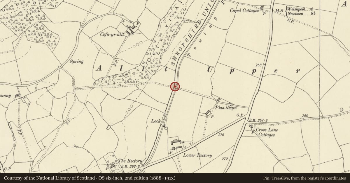
Slide toward Today to fade the historical sheet and see the modern map underneath.
David Rumsey Map Collection, Stanford LibrariesDavid Rumsey Map Collection, Stanford LibrariesDavid Rumsey Map Collection, Stanford LibrariesDavid Rumsey Map Collection, Stanford LibrariesLlyfrgell Genedlaethol Cymru – The National Library of Wales
5 historical maps cover this location, the earliest the 1795 map "To Sir Watkin Williams-Wynn Bart ... the map of the six counties of North Wales is most humbly inscribed by his obedient humble servant" (Llyfrgell Genedlaethol Cymru – The National Library of Wales).
Historical maps covering this location
- 1795 · To Sir Watkin Williams-Wynn Bart ... the map of the six counties of North Wales is most… (Llyfrgell Genedlaethol Cymru – The National Library of Wales)
- 1883 · Watershed map England, Wales 3. (David Rumsey Map Collection, Stanford Libraries)
- 1899 · 151 Welshpool (Hills) (David Rumsey Map Collection, Stanford Libraries)
- 1901 · Sheet 9 and 10. (David Rumsey Map Collection, Stanford Libraries)
- 1916 · Sheet 60. Shrewsbury. (David Rumsey Map Collection, Stanford Libraries)
Cadw's description
Location
Carries a field track across the canal, 400m approx. NE of bridge 128 and the B4390 road into Berriew.
History
Probably built 1794-7 as part of the first phase of construction of the Montgomeryshire Canal, which was completed as far as Garthmyl in these years. Parapets and part of the N face of the bridge later rebuilt, possibly as part of a programme of works carried out by the Shropshire Union Railways and Canal Company towards the end of the C19.
Exterior
Single span brick arched bridge. Rendered red brick lower structure, including segmental archway. Blue brick repair work to N side, and to parapets above string course. Curved stone copings to parapet, and terminal piers.
Reason for designation
A typical example of the bridge design associated with the Montgomeryshire Canal, which also shows a typical pattern of repair.
Nearby in the register
- Berriew LockTransportunder 1 mi
- Lock CottageDomesticunder 1 mi
- Bridge 128 over the Montgomeryshire CanalTransportunder 1 mi
- Upper Rectory FarmhouseDomesticunder 1 mi
Other entries of the same register within about three miles of this one, by straight line.