Cof Cymru: National Historic Assets of Wales · Wales
Former External Kitchen at Cwm Bwchel Farm
Crucorney, Monmouthshire, Wales
A Grade II listed building in Llanthony, Abergavenny, Crucorney, Monmouthshire, designated on 7 August 1995.
The record
- Designation
- Listed building, Grade II
- Broad class
- Domestic
- Date of designation
- 7 August 1995
- Locality
- Llanthony
- Town
- Abergavenny
- Community
- Crucorney
- Unitary authority
- Monmouthshire
- Country
- Wales
- Coordinates
- 51.94042, -3.04354
- Cadw reference
- 16279
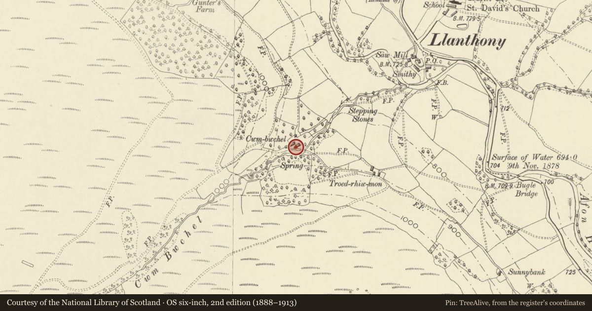
Slide toward Today to fade the historical sheet and see the modern map underneath.
David Rumsey Map Collection, Stanford LibrariesDavid Rumsey Map Collection, Stanford LibrariesDavid Rumsey Map Collection, Stanford LibrariesDavid Rumsey Map Collection, Stanford LibrariesDavid Rumsey Map Collection, Stanford Libraries
5 historical maps cover this location, the earliest the 1636 map "Cornubia : Devonia, Somersetus, Dorcestria, Wiltonia, Glocestria ..." (David Rumsey Map Collection, Stanford Libraries).
Historical maps covering this location
- 1636 · Cornubia : Devonia, Somersetus, Dorcestria, Wiltonia, Glocestria ... (David Rumsey Map Collection, Stanford Libraries)
- 1856 · 42. Brecon. (David Rumsey Map Collection, Stanford Libraries)
- 1895 · Sheet 11. Ordnance Survey of England and Wales. (David Rumsey Map Collection, Stanford Libraries)
- 1896 · 214 Talgarth (Hills) (David Rumsey Map Collection, Stanford Libraries)
- 1901 · Sheet 14. (David Rumsey Map Collection, Stanford Libraries)
Cadw's description
Location
Opposite farmhouse, set back from adjacent stable range.
History
Late C16/early C17, former external kitchen. The kitchen was last refurbished in the C19 and the chimney appears to have been rebuilt then. It seems likely that this kitchen was added to the medieval house at a period well before the upgrading of the house itself in 1694.
Exterior
Roughly squared thin coursed local sandstone rubble with corrugated sheet metal roof covering. Single-storey, single cell building. stone chimney with cornice to right gable. To left a doorway with stone slated canopy over; small window to right of door. 5-light oak diamond mullioned window to rear, window in left gable apex. The right gable has an attached stone C19 privy. The left corner is attached to the rear of the Stable (qv).
Interior
The interior is open to the roof which is a principal rafter roof with two tiers of trenched purlins, most of the subsidiary timbers are gone. Fox and Raglan record a fireplace, boiler and oven at the west end, but it was not possible to say more than they still seem to be there at resurvey (May 1997).
Reason for designation
Listed as rare and well preserved example of this early building type. Group value with adjacent farm buildings.
Nearby in the register
- Stable Range at Cwm Bwchel FarmDomesticunder 1 mi
- Cwm Bwchel FarmhouseDomesticunder 1 mi
- Barn at Cwm Bwchel FarmAgriculture and Subsistenceunder 1 mi
- Cottage 40m south of turning to Llanthony PrioryDomesticunder 1 mi
Other entries of the same register within about three miles of this one, by straight line.