Cof Cymru: National Historic Assets of Wales · Wales
Former Cow-House at Troedyrhiw
Cynwyl Gaeo, Carmarthenshire, Wales
A Grade II listed building in Hafod Bridge, Cynwyl Gaeo, Carmarthenshire, designated on 2 August 1995.
The record
- Designation
- Listed building, Grade II
- Broad class
- Agriculture and Subsistence
- Date of designation
- 2 August 1995
- Locality
- Hafod Bridge
- Community
- Cynwyl Gaeo
- Unitary authority
- Carmarthenshire
- Country
- Wales
- Coordinates
- 52.01227, -3.91553
- Cadw reference
- 16251
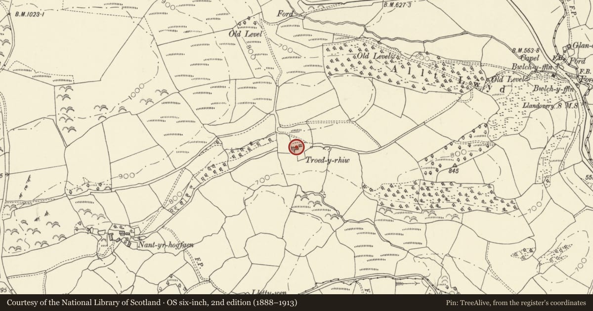
Slide toward Today to fade the historical sheet and see the modern map underneath.
David Rumsey Map Collection, Stanford LibrariesDavid Rumsey Map Collection, Stanford LibrariesDavid Rumsey Map Collection, Stanford LibrariesDavid Rumsey Map Collection, Stanford LibrariesDavid Rumsey Map Collection, Stanford Libraries
5 historical maps cover this location, the earliest the 1860 map "41. Caermathen." (David Rumsey Map Collection, Stanford Libraries).
Historical maps covering this location
- 1860 · 41. Caermathen. (David Rumsey Map Collection, Stanford Libraries)
- 1891 · Sheet 10. Ordnance Survey of England and Wales. . (David Rumsey Map Collection, Stanford Libraries)
- 1898 · 212 Llandovery (Hills) (David Rumsey Map Collection, Stanford Libraries)
- 1898 · 212 Llandovery (Outline) (David Rumsey Map Collection, Stanford Libraries)
- 1901 · Sheet 14. (David Rumsey Map Collection, Stanford Libraries)
Cadw's description
Location
Farm at end of long track off A482 1 KM N of Hafod Bridge. Cow- house to SW of farmhouse.
History
Mid/late C18 cow-house. Clearly shown on 1830 O.S map. 1841 owner, David Arthur Saunders Davies; occupier, Mary Edwards.
Exterior
Whitewashed rubble cow-house. Corrugated-iron roof, wooden soffits. Three doors to front with timber lintels; the central door is partly blocked. Right end with small loop to ground floor and doorway to gable with timber lintel reduced to form window. Left end with blocked ground floor loop, timber lintel. Plain rear.
Interior
Four-bay roof structure consisting of three pairs of slightly curving thin upper principals resting on cut-off beams. Pegged collars and yoked apexes, rough purlins on cleats. The soffits of the crucks are chamfered. Thatch complete: underthatch of rough poles. C19 wooden cow-stalls.
Reason for designation
Listed for the upper-cruck type of roof construction, a rare regional example in an agricultural building; close proximity to the fine scarfed-cruck barn range nearby.
Nearby in the register
- Barn Range at TroedyrhiwAgriculture and Subsistenceunder 1 mi
- Lletty UchafDomesticunder 1 mi
- Byre attached to Ty'n CoedAgriculture and Subsistenceunder 1 mi
- Ty'n CoedDomesticunder 1 mi
Other entries of the same register within about three miles of this one, by straight line.