Cof Cymru: National Historic Assets of Wales · Wales
Lychgate to Parish church of St Cynwyl
Cynwyl Gaeo, Carmarthenshire, Wales
A Grade II listed building in Caeo, Cynwyl Gaeo, Carmarthenshire, designated on 2 August 1995.
The record
- Designation
- Listed building, Grade II
- Broad class
- Religious, Ritual and Funerary
- Date of designation
- 2 August 1995
- Locality
- Caeo
- Community
- Cynwyl Gaeo
- Unitary authority
- Carmarthenshire
- Country
- Wales
- Coordinates
- 52.04140, -3.93320
- Cadw reference
- 16231
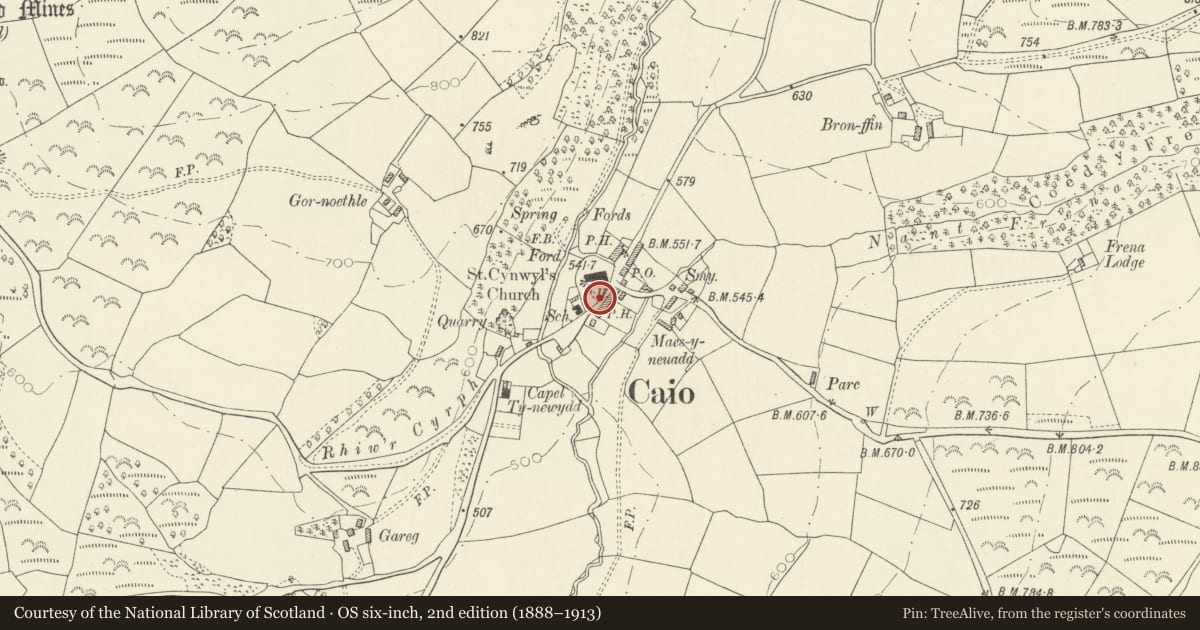
Slide toward Today to fade the historical sheet and see the modern map underneath.
David Rumsey Map Collection, Stanford LibrariesDavid Rumsey Map Collection, Stanford LibrariesDavid Rumsey Map Collection, Stanford LibrariesDavid Rumsey Map Collection, Stanford LibrariesDavid Rumsey Map Collection, Stanford Libraries
5 historical maps cover this location, the earliest the 1860 map "41. Caermathen." (David Rumsey Map Collection, Stanford Libraries).
Historical maps covering this location
- 1860 · 41. Caermathen. (David Rumsey Map Collection, Stanford Libraries)
- 1891 · Sheet 10. Ordnance Survey of England and Wales. . (David Rumsey Map Collection, Stanford Libraries)
- 1898 · 212 Llandovery (Outline) (David Rumsey Map Collection, Stanford Libraries)
- 1898 · 212 Llandovery (Hills) (David Rumsey Map Collection, Stanford Libraries)
- 1901 · Sheet 14. (David Rumsey Map Collection, Stanford Libraries)
Cadw's description
Location
Located some 50m S of parish church
History
Erected 1932 in memory of members of the Johnes family of Dolaucothi. The church of St Cynwyl is predominantly C15 and the lychgate is appropriately in the Perpendicular style.
Exterior
Gabled front of squared rock-faced grey sandstone, ashlar dressings. Steeply pitched stone-tiled roof, wooden soffits, projecting bracketed bargeboards with carved consoles. Wide 4-centred entry, ashlar head with drip. Low paired wooden panelled gates with strap hinges, the upper panels open with spiral twist iron bars. Square Perpendicular two-light window above, label, trefoiled lights, latticed iron panes. Carved gablet above window rising to a crucifix. Rear elevation as front, but without gates.
Pair of earlier square ashlar gate-piers in front of lychgate, moulded stone copings rising to ball finials. Short wide flight of cemented steps in front.
Interior
Collarbeam roof, flagstone floor, stone benches. Inscribed stone memorial tablets to left and right.
Reason for designation
Well designed lychgate of 1932. Group value with parish church.
Nearby in the register
- Parish Church of St CynwylReligious, Ritual and Funeraryunder 1 mi
- Railed Family Vault attached to Parish ChurchReligious, Ritual and Funeraryunder 1 mi
- Bridge over River Annell including attached retaining wallsTransportunder 1 mi
- DyffrynDomesticunder 1 mi
Other entries of the same register within about three miles of this one, by straight line.