Cof Cymru: National Historic Assets of Wales · Wales
Hydro-electric Station below Caban Coch Dam (south power house)
Llanwrthwl, Powys, Wales
A Grade II listed building in Elan Valley, Llanwrthwl, Powys, designated on 31 July 1995.
The record
- Designation
- Listed building, Grade II
- Broad class
- Industrial
- Date of designation
- 31 July 1995
- Locality
- Elan Valley
- Community
- Llanwrthwl
- Unitary authority
- Powys
- Country
- Wales
- Coordinates
- 52.26796, -3.57549
- Cadw reference
- 16205
Slide toward Today to fade the historical sheet and see the modern map underneath.
David Rumsey Map Collection, Stanford LibrariesDavid Rumsey Map Collection, Stanford LibrariesDavid Rumsey Map Collection, Stanford LibrariesDavid Rumsey Map Collection, Stanford LibrariesDavid Rumsey Map Collection, Stanford Libraries
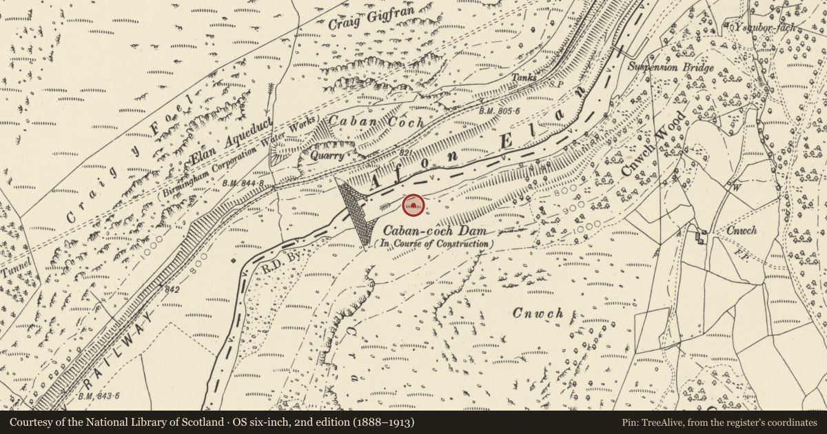
5 historical maps cover this location, the earliest the 1608 map "(13) Cambriae Typus." (David Rumsey Map Collection, Stanford Libraries).
Historical maps covering this location
- 1608 · (13) Cambriae Typus. (David Rumsey Map Collection, Stanford Libraries)
- 1637 · Particular description of Wales. Cambria seu Wallia (David Rumsey Map Collection, Stanford Libraries)
- 1883 · Watershed map England, Wales 3. (David Rumsey Map Collection, Stanford Libraries)
- 1898 · 179 Rhyader (Hills) (David Rumsey Map Collection, Stanford Libraries)
- 1901 · Sheet 14. (David Rumsey Map Collection, Stanford Libraries)
Cadw's description
Location
Below Caban Coch dam (partly in the Community of Llanwrthwl). Consists of 2 power houses linked by bridge spanning River Elan. Brecon District
History
Early C20 hydro-electric station generating power from water from Elan Valley dams.
Exterior
Power stations are symmetrical pair. Brown stone, slate roof. Parallel to river Elan. Each has one 4-window block with attached lower 3-window block set towards river; lantern ventilator to each block. Larger block has, to river, central doorway with small window over; 2 windows to each side (cruciform glazing); rear elevation similar but lacks doorway; gable end towards dam has doorway with elliptical head, and round window above. Lower block set forward with doorway in angle; 3 windows, central 2-light window flanked by 3-light windows, rear similar but with central doorway, not window; gable end away from dam has large 3-light round-headed window with heavy transom. Interior retains operating machinery including turbines and generators to upstream blocks, downstream blocks have railed pits, wooden cases with gauges etc.
Footbridge connects the two stations. Stone; 3 broad elliptical arches; return walls to ends opposite entrances to power houses. Bridge connects with revetment walls below power houses; grey stone, splayed downstream ends with arched outlets.
Reason for designation
Listed as part of one of the greatest civil engineering projects of C19.
Group value with adjacent dam.
Nearby in the register
- Footbridge at hydro-electric station (partly in Rhayader community)Industrialunder 1 mi
- Footbridge at hydro-electric station (partly in Llanwrthwl community)Industrialunder 1 mi
- Hydro-electric Station below Caban Coch Dam (north power house)Industrialunder 1 mi
- Caban Coch dam (partly in Rhayader community)Water Supply and Drainageunder 1 mi
Other entries of the same register within about three miles of this one, by straight line.