Cof Cymru: National Historic Assets of Wales · Wales
Arch at Maes-y-Bryner Isaf
Llanelltyd, Gwynedd, Wales
A Grade II listed building in Cymmer Castle, Llanelltyd, Gwynedd, designated on 20 July 1995.
The record
- Designation
- Listed building, Grade II
- Broad class
- Domestic
- Date of designation
- 20 July 1995
- Locality
- Cymmer Castle
- Community
- Llanelltyd
- Unitary authority
- Gwynedd
- Country
- Wales
- Coordinates
- 52.76342, -3.86913
- Cadw reference
- 16167
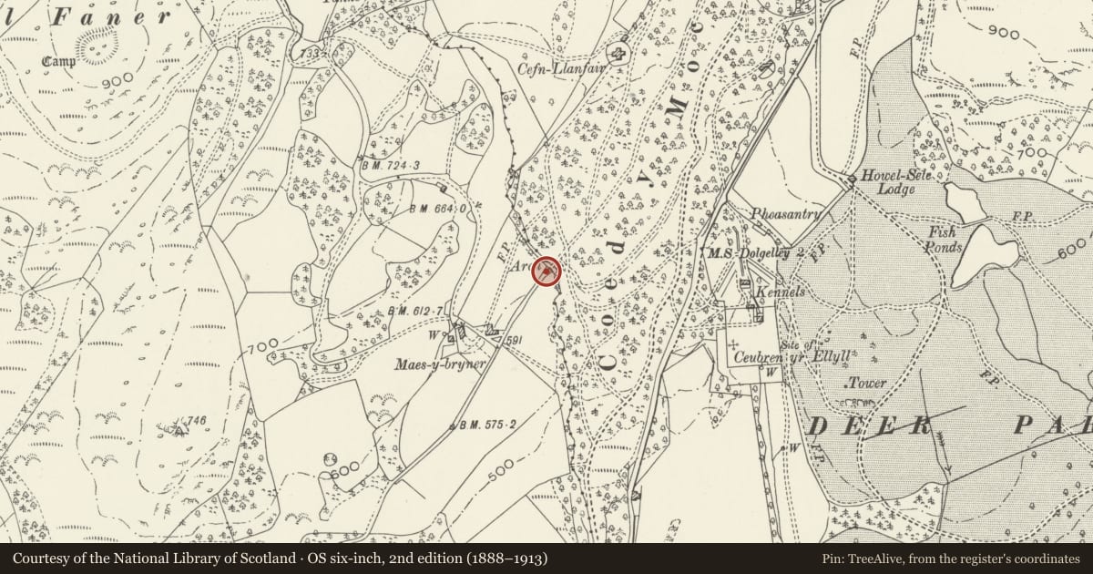
Slide toward Today to fade the historical sheet and see the modern map underneath.
David Rumsey Map Collection, Stanford LibrariesDavid Rumsey Map Collection, Stanford LibrariesDavid Rumsey Map Collection, Stanford LibrariesLlyfrgell Genedlaethol Cymru – The National Library of WalesDavid Rumsey Map Collection, Stanford Libraries
5 historical maps cover this location, the earliest the 1795 map "To Sir Watkin Williams-Wynn Bart ... the map of the six counties of North Wales is most humbly inscribed by his obedient humble servant" (Llyfrgell Genedlaethol Cymru – The National Library of Wales).
Historical maps covering this location
- 1795 · To Sir Watkin Williams-Wynn Bart ... the map of the six counties of North Wales is most… (Llyfrgell Genedlaethol Cymru – The National Library of Wales)
- 1883 · Watershed map England, Wales 3. (David Rumsey Map Collection, Stanford Libraries)
- 1896 · Sheet 7. Ordnance Survey of England and Wales. (David Rumsey Map Collection, Stanford Libraries)
- 1899 · 135 Harlech (Hills) (David Rumsey Map Collection, Stanford Libraries)
- 1901 · Sheet 9 and 10. (David Rumsey Map Collection, Stanford Libraries)
Cadw's description
Location
Located 1km SW of Nannau hall at the boundary of the Llanelltyd community with the Brithdir and Llanfachreth community. The archis on the Llanelltyd side of an unnamed stream and spans a metalled road leading to Maes Y Bryner Isaf.
Exterior
Early C19 decorative folly-arch built as an estate feature by Sir Robert Williames Vaughan of Nannau, Bart. in rustic style. Rubble-built arch with flanking sections of wall containing arched slits with projecting rubble cills and vernacular projecting voussoirs; plain string-course above. The arch was originally capped to give a pedimented effect; 2 large slate-stone lintel pieces formerly performing this function lienearby.
Reason for designation
Of special interest as one of a number of unusual and interesting estate features relating to Sir Robert Vaughan's period at Nannau.
Nearby in the register
- Arch to the SW of the Howel-Sele LodgeDomesticunder 1 mi
- Adjoining Arched Gateway to Howel-Sele LodgeDomesticunder 1 mi
- Howel-Sele LodgeDomesticunder 1 mi
- Coed-y-Moch LodgeDomesticunder 1 mi
Other entries of the same register within about three miles of this one, by straight line.