Cof Cymru: National Historic Assets of Wales · Wales
Tyn-y-Llwyn
Llanelltyd, Gwynedd, Wales
A Grade II listed building in Cwm-yr-Whin, Llanelltyd, Gwynedd, designated on 20 July 1995.
The record
- Designation
- Listed building, Grade II
- Broad class
- Domestic
- Date of designation
- 20 July 1995
- Locality
- Cwm-yr-Whin
- Community
- Llanelltyd
- Unitary authority
- Gwynedd
- Country
- Wales
- Coordinates
- 52.77458, -3.91352
- Cadw reference
- 16163
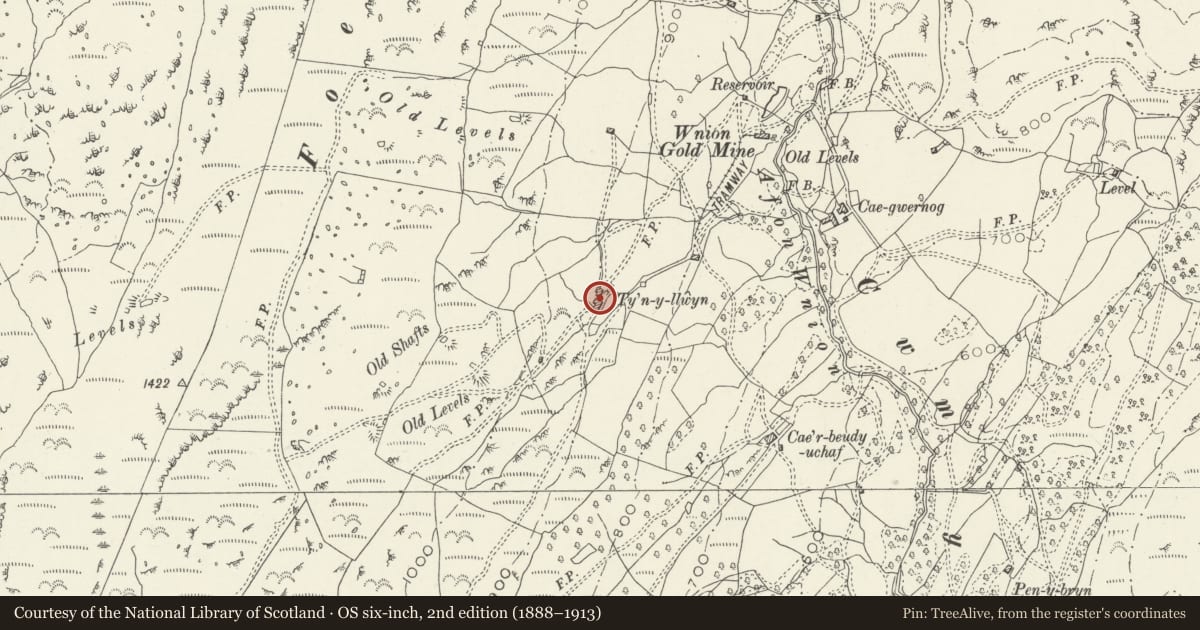
Slide toward Today to fade the historical sheet and see the modern map underneath.
David Rumsey Map Collection, Stanford LibrariesDavid Rumsey Map Collection, Stanford LibrariesDavid Rumsey Map Collection, Stanford LibrariesLlyfrgell Genedlaethol Cymru – The National Library of WalesDavid Rumsey Map Collection, Stanford Libraries
5 historical maps cover this location, the earliest the 1795 map "To Sir Watkin Williams-Wynn Bart ... the map of the six counties of North Wales is most humbly inscribed by his obedient humble servant" (Llyfrgell Genedlaethol Cymru – The National Library of Wales).
Historical maps covering this location
- 1795 · To Sir Watkin Williams-Wynn Bart ... the map of the six counties of North Wales is most… (Llyfrgell Genedlaethol Cymru – The National Library of Wales)
- 1883 · Watershed map England, Wales 3. (David Rumsey Map Collection, Stanford Libraries)
- 1896 · Sheet 7. Ordnance Survey of England and Wales. (David Rumsey Map Collection, Stanford Libraries)
- 1899 · 135 Harlech (Hills) (David Rumsey Map Collection, Stanford Libraries)
- 1901 · Sheet 9 and 10. (David Rumsey Map Collection, Stanford Libraries)
Cadw's description
Location
Situated approximately 2.5km N of Llanelltyd village on a high sloping site to the W of the Cwm-yr-Wnin; accessed via a long, rough track leading from the termination point off a metalled road running N from Llanelltyd.
Exterior
Third-quarter C17 L-shaped storied farmhouse with cosmetic alterations of the second quarter C18. Of coursed, rough-dressed rubble built into the gentle slope of the hill to the W where rock-cut. Slate roof with rubble kneelered gable parapets and tall chimneys with moulded capping and weather-coursing. Near-centre entrance with C19 boarded door and re-used ironwork hinges. Flanking 4-pane early C20 casement windows with 3 further, similar windows under the eaves. The rear arm, with rubble parapet and chimney as before is ruinous.
Interior
This was not inspected during the survey (March 1995), though is thought to retain a good C18 dog-leg stair, contemporary panelled doors and post-and-partition screens.
Reason for designation
An early storied upland farmhouse retaining much of its historic character.
Nearby in the register
- Cefn Coch Cairn and CistRound Cairnunder 1 mi
- Cesailgwm-BachDomesticunder 1 mi
- Tyn-y-CelynDomestic1 mi
- AwelonDomestic1 mi
Other entries of the same register within about three miles of this one, by straight line.