Cof Cymru: National Historic Assets of Wales · Wales
Pen-y-Fron Baptist Chapel (including burial ground walls).
Gwernaffield with Pantmwyn, Flintshire, Wales
A Grade II listed building in Pen-y-Fron, Gwernaffield with Pantmwyn, Flintshire, designated on 14 June 1995.
The record
- Designation
- Listed building, Grade II
- Broad class
- Religious, Ritual and Funerary
- Date of designation
- 14 June 1995
- Locality
- Pen-y-Fron
- Community
- Gwernaffield with Pantmwyn
- Unitary authority
- Flintshire
- Country
- Wales
- Coordinates
- 53.18297, -3.20334
- Cadw reference
- 16133
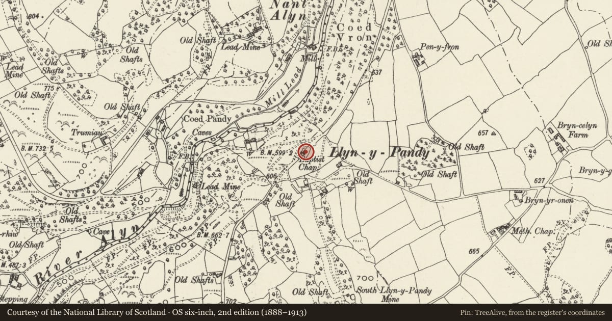
Slide toward Today to fade the historical sheet and see the modern map underneath.
David Rumsey Map Collection, Stanford LibrariesDavid Rumsey Map Collection, Stanford LibrariesDavid Rumsey Map Collection, Stanford LibrariesDavid Rumsey Map Collection, Stanford LibrariesLlyfrgell Genedlaethol Cymru – The National Library of Wales
5 historical maps cover this location, the earliest the 1795 map "To Sir Watkin Williams-Wynn Bart ... the map of the six counties of North Wales is most humbly inscribed by his obedient humble servant" (Llyfrgell Genedlaethol Cymru – The National Library of Wales).
Historical maps covering this location
- 1795 · To Sir Watkin Williams-Wynn Bart ... the map of the six counties of North Wales is most… (Llyfrgell Genedlaethol Cymru – The National Library of Wales)
- 1883 · Watershed map England, Wales 3. (David Rumsey Map Collection, Stanford Libraries)
- 1898 · 108 Flint (Hills) (David Rumsey Map Collection, Stanford Libraries)
- 1898 · 108 Flint (Outline) (David Rumsey Map Collection, Stanford Libraries)
- 1901 · Sheet 9 and 10. (David Rumsey Map Collection, Stanford Libraries)
Cadw's description
Exterior
16133
Situated on the E side of Pen-y-fron Road on the N side of the settlement.
History: Built in 1825 it is the oldest surviving Baptist chapel in use in the former county of Flintshire, and is the only intact example with a square plan with central entrance in the side wall. The chapel was repaired and restored late C20 and furnishings brought from elsewhere.
Exterior: Rubble with roughly squared quoins and stepped architraves to openings. Renewed slate roof. Symmetrical elevation with a central entrance with C19 door flanked by sash windows with margin lights and textured glass, that to the right has renewed stone lintel. Above the door is a stone with a Welsh inscription from Isiah 55.3 and the date 1825. Outbuilding with C20 door attached to right. Left hand return elevation is rendered, rear elevation has 2 sash windows as before.
Rubble walls to burial ground extend from the front and rear of the building and return to form a rectangular enclosure containing gravestones. The wall was restored late C20.
Interior: Not accessible at the time of inspection March 1995.
Listed as a locally rare example of a Baptist Chapel with an early plan form which survives in relation to its burial ground.
References: Seaborne, M. Early Flintshire Chapel Plans Capel Newsletter 18, 1992 pp10-15. Additional information from M. Seaborne.
Nearby in the register
- Bryn-Gwyn (including front Garden walls and stone outbuildingsDomesticunder 1 mi
- Llyn-y-Pandy Calvinistic Methodist Chapel (including attached chapel house, forecourt walls & gate)Religious, Ritual and Funeraryunder 1 mi
- Bath HouseDomesticunder 1 mi
- Coed Du HospitalHealth and Welfareunder 1 mi
Other entries of the same register within about three miles of this one, by straight line.