Cof Cymru: National Historic Assets of Wales · Wales
Tower Folly in Garden of Towerside (Including perimeter Wall)
Gwernaffield with Pantmwyn, Flintshire, Wales
A Grade II listed building in Pant-y-Buarth, Gwernaffield with Pantmwyn, Flintshire, designated on 14 June 1995.
The record
- Designation
- Listed building, Grade II
- Broad class
- Gardens, Parks and Urban Spaces
- Date of designation
- 14 June 1995
- Locality
- Pant-y-Buarth
- Community
- Gwernaffield with Pantmwyn
- Unitary authority
- Flintshire
- Country
- Wales
- Coordinates
- 53.16822, -3.20403
- Cadw reference
- 16130
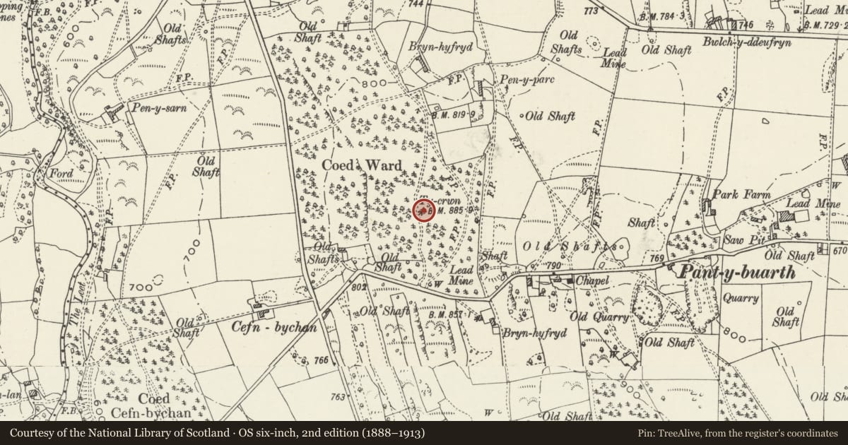
Slide toward Today to fade the historical sheet and see the modern map underneath.
David Rumsey Map Collection, Stanford LibrariesDavid Rumsey Map Collection, Stanford LibrariesDavid Rumsey Map Collection, Stanford LibrariesDavid Rumsey Map Collection, Stanford LibrariesLlyfrgell Genedlaethol Cymru – The National Library of Wales
5 historical maps cover this location, the earliest the 1795 map "To Sir Watkin Williams-Wynn Bart ... the map of the six counties of North Wales is most humbly inscribed by his obedient humble servant" (Llyfrgell Genedlaethol Cymru – The National Library of Wales).
Historical maps covering this location
- 1795 · To Sir Watkin Williams-Wynn Bart ... the map of the six counties of North Wales is most… (Llyfrgell Genedlaethol Cymru – The National Library of Wales)
- 1883 · Watershed map England, Wales 3. (David Rumsey Map Collection, Stanford Libraries)
- 1898 · 108 Flint (Hills) (David Rumsey Map Collection, Stanford Libraries)
- 1898 · 108 Flint (Outline) (David Rumsey Map Collection, Stanford Libraries)
- 1901 · Sheet 9 and 10. (David Rumsey Map Collection, Stanford Libraries)
Cadw's description
Location
Situated in the garden of Towerside reached from a rough track leading N off Pant-y-buarth Road.
History
Mid-late C18 folly tower, possibily originally part of the Cefn Mawr Estate. This 2-storey tower is reputed locally to have been the look out station for a Liverpool tea merchant who could watch his ships approach port up the Mersey from this point.
Exterior
2-storey crenellated tower constructed of roughly coursed local limestone. Single doorway and various C20 windows. It is surrounded by a concentric single storey crenellated wall of roughly coursed limestone with sham arrow slits.
Interior
A flue runs the entire height of the building, originally it is thought to have had a flight of stone steps which led to the flat viewing roof. Remodelled in the C20.
Reason for designation
Listed as an interesting folly tower which is a recognised local landmark.
Nearby in the register
- Bryn-Hyfryd Farmhouse (including attached Farmbuilding) FARMBUILDING),Domesticunder 1 mi
- Milestone opposite Pantymwyn Post OfficeTransportunder 1 mi
- Churchyard Gates to Holy Trinity ChurchReligious, Ritual and Funeraryunder 1 mi
- Maes-y-Groes BellaDomesticunder 1 mi
Other entries of the same register within about three miles of this one, by straight line.