Cof Cymru: National Historic Assets of Wales · Wales
Baptismal Tank at Rhual
Gwernaffield with Pantmwyn, Flintshire, Wales
A Grade II listed building in Rhual, Gwernaffield with Pantmwyn, Flintshire, designated on 14 June 1995.
The record
- Designation
- Listed building, Grade II
- Broad class
- Religious, Ritual and Funerary
- Date of designation
- 14 June 1995
- Locality
- Rhual
- Community
- Gwernaffield with Pantmwyn
- Unitary authority
- Flintshire
- Country
- Wales
- Coordinates
- 53.17635, -3.15844
- Cadw reference
- 16114
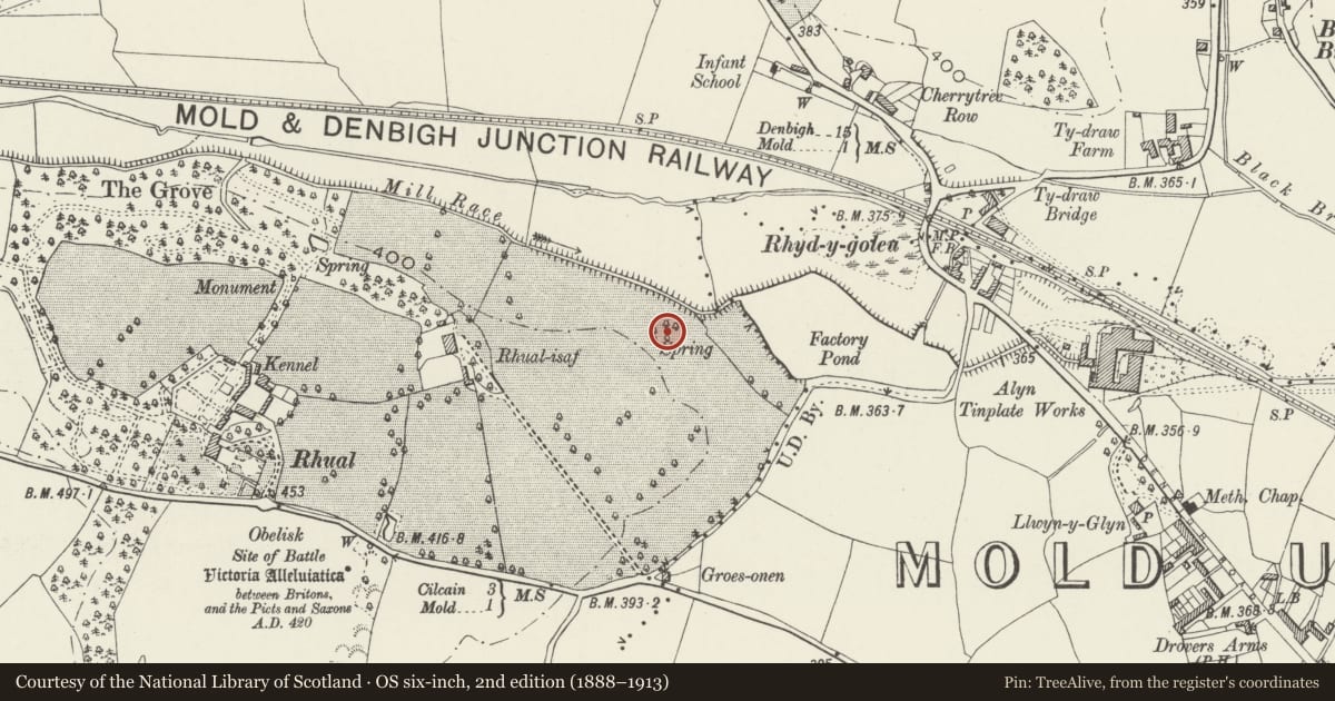
Slide toward Today to fade the historical sheet and see the modern map underneath.
David Rumsey Map Collection, Stanford LibrariesDavid Rumsey Map Collection, Stanford LibrariesDavid Rumsey Map Collection, Stanford LibrariesDavid Rumsey Map Collection, Stanford LibrariesLlyfrgell Genedlaethol Cymru – The National Library of Wales
5 historical maps cover this location, the earliest the 1795 map "To Sir Watkin Williams-Wynn Bart ... the map of the six counties of North Wales is most humbly inscribed by his obedient humble servant" (Llyfrgell Genedlaethol Cymru – The National Library of Wales).
Historical maps covering this location
- 1795 · To Sir Watkin Williams-Wynn Bart ... the map of the six counties of North Wales is most… (Llyfrgell Genedlaethol Cymru – The National Library of Wales)
- 1883 · Watershed map England, Wales 3. (David Rumsey Map Collection, Stanford Libraries)
- 1898 · 108 Flint (Hills) (David Rumsey Map Collection, Stanford Libraries)
- 1898 · 108 Flint (Outline) (David Rumsey Map Collection, Stanford Libraries)
- 1901 · Sheet 9 and 10. (David Rumsey Map Collection, Stanford Libraries)
Cadw's description
Location
Situated in a field 550m E of Rhual reached from the Mold/ Gwernaffield by-road.
History
Erected c1685 by Thomas Edwards of Rhual, a leading figure in local Nonconformist circles, restored 1931.
Exterior
Random rubble; square stone tank set in an oval enclosure with stone steps down to the tank and a channel for the spring which feeds it on the N side. On the S side the walls crank up and a marble plaque set on the inner face commemorates the 1931 restoration. On the W side is an attached circular stone enclosure, apparently of a different build and probably from where the minister officiated at a service; 3 niches set into the inner faces of the walls.
Reason for designation
Listed as an outdoor baptismal tank with C17 origins of which very few examples survive and for associations with the prominent Nonconformist Edwards family of Rhual.
Nearby in the register
- Rhual-Isaf Round BarrowRound Barrowunder 1 mi
- Rhual Grange (including walled garden)Domesticunder 1 mi
- 5 Red HousesDomesticunder 1 mi
- 4 Red HousesDomesticunder 1 mi
Other entries of the same register within about three miles of this one, by straight line.