Cof Cymru: National Historic Assets of Wales · Wales
Curved forecourt Walls to Coed-y-Moch
Brithdir and Llanfachreth, Gwynedd, Wales
A Grade II listed building in Nannau, Brithdir and Llanfachreth, Gwynedd, designated on 26 May 1995.
The record
- Designation
- Listed building, Grade II
- Broad class
- Domestic
- Date of designation
- 26 May 1995
- Locality
- Nannau
- Community
- Brithdir and Llanfachreth
- Unitary authority
- Gwynedd
- Country
- Wales
- Coordinates
- 52.75773, -3.86570
- Cadw reference
- 16048
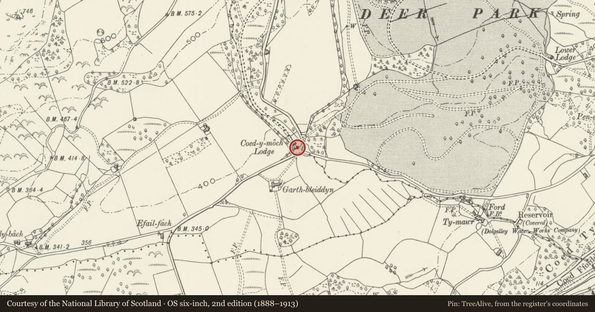
Slide toward Today to fade the historical sheet and see the modern map underneath.
David Rumsey Map Collection, Stanford LibrariesDavid Rumsey Map Collection, Stanford LibrariesDavid Rumsey Map Collection, Stanford LibrariesLlyfrgell Genedlaethol Cymru – The National Library of WalesDavid Rumsey Map Collection, Stanford Libraries
5 historical maps cover this location, the earliest the 1795 map "To Sir Watkin Williams-Wynn Bart ... the map of the six counties of North Wales is most humbly inscribed by his obedient humble servant" (Llyfrgell Genedlaethol Cymru – The National Library of Wales).
Historical maps covering this location
- 1795 · To Sir Watkin Williams-Wynn Bart ... the map of the six counties of North Wales is most… (Llyfrgell Genedlaethol Cymru – The National Library of Wales)
- 1883 · Watershed map England, Wales 3. (David Rumsey Map Collection, Stanford Libraries)
- 1896 · Sheet 7. Ordnance Survey of England and Wales. (David Rumsey Map Collection, Stanford Libraries)
- 1899 · 135 Harlech (Hills) (David Rumsey Map Collection, Stanford Libraries)
- 1901 · Sheet 9 and 10. (David Rumsey Map Collection, Stanford Libraries)
Cadw's description
Location
Located at the SW boundary of the community at a cross-roads between the Llanfachreth-Dolgellau lane and a further lane running E to join the A 494.
History
1830s lodge built by Sir Robert Williames Vaughan of Nannau, Bart in Tudor style to serve the house; also known formerly as the Clock Lodge.
Exterior
Rectangular gate lodge with off-centre arched entrance to L; rubble construction under a slate roof with central paired, off-set chimneys with weather-coursing and moulded capping. Of one-and-a-half storeys, with the lodge-keeper's accomodation tothe R of and above the carriageway. Tudor arches with dripstones and partial stringcourse above, returned around the L gable end. Above the arch a wide gable with a 3-light mullioned and transomed wooden window with returned label. Above this a niche containing an early C20 painted clock face showing the time 6 minutes to 5 (it was 6 minutes ride to Nannau from the lodge, so one was neverlate for tea!) Windows as before to ground floor R and gableends; windows as before to rear, one blocked. Entrance to R underarch, stepped-up and with modern door; window to R.
Sweeping out to L and R in front of the lodge, unusual contemporary curved rubble walls with surmounting multi-Tudor-arched arcades; continuous, joined labels and slatecoping. Later plain iron railings and rubble gate piers to carriage forecourt.
Reason for designation
An imposing Tudor style second-quarter C19 Nannau estate lodge in a striking location. One of a group of estate buildings with varied and unusually experimental designs for the period.
Nearby in the register
- Coed-y-Moch LodgeDomesticunder 1 mi
- Decorative Gate including Railings and Gatepiers opposite Coed-y-Moch LodgeDomesticunder 1 mi
- Garth-BleiddynDomesticunder 1 mi
- Barn at Garth MaelanAgriculture and Subsistenceunder 1 mi
Other entries of the same register within about three miles of this one, by straight line.