Cof Cymru: National Historic Assets of Wales · Wales
Pentregaer Farmhouse
Meifod, Powys, Wales
A Grade II listed building in Geuffordd, Meifod, Powys, designated on 26 May 1995.
The record
- Designation
- Listed building, Grade II
- Broad class
- Domestic
- Date of designation
- 26 May 1995
- Locality
- Geuffordd
- Community
- Meifod
- Unitary authority
- Powys
- Country
- Wales
- Coordinates
- 52.73364, -3.16597
- Cadw reference
- 15975
Slide toward Today to fade the historical sheet and see the modern map underneath.
David Rumsey Map Collection, Stanford LibrariesDavid Rumsey Map Collection, Stanford LibrariesDavid Rumsey Map Collection, Stanford LibrariesDavid Rumsey Map Collection, Stanford LibrariesLlyfrgell Genedlaethol Cymru – The National Library of Wales
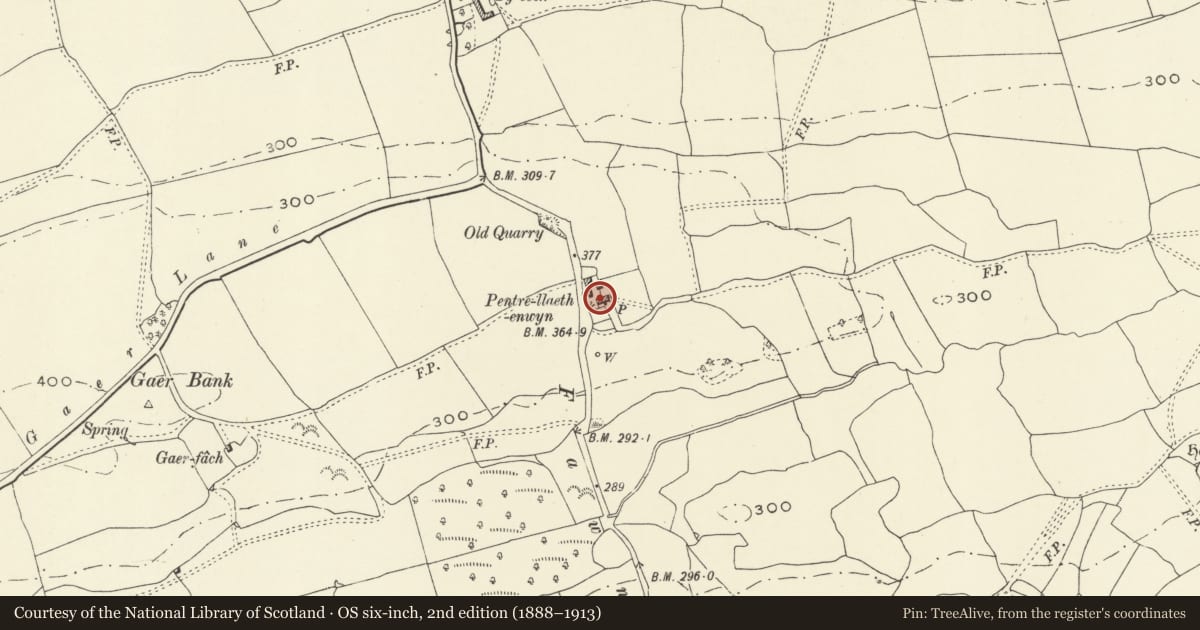
5 historical maps cover this location, the earliest the 1795 map "To Sir Watkin Williams-Wynn Bart ... the map of the six counties of North Wales is most humbly inscribed by his obedient humble servant" (Llyfrgell Genedlaethol Cymru – The National Library of Wales).
Historical maps covering this location
- 1795 · To Sir Watkin Williams-Wynn Bart ... the map of the six counties of North Wales is most… (Llyfrgell Genedlaethol Cymru – The National Library of Wales)
- 1883 · Watershed map England, Wales 3. (David Rumsey Map Collection, Stanford Libraries)
- 1899 · 151 Welshpool (Hills) (David Rumsey Map Collection, Stanford Libraries)
- 1901 · Sheet 9 and 10. (David Rumsey Map Collection, Stanford Libraries)
- 1916 · Sheet 60. Shrewsbury. (David Rumsey Map Collection, Stanford Libraries)
Cadw's description
Location
Located on a spur of land overlooking the valley of the Holywell Brook.
Exterior
Farmhouse probably of C16 or earlier origin, with a later C17 cross wing, raised in the C18. Timber framed with colourwashed infill, slate roof. One storey, raised to 2, with 2 storey cross wing at the W end.
Lattice bracing exposed on N gable of wing, the S gable weatherboarded over similar framing in the C20. Stone side wall to wing. Main range has a blocked door with a Tudor arch doorhead at the E end of the S wall opposite stack. Framing appears to be raised above bressumer level with large panels in light scantling timber. Later door in S angle with wing now removed and entrance in gabled porch to cross wing. Various C20 windows.
Later farm buildings attached to N side.
Interior
Not accessible at the time of inspection.
Reason for designation
Included for its special interest as a sub-medieval farmhouse retaining good period detailing.
Nearby in the register
- Upper FawnogDomesticunder 1 mi
- Bryn Mawr FarmhouseDomesticunder 1 mi
- Street FarmhouseDomesticunder 1 mi
- Colfryn FarmhouseAgriculture and Subsistenceunder 1 mi
Other entries of the same register within about three miles of this one, by straight line.