Cof Cymru: National Historic Assets of Wales · Wales
Farm Range at Old Court Farm
Rogiet, Monmouthshire, Wales
A Grade II listed building in Llanfihangel Rogiet, Rogiet, Monmouthshire, designated on 22 February 1995.
The record
- Designation
- Listed building, Grade II
- Broad class
- Agriculture and Subsistence
- Date of designation
- 22 February 1995
- Locality
- Llanfihangel Rogiet
- Community
- Rogiet
- Unitary authority
- Monmouthshire
- Country
- Wales
- Coordinates
- 51.58677, -2.79363
- Cadw reference
- 15938
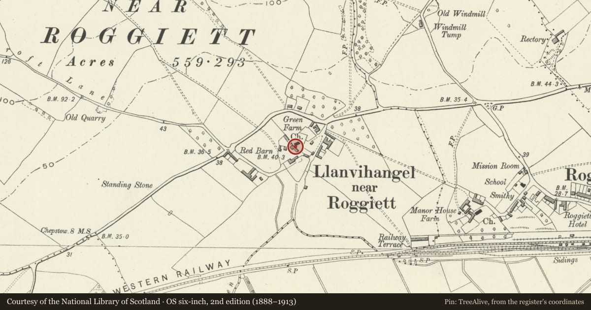
Slide toward Today to fade the historical sheet and see the modern map underneath.
David Rumsey Map Collection, Stanford LibrariesDavid Rumsey Map Collection, Stanford LibrariesDavid Rumsey Map Collection, Stanford LibrariesDavid Rumsey Map Collection, Stanford LibrariesDavid Rumsey Map Collection, Stanford Libraries
5 historical maps cover this location, the earliest the 1636 map "Cornubia : Devonia, Somersetus, Dorcestria, Wiltonia, Glocestria ..." (David Rumsey Map Collection, Stanford Libraries).
Historical maps covering this location
- 1636 · Cornubia : Devonia, Somersetus, Dorcestria, Wiltonia, Glocestria ... (David Rumsey Map Collection, Stanford Libraries)
- 1895 · Sheet 11. Ordnance Survey of England and Wales. (David Rumsey Map Collection, Stanford Libraries)
- 1897 · 250 Chepstow (Outline) (David Rumsey Map Collection, Stanford Libraries)
- 1905 · 250 Chepstow (Hills) (David Rumsey Map Collection, Stanford Libraries)
- 1913 · Sheet 102. Newport. (David Rumsey Map Collection, Stanford Libraries)
Cadw's description
Location
Situated west of St Michael and All Angels church and at right angles to Old Court Farm Farmhouse.
History
Range of farmyard buildings mostly post-dating the 1830 Ordnance Survey map.
Exterior
Of rubble with some brick dressings, pantile and Welsh slate roofs. To right a two-storey range of 5 bays with lightweight collar and tie trusses, cambered brick arched doors and windows with plank door and shutters in west frontage only - east backing onto churchyard; external stone steps to first floor granary/ hayloft; internal door at first floor level connects with single storey cowshed with plank doors and ventilation slit to front and simple rectangular openings with wooden lintels to rear.
Reason for designation
Listed for group value with Old Court Farm Farmhouse and as part of complex comprising the farmhouses and farmyard buildings of Old Court Farm, Green Farm and St Michael and All Angels church and churchyard.
Nearby in the register
- Church of St Michael and All AngelsReligious, Ritual and Funeraryunder 1 mi
- St. Michael's Churchyard Cross, Llanfihangel RogietCross baseunder 1 mi
- Cross Base in Churchyard to St. Michael and all Angels ChurchReligious, Ritual and Funeraryunder 1 mi
- Stables at Old Court FarmDomesticunder 1 mi
Other entries of the same register within about three miles of this one, by straight line.