Cof Cymru: National Historic Assets of Wales · Wales
Former Fire Station
Barry, Vale of Glamorgan, Wales
A Grade II listed building in Barry, Vale of Glamorgan, designated on 30 March 1995.
The record
- Designation
- Listed building, Grade II
- Broad class
- Civil
- Date of designation
- 30 March 1995
- Locality
- Barry
- Community
- Barry
- Unitary authority
- Vale of Glamorgan
- Country
- Wales
- Coordinates
- 51.40723, -3.26321
- Cadw reference
- 15886
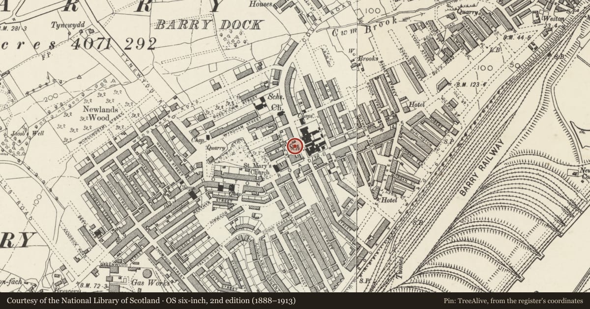
Slide toward Today to fade the historical sheet and see the modern map underneath.
David Rumsey Map Collection, Stanford LibrariesDavid Rumsey Map Collection, Stanford LibrariesDavid Rumsey Map Collection, Stanford LibrariesDavid Rumsey Map Collection, Stanford LibrariesDavid Rumsey Map Collection, Stanford Libraries
5 historical maps cover this location, the earliest the 1636 map "Cornubia : Devonia, Somersetus, Dorcestria, Wiltonia, Glocestria ..." (David Rumsey Map Collection, Stanford Libraries).
Historical maps covering this location
- 1636 · Cornubia : Devonia, Somersetus, Dorcestria, Wiltonia, Glocestria ... (David Rumsey Map Collection, Stanford Libraries)
- 1858 · 20. Bridgewater. (David Rumsey Map Collection, Stanford Libraries)
- 1865 · England and Wales. England No. 6. (David Rumsey Map Collection, Stanford Libraries)
- 1898 · 263 Cardiff (Hills) (David Rumsey Map Collection, Stanford Libraries)
- 1913 · Sheet 110. Cardiff & Mouth of the Severn. (David Rumsey Map Collection, Stanford Libraries)
Cadw's description
Location
Opposite Court Road block of Holton Road School.
History
1901.
Exterior
Three storeys, yellow brick with red brick string courses and arches; some stone dressings and sills, hipped slate roof. Three bays (of 2 windows) divided by pilaster strips; top floor has horned sash windows with square heads (stone lintels); first floor has horned sash windows with red brick arches. On ground floor, 3 broad segmental red brick arches with stone springers and keystones. Left archway has entrance door with glazing above and to R; other arches were vehicular entrances, now glazed.
To rear, elaborate square practice and look-out tower in yellow brick with some red brick banding and stone dressings. Two windows to each face articulated by pilaster strips. Lead pavilion roof with railed look-out platform; top (attic) stage has, between cornices, two oculi to each face. Four stages with louvred openings; iron fire escape to W.
Reason for designation
Included for exceptional historic interest as custom designed fire station with remarkable tower.
Nearby in the register
- Barry Municipal Buildings and LibraryCivilunder 1 mi
- Former Customs House and Mercantile Marine OfficeCommercialunder 1 mi
- 4. Lampstandard outside the Barry Docks OfficesGardens, Parks and Urban Spacesunder 1 mi
- 1, Lampstandard outside the Barry Docks OfficesGardens, Parks and Urban Spacesunder 1 mi
Other entries of the same register within about three miles of this one, by straight line.