Cof Cymru: National Historic Assets of Wales · Wales
Corn Barn at Treprior Farm
Y Ferwig, Ceredigion, Wales
A Grade II listed building in Tremain, Y Ferwig, Ceredigion, designated on 6 March 1995.
The record
- Designation
- Listed building, Grade II
- Broad class
- Agriculture and Subsistence
- Date of designation
- 6 March 1995
- Locality
- Tremain
- Community
- Y Ferwig
- Unitary authority
- Ceredigion
- Country
- Wales
- Coordinates
- 52.10920, -4.58583
- Cadw reference
- 15873
Slide toward Today to fade the historical sheet and see the modern map underneath.
David Rumsey Map Collection, Stanford LibrariesDavid Rumsey Map Collection, Stanford LibrariesDavid Rumsey Map Collection, Stanford LibrariesDavid Rumsey Map Collection, Stanford LibrariesDavid Rumsey Map Collection, Stanford Libraries
5 historical maps cover this location, the earliest the 1608 map "(13) Cambriae Typus." (David Rumsey Map Collection, Stanford Libraries).
Historical maps covering this location
- 1608 · (13) Cambriae Typus. (David Rumsey Map Collection, Stanford Libraries)
- 1636 · Cornubia : Devonia, Somersetus, Dorcestria, Wiltonia, Glocestria ... (David Rumsey Map Collection, Stanford Libraries)
- 1637 · Particular description of Wales. Cambria seu Wallia (David Rumsey Map Collection, Stanford Libraries)
- 1830 · V.3:11-15:XV. Britisches Reich. A. Kon: England. b. Frstenthum Wales: Shire: 37-40 (David Rumsey Map Collection, Stanford Libraries)
- 1899 · 194 Llangranog (Hills) (David Rumsey Map Collection, Stanford Libraries)
Cadw's description
Location
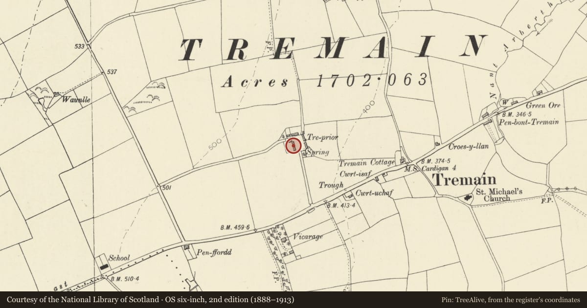
Situated on W side of farmyard at Treprior Farm, approximately 200m N of the A487 at Tremain.
History
Treprior mentioned as an ancient house now farm by S Lewis in 1833. The farm formed part of the Priory estate until 1886 when it was sold. The corn barn was probably built in the 1860's. The brickworks in Cardigan manufactured bricks from about 1858 to around 1923.
Exterior
C1860-70 red brick corn barn with plinth on raised rubble stone base. Built of large Cardigan L shaped hollow bricks. Slate roof with swept eaves. One sliding door on each of N, S and E sides have chamfered brick surrounds, segmental pointed. One circular window high on E end wall and one similar lower on S and N walls. One window high in W end wall. Scissor rafter roof.
Reason for designation
Included for group value with the cow shed adjoining as the best local examples of farm buildings built of the large Cardigan L-shaped hollow bricks. Other examples can be seen at Bryn Pedr Farm near Gwbert.
Nearby in the register
- Cow shed at Treprior FarmAgriculture and Subsistenceunder 1 mi
- DolcoedDomesticunder 1 mi
- MilestoneTransportunder 1 mi
- Church of St MichaelReligious, Ritual and Funeraryunder 1 mi
Other entries of the same register within about three miles of this one, by straight line.