Cof Cymru: National Historic Assets of Wales · Wales
2 Church Street
Lampeter, Ceredigion, Wales
A Grade II listed building in Lampeter, Ceredigion, designated on 11 March 1992.
The record
- Designation
- Listed building, Grade II
- Broad class
- Domestic
- Date of designation
- 11 March 1992
- Town
- Lampeter
- Community
- Lampeter
- Unitary authority
- Ceredigion
- Country
- Wales
- Coordinates
- 52.11386, -4.08178
- Cadw reference
- 15855
Slide toward Today to fade the historical sheet and see the modern map underneath.
David Rumsey Map Collection, Stanford LibrariesDavid Rumsey Map Collection, Stanford LibrariesDavid Rumsey Map Collection, Stanford LibrariesDavid Rumsey Map Collection, Stanford LibrariesDavid Rumsey Map Collection, Stanford Libraries
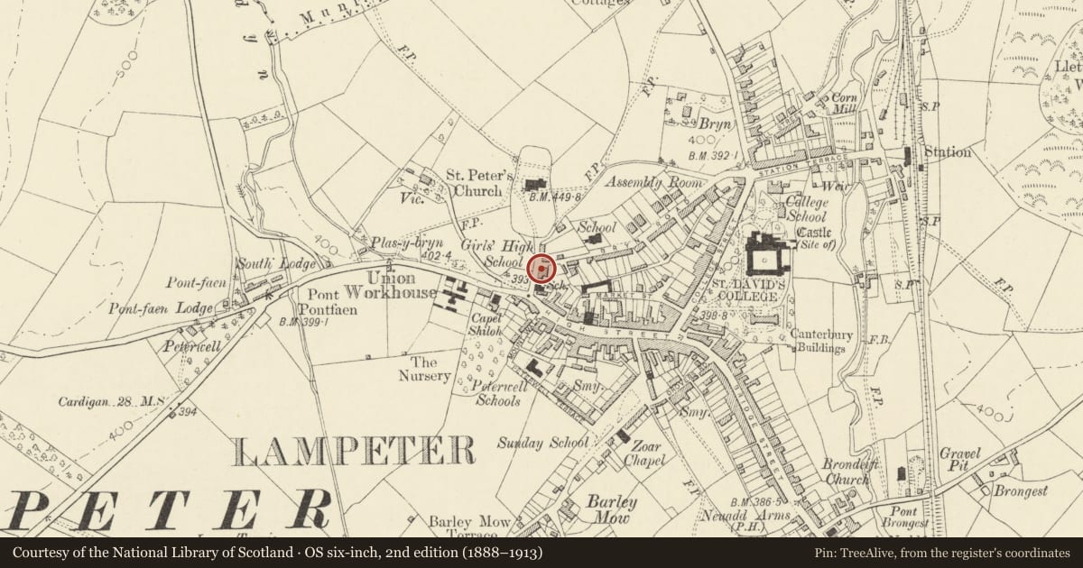
5 historical maps cover this location, the earliest the 1608 map "(13) Cambriae Typus." (David Rumsey Map Collection, Stanford Libraries).
Historical maps covering this location
- 1608 · (13) Cambriae Typus. (David Rumsey Map Collection, Stanford Libraries)
- 1830 · V.3:11-15:XV. Britisches Reich. A. Kon: England. b. Frstenthum Wales: Shire: 37-40 (David Rumsey Map Collection, Stanford Libraries)
- 1899 · 195 Lampeter (Hills) (David Rumsey Map Collection, Stanford Libraries)
- 1901 · Sheet 14. (David Rumsey Map Collection, Stanford Libraries)
- 1919 · Sheet 78. Lampeter. (David Rumsey Map Collection, Stanford Libraries)
Cadw's description
Location
Situated on street line, immediately S of junction with Bryn Road.
History
Early C19.
Exterior
Pair of houses, each 3-storey, 3-window, stucco fronted with slate roofs and rendered stacks. No 1 (Buckingham House) to right, has 6-pane attic windows, 12-pane first floor sashes, the lower half of each sash replaced in plate glass and ground floor pair of late C19 canted bay windows with lean-to slate roof between. Centre door and overlight. Rubble stone rear with 2-storey lean-to rear range and NE rear wing with big stone end stack.
This house has scarfed cruck roof trusses indicating a date of c1800 or earlier, but may be a late example of the type.
No 2 to left has modern small-pane windows throughout, centre door and overlight, rubble stone end wall with straight joint to rubble low 2-storey rear wing with large E end stone stack.
Reason for designation
Included for its special architectural interest as a good example of an early C19 pair of town-houses constructed in a formal late Georgian style. Group value with other listed items in Church Street.
Nearby in the register
- 1 Church StreetDomesticunder 1 mi
- Church Hall/Neuadd Yr Eglwys & Attached HouseReligious, Ritual and Funeraryunder 1 mi
- The Old Grammar SchoolEducationunder 1 mi
- 30 High StreetDomesticunder 1 mi
Other entries of the same register within about three miles of this one, by straight line.