Cof Cymru: National Historic Assets of Wales · Wales
Gates and Gate Piers at the former E entrance to Garth
Guilsfield, Powys, Wales
A Grade II listed building in Garth, Guilsfield, Powys, designated on 22 February 1995.
The record
- Designation
- Listed building, Grade II
- Broad class
- Domestic
- Date of designation
- 22 February 1995
- Locality
- Garth
- Community
- Guilsfield
- Unitary authority
- Powys
- Country
- Wales
- Coordinates
- 52.69262, -3.16527
- Cadw reference
- 15798
Slide toward Today to fade the historical sheet and see the modern map underneath.
David Rumsey Map Collection, Stanford LibrariesDavid Rumsey Map Collection, Stanford LibrariesDavid Rumsey Map Collection, Stanford LibrariesDavid Rumsey Map Collection, Stanford LibrariesLlyfrgell Genedlaethol Cymru – The National Library of Wales
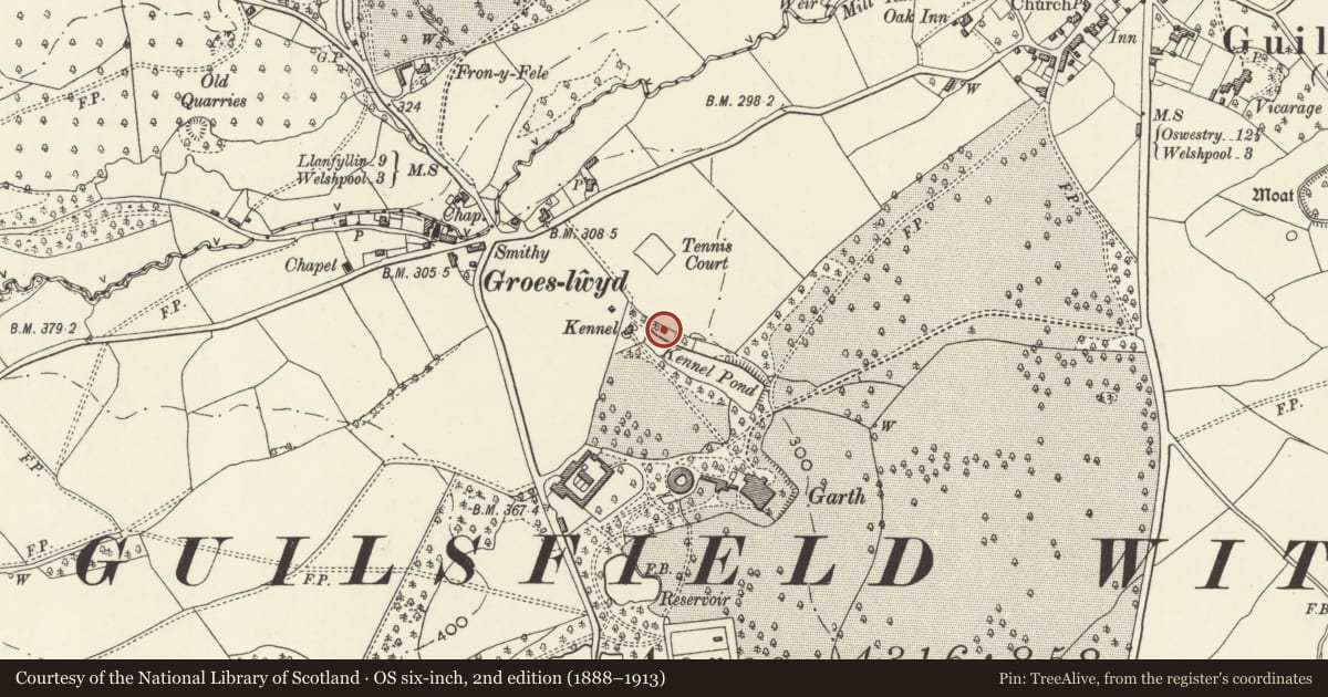
5 historical maps cover this location, the earliest the 1795 map "To Sir Watkin Williams-Wynn Bart ... the map of the six counties of North Wales is most humbly inscribed by his obedient humble servant" (Llyfrgell Genedlaethol Cymru – The National Library of Wales).
Historical maps covering this location
- 1795 · To Sir Watkin Williams-Wynn Bart ... the map of the six counties of North Wales is most… (Llyfrgell Genedlaethol Cymru – The National Library of Wales)
- 1883 · Watershed map England, Wales 3. (David Rumsey Map Collection, Stanford Libraries)
- 1899 · 151 Welshpool (Hills) (David Rumsey Map Collection, Stanford Libraries)
- 1901 · Sheet 9 and 10. (David Rumsey Map Collection, Stanford Libraries)
- 1916 · Sheet 60. Shrewsbury. (David Rumsey Map Collection, Stanford Libraries)
Cadw's description
Location
Located on a field boundary, NE of Garth Farm.
History
Gatepiers to the E entrance to Garth, c.1812, by J. C. Loudon, architect and landscape designer, for Revd. Richard Mytton.
Exterior
Monolithic sandstone. Piers have each a square base, rising to octagonal on shafts, spreading out to octagonal crenellated caps, and finishing with tall octagonal pyramidal finials, in what has been called Loudon's Moresque style. The gate has square section rails rising to pointed arrow terminals with flared tines, and similar terminals to the dog rails, all braced by curved flats meeting at the centre.
Reason for designation
Included as the sole surviving remnant of Garth, demolished 1947-1952, which was the major architectural oeuvre of J.C.Loudon.
Nearby in the register
- Farm Buildings at Garth Farm and Heylin FarmAgriculture and Subsistenceunder 1 mi
- Walled Garden at Garth Farm and Heylin FarmGardens, Parks and Urban Spacesunder 1 mi
- Fron-y-FeleDomesticunder 1 mi
- The PorchesDomesticunder 1 mi
Other entries of the same register within about three miles of this one, by straight line.