Cof Cymru: National Historic Assets of Wales · Wales
Broniarth Farmhouse
Guilsfield, Powys, Wales
A Grade II listed building in Broniarth, Guilsfield, Powys, designated on 22 February 1995.
The record
- Designation
- Listed building, Grade II
- Broad class
- Domestic
- Date of designation
- 22 February 1995
- Locality
- Broniarth
- Community
- Guilsfield
- Unitary authority
- Powys
- Country
- Wales
- Coordinates
- 52.71341, -3.16944
- Cadw reference
- 15791
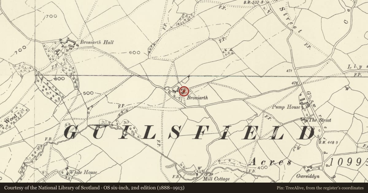
Slide toward Today to fade the historical sheet and see the modern map underneath.
David Rumsey Map Collection, Stanford LibrariesDavid Rumsey Map Collection, Stanford LibrariesDavid Rumsey Map Collection, Stanford LibrariesDavid Rumsey Map Collection, Stanford LibrariesLlyfrgell Genedlaethol Cymru – The National Library of Wales
5 historical maps cover this location, the earliest the 1795 map "To Sir Watkin Williams-Wynn Bart ... the map of the six counties of North Wales is most humbly inscribed by his obedient humble servant" (Llyfrgell Genedlaethol Cymru – The National Library of Wales).
Historical maps covering this location
- 1795 · To Sir Watkin Williams-Wynn Bart ... the map of the six counties of North Wales is most… (Llyfrgell Genedlaethol Cymru – The National Library of Wales)
- 1883 · Watershed map England, Wales 3. (David Rumsey Map Collection, Stanford Libraries)
- 1899 · 151 Welshpool (Hills) (David Rumsey Map Collection, Stanford Libraries)
- 1901 · Sheet 9 and 10. (David Rumsey Map Collection, Stanford Libraries)
- 1916 · Sheet 60. Shrewsbury. (David Rumsey Map Collection, Stanford Libraries)
Cadw's description
Location
Located on a platform site overlooking a wide valley at the N end of the Community Area
History
c1850
Exterior
Farmhouse, c.1850, Flemish bond brickwork on stone foundations, hipped slate roof. Two storeys, double pile plan of 3 bays with central stair hall.
Tall central doorcase with 4-panelled door and overlight within an open pedimented timber doorcase. Twelve-paned sash windows in opening with 1+ brick segmental heads, 6-pane sashes to first floor, all with stone sills. Brick dentilled eaves. Two stacks on central cross wall. Lean-to at W end of c.1920. Rear elevation has 3-light transomed paned windows with central iron casement.
Interior
Interior has king post roof trusses with angled struts off the haunches. Single tier of purlins.
Reason for designation
Included as an unaltered example of a mid C19 farmhouse.
Nearby in the register
- Broniarth HallDomesticunder 1 mi
- Street FarmhouseDomesticunder 1 mi
- Stable Building at Trawscoed HenDomesticunder 1 mi
- Trawscoed Hen (East Wing)Domesticunder 1 mi
Other entries of the same register within about three miles of this one, by straight line.