Cof Cymru: National Historic Assets of Wales · Wales
Cemetery Chapel
Guilsfield, Powys, Wales
A Grade II listed building in Guilsfield, Powys, designated on 22 February 1995.
The record
- Designation
- Listed building, Grade II
- Broad class
- Religious, Ritual and Funerary
- Date of designation
- 22 February 1995
- Locality
- Guilsfield
- Community
- Guilsfield
- Unitary authority
- Powys
- Country
- Wales
- Coordinates
- 52.69633, -3.15265
- Cadw reference
- 15785
Slide toward Today to fade the historical sheet and see the modern map underneath.
David Rumsey Map Collection, Stanford LibrariesDavid Rumsey Map Collection, Stanford LibrariesDavid Rumsey Map Collection, Stanford LibrariesDavid Rumsey Map Collection, Stanford LibrariesLlyfrgell Genedlaethol Cymru – The National Library of Wales
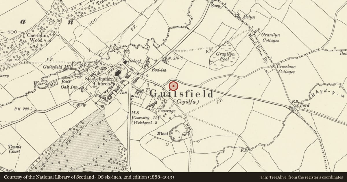
5 historical maps cover this location, the earliest the 1795 map "To Sir Watkin Williams-Wynn Bart ... the map of the six counties of North Wales is most humbly inscribed by his obedient humble servant" (Llyfrgell Genedlaethol Cymru – The National Library of Wales).
Historical maps covering this location
- 1795 · To Sir Watkin Williams-Wynn Bart ... the map of the six counties of North Wales is most… (Llyfrgell Genedlaethol Cymru – The National Library of Wales)
- 1883 · Watershed map England, Wales 3. (David Rumsey Map Collection, Stanford Libraries)
- 1899 · 151 Welshpool (Hills) (David Rumsey Map Collection, Stanford Libraries)
- 1901 · Sheet 9 and 10. (David Rumsey Map Collection, Stanford Libraries)
- 1916 · Sheet 60. Shrewsbury. (David Rumsey Map Collection, Stanford Libraries)
Cadw's description
Location
Located at the centre of the cemetery, near the centre of Guilsfield.
History
Chapel, after 1902.
Exterior
Uncoursed limestone rubble with some timber framing, tiled roof.
Gable walls have a high plinth and battered ends, the side walls slightly recessed, and timber framed upper section on a continuation of the plinth, and is glazed between the framing with patterned calmes. West door, set in gabled walling slightly set forward, has 2-centred arch from a low springing on the plinth and canted reveals to double boarded doors. Wall plates and purlins have shaped ends. Door at centre of N side.
Interior
Has open timber roof and simple altar at E end on a raised dais.
Reason for designation
Included in the list as a well considered design in the Arts and Crafts style, unusual in cemetery chapels.
Nearby in the register
- VicarageDomesticunder 1 mi
- Glebe HouseDomesticunder 1 mi
- Bod-IsaDomesticunder 1 mi
- Bod-Isa CottageDomesticunder 1 mi
Other entries of the same register within about three miles of this one, by straight line.