Cof Cymru: National Historic Assets of Wales · Wales
Gwynion Llethri Farmhouse
Talley, Carmarthenshire, Wales
A Grade II listed building in Gwynion Llethri, Talley, Carmarthenshire, designated on 1 March 1995.
The record
- Designation
- Listed building, Grade II
- Broad class
- Domestic
- Date of designation
- 1 March 1995
- Locality
- Gwynion Llethri
- Community
- Talley
- Unitary authority
- Carmarthenshire
- Country
- Wales
- Coordinates
- 51.99001, -3.96996
- Cadw reference
- 15779
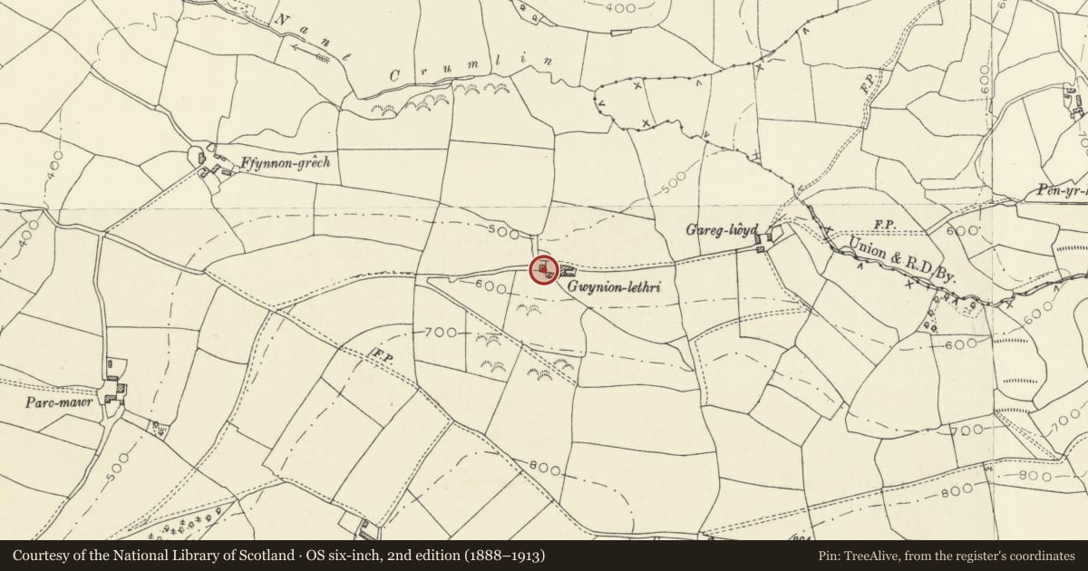
Slide toward Today to fade the historical sheet and see the modern map underneath.
David Rumsey Map Collection, Stanford LibrariesDavid Rumsey Map Collection, Stanford LibrariesDavid Rumsey Map Collection, Stanford LibrariesDavid Rumsey Map Collection, Stanford LibrariesDavid Rumsey Map Collection, Stanford Libraries
5 historical maps cover this location, the earliest the 1860 map "41. Caermathen." (David Rumsey Map Collection, Stanford Libraries).
Historical maps covering this location
- 1860 · 41. Caermathen. (David Rumsey Map Collection, Stanford Libraries)
- 1891 · Sheet 10. Ordnance Survey of England and Wales. . (David Rumsey Map Collection, Stanford Libraries)
- 1898 · 212 Llandovery (Hills) (David Rumsey Map Collection, Stanford Libraries)
- 1898 · 212 Llandovery (Outline) (David Rumsey Map Collection, Stanford Libraries)
- 1901 · Sheet 14. (David Rumsey Map Collection, Stanford Libraries)
Cadw's description
Location
Isolated location, some 2 km NE of Talley. Along long track reached off the B4302 road near lodge to Edwinsford.
History
Farmstead shown on 1839 Tithe map, but not present house. Owner, Sir James Williams of Edwinsford.
Exterior
Small early C19 2-storey farmhouse. Whitewashed rubble walls, slate roof, wooden soffits. Rendered gable chimney-stacks, thicker to right. Plinth. Offset 2-window facade, cambered heads to windows with stone voussoirs. 12-pane hornless sashes to ground floor; 9-pane ( 6 over 3 ) sashes to first floor. Entry to right hand return elevation alongside chimney, modern half-glazed door. Rendered return elevations. Rubble rear, 2 modern wide steel framed windows to ground floor, 2 sashes above, 9-pane, hornless with heads as to front.
Reason for designation
Unaltered little farmhouse showing the late survival of the chimney entry plan in the area.
Nearby in the register
- Gate Piers & Gates to Edwinsford Mansion at Irongate LodgeDomesticunder 1 mi
- bridge over River Gothi at EdwinsfordTransport1 mi
- The Coach House- no description available 3/12/2004 RMDomestic1 mi
- The DairyAgriculture and Subsistence1 mi
Other entries of the same register within about three miles of this one, by straight line.