Cof Cymru: National Historic Assets of Wales · Wales
Gwanuforfydd House
Talley, Carmarthenshire, Wales
A Grade II listed building in Cwmdu, Talley, Carmarthenshire, designated on 1 March 1995.
The record
- Designation
- Listed building, Grade II
- Broad class
- Domestic
- Date of designation
- 1 March 1995
- Locality
- Cwmdu
- Community
- Talley
- Unitary authority
- Carmarthenshire
- Country
- Wales
- Coordinates
- 51.95395, -3.98775
- Cadw reference
- 15776
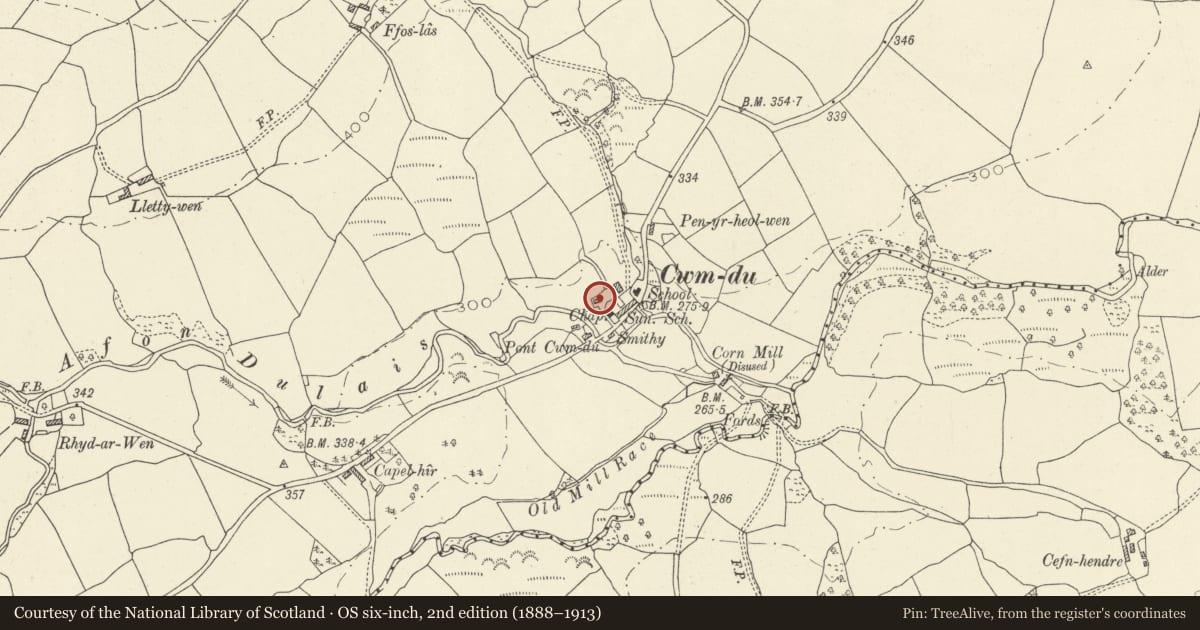
Slide toward Today to fade the historical sheet and see the modern map underneath.
David Rumsey Map Collection, Stanford LibrariesDavid Rumsey Map Collection, Stanford LibrariesDavid Rumsey Map Collection, Stanford LibrariesDavid Rumsey Map Collection, Stanford LibrariesDavid Rumsey Map Collection, Stanford Libraries
5 historical maps cover this location, the earliest the 1860 map "41. Caermathen." (David Rumsey Map Collection, Stanford Libraries).
Historical maps covering this location
- 1860 · 41. Caermathen. (David Rumsey Map Collection, Stanford Libraries)
- 1891 · Sheet 10. Ordnance Survey of England and Wales. . (David Rumsey Map Collection, Stanford Libraries)
- 1898 · 212 Llandovery (Outline) (David Rumsey Map Collection, Stanford Libraries)
- 1898 · 212 Llandovery (Hills) (David Rumsey Map Collection, Stanford Libraries)
- 1901 · Sheet 14. (David Rumsey Map Collection, Stanford Libraries)
Cadw's description
Location
Situated to the rear of Baptist Chapel, reached off a short lane.
History
Shown on 1839 Tithe map. Owner, David James of Cwmgigfran.
Exterior
Early C19. Roughcast painted 2-storey, 3-window symmetrical facade. Slate roof, rendered gable chimney stacks, thicker to right. 3 first floor 9-pane (6-pane over 3) horned sash windows with raised cemented double-lugged architraves. Small simple central gabled porch, modern halfglazed inner door. Raised cemented corner vertical strips, similarly treated horizontal string between storeys. Lean-to on left side with half-glazed door.
Reason for designation
Included for group value with the Baptist Chapel and Cwmdu Terace immediately to the SW. Part of highly picturesque village group.
Nearby in the register
- Providence Baptist Chapel, CwmduReligious, Ritual and Funeraryunder 1 mi
- Post Office (Rhyderonnen)Communicationsunder 1 mi
- Inn (Rhyderonnen)Commercialunder 1 mi
- Cottage Row (Rhyderonnen)Domesticunder 1 mi
Other entries of the same register within about three miles of this one, by straight line.