Cof Cymru: National Historic Assets of Wales · Wales
Sunday Schoolroom
Talley, Carmarthenshire, Wales
A Grade II listed building in Talley, Carmarthenshire, designated on 1 March 1995.
The record
- Designation
- Listed building, Grade II
- Broad class
- Religious, Ritual and Funerary
- Date of designation
- 1 March 1995
- Locality
- Talley
- Community
- Talley
- Unitary authority
- Carmarthenshire
- Country
- Wales
- Coordinates
- 51.97638, -3.99262
- Cadw reference
- 15768
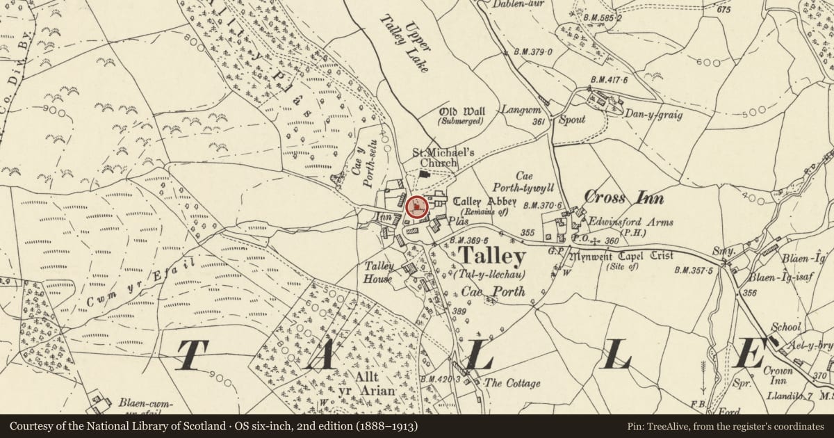
Slide toward Today to fade the historical sheet and see the modern map underneath.
David Rumsey Map Collection, Stanford LibrariesDavid Rumsey Map Collection, Stanford LibrariesDavid Rumsey Map Collection, Stanford LibrariesDavid Rumsey Map Collection, Stanford LibrariesDavid Rumsey Map Collection, Stanford Libraries
5 historical maps cover this location, the earliest the 1860 map "41. Caermathen." (David Rumsey Map Collection, Stanford Libraries).
Historical maps covering this location
- 1860 · 41. Caermathen. (David Rumsey Map Collection, Stanford Libraries)
- 1891 · Sheet 10. Ordnance Survey of England and Wales. . (David Rumsey Map Collection, Stanford Libraries)
- 1898 · 212 Llandovery (Hills) (David Rumsey Map Collection, Stanford Libraries)
- 1898 · 212 Llandovery (Outline) (David Rumsey Map Collection, Stanford Libraries)
- 1901 · Sheet 14. (David Rumsey Map Collection, Stanford Libraries)
Cadw's description
Location
Prominently sited immediately W of the grounds of the ruined Abbey in the village centre.
History
Built 1803 for the vestry committee of the parish church by John Phillips and John Rees Jones who undertook to build the whole by June 1803 at the cost of 1/8-0 per perch.
Exterior
Small single storey rubble-built schoolroom, formerly limewashed. Slate roof, timber close barges. Rubble chimney stack to left. Door to left with elliptical head, stone voussoirs. Raised cemented plain architrave, boarded door. 2 windows to right with cambered stone voussoired heads and slate sills. Early C20 4-pane casements with plain top-hung light. Straight joints below sill indicates that left-hand window was formerly a door. 2 similar windows to rear.
Attached lower shed to right, rubble walls, slate roof and slated barging. Doorway to gable end with flat stone voussoired head and boarded door.
Reason for designation
Group value with the Abbey ruin to the NE.
Nearby in the register
- Talley AbbeyAbbeyunder 1 mi
- Ruin of Talley AbbeyReligious, Ritual and Funeraryunder 1 mi
- Y PlasDomesticunder 1 mi
- Parish Church of St MichaelReligious, Ritual and Funeraryunder 1 mi
Other entries of the same register within about three miles of this one, by straight line.