Cof Cymru: National Historic Assets of Wales · Wales
Broth Lodge (West) including attached screen wall and gatepiers
Ruabon, Wrexham, Wales
A Grade II listed building in Wynnstay, Ruabon, Wrexham, designated on 22 February 1995.
The record
- Designation
- Listed building, Grade II
- Broad class
- Domestic
- Date of designation
- 22 February 1995
- Locality
- Wynnstay
- Community
- Ruabon
- Unitary authority
- Wrexham
- Country
- Wales
- Coordinates
- 52.98307, -3.02716
- Cadw reference
- 15751
Slide toward Today to fade the historical sheet and see the modern map underneath.
David Rumsey Map Collection, Stanford LibrariesDavid Rumsey Map Collection, Stanford LibrariesDavid Rumsey Map Collection, Stanford LibrariesDavid Rumsey Map Collection, Stanford LibrariesLlyfrgell Genedlaethol Cymru – The National Library of Wales
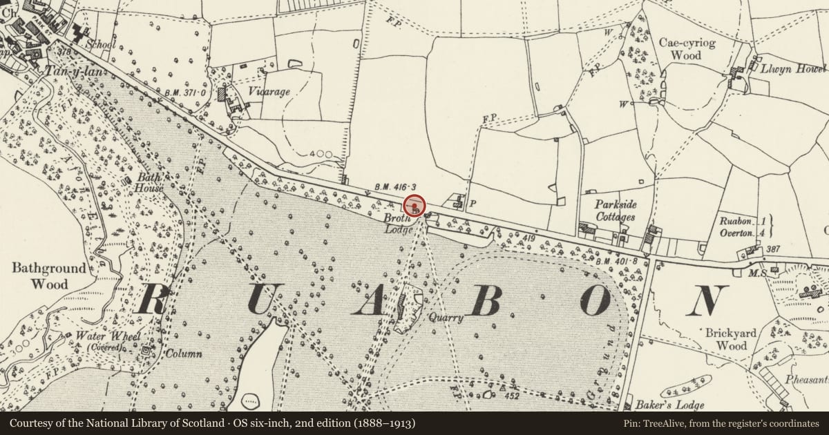
5 historical maps cover this location, the earliest the 1795 map "To Sir Watkin Williams-Wynn Bart ... the map of the six counties of North Wales is most humbly inscribed by his obedient humble servant" (Llyfrgell Genedlaethol Cymru – The National Library of Wales).
Historical maps covering this location
- 1795 · To Sir Watkin Williams-Wynn Bart ... the map of the six counties of North Wales is most… (Llyfrgell Genedlaethol Cymru – The National Library of Wales)
- 1883 · Watershed map England, Wales 3. (David Rumsey Map Collection, Stanford Libraries)
- 1898 · 121 Wrexham (Hills) (David Rumsey Map Collection, Stanford Libraries)
- 1898 · 121 Wrexham (Outline) (David Rumsey Map Collection, Stanford Libraries)
- 1901 · Sheet 9 and 10. (David Rumsey Map Collection, Stanford Libraries)
Cadw's description
Location
Situated beside main road, 1km E of Ruabon.
History
One of a pair of gate lodges to the Wynnstay estate of early-mid C19 date.
Exterior
2-storey lodge faced in sandstone ashlar with slate roof, red ridge-tiles, stone chimneys, bracketed eaves cornice and advanced bay with hipped roof. Single storey extensions. 6-pane sash windows, that on ground floor in altered opening. On right hand side an attached rubble wall with stone copings with a later small window. Attached to the left hand side are two stone gate-piers with pyramidal caps linked by inset wall. Left hand return elevation has entrance to right and blocked window to left.
Interior
Later C19 stair and doors and a single-storey extension built within the curve of the exterior estate wall.
Reason for designation
Included for group value with Broth Lodge (east) together with which it has special interest as an earlier C19 gate lodge to the Wynnstay estate.
Nearby in the register
- Broth Lodge (East) including attached screen wall and gatepiersDomesticunder 1 mi
- Boat HouseDomesticunder 1 mi
- Wat's Dyke: Section extending from Pentre-Clawdd to Wynnstay ParkLinear Earthworkunder 1 mi
- Gates and Gate piers at Bakers LodgeDomesticunder 1 mi
Other entries of the same register within about three miles of this one, by straight line.