Cof Cymru: National Historic Assets of Wales · Wales
19 Park Street
Ruabon, Wrexham, Wales
A Grade II listed building in Ruabon, Wrexham, designated on 22 February 1995.
The record
- Designation
- Listed building, Grade II
- Broad class
- Domestic
- Date of designation
- 22 February 1995
- Locality
- Ruabon
- Community
- Ruabon
- Unitary authority
- Wrexham
- Country
- Wales
- Coordinates
- 52.98638, -3.03890
- Cadw reference
- 15715
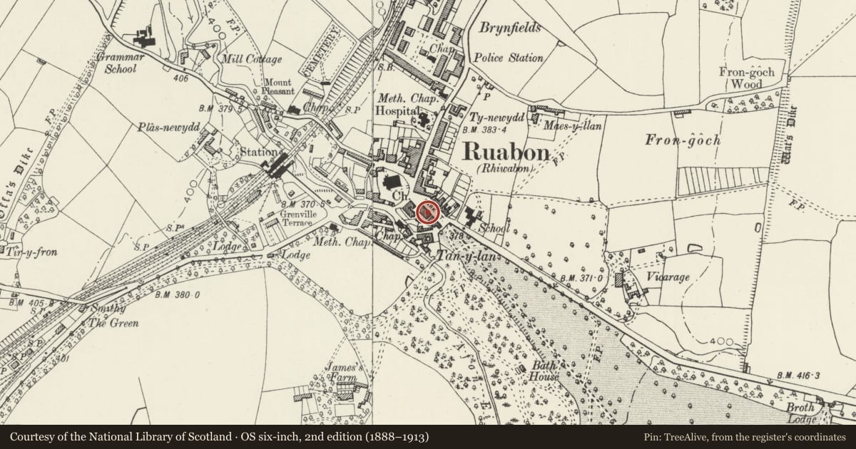
Slide toward Today to fade the historical sheet and see the modern map underneath.
David Rumsey Map Collection, Stanford LibrariesDavid Rumsey Map Collection, Stanford LibrariesDavid Rumsey Map Collection, Stanford LibrariesDavid Rumsey Map Collection, Stanford LibrariesLlyfrgell Genedlaethol Cymru – The National Library of Wales
5 historical maps cover this location, the earliest the 1795 map "To Sir Watkin Williams-Wynn Bart ... the map of the six counties of North Wales is most humbly inscribed by his obedient humble servant" (Llyfrgell Genedlaethol Cymru – The National Library of Wales).
Historical maps covering this location
- 1795 · To Sir Watkin Williams-Wynn Bart ... the map of the six counties of North Wales is most… (Llyfrgell Genedlaethol Cymru – The National Library of Wales)
- 1883 · Watershed map England, Wales 3. (David Rumsey Map Collection, Stanford Libraries)
- 1898 · 121 Wrexham (Hills) (David Rumsey Map Collection, Stanford Libraries)
- 1898 · 121 Wrexham (Outline) (David Rumsey Map Collection, Stanford Libraries)
- 1901 · Sheet 9 and 10. (David Rumsey Map Collection, Stanford Libraries)
Cadw's description
Location
The western of the two blocks of estate cottages on this side of Park Street.
History
One of four blocks of estate cottages on Park Street probably built c1840. Each block originally consisted of two 1-up 1-down units reached from the side, two 2-up 2-down units reached from a pair of doors in the street elevation, and a further pair of 1-up 1-down units reached from the other side. All rooms had corner fireplaces and the units shared flues leading to large octagonal chimneys. Neighbouring 1-up 1-down units have now been altered to form one dwelling and the blocks all have later extensions to the rear.
Exterior
Symmetrical elevation, 2-storey 4 windows. Roughly coursed and squared sandstone rubble with dressed stone quoins, hipped slate roof with two octagonal stone chimneys. Paired central entrances share a stone canopy. Windows have hoodmoulds, those at ground floor badly eroded, those at upper level restored. Left hand return has paired entrances under shared stone canopy, that to the right now a window. Right hand return as left hand return.
Interior
Generally the two unit cottages retain basic plan form, some original stairs and blocked corner fireplaces.
Reason for designation
Listed as relatively intact examples of carefully planned estate cottages relating to the Wynnstay Estate.
Group value with neighbouring listed buildings on Park Street.
Nearby in the register
- 20 Park StreetDomesticunder 1 mi
- 21 Park StreetDomesticunder 1 mi
- 17 Park StreetDomesticunder 1 mi
- 18 Park StreetDomesticunder 1 mi
Other entries of the same register within about three miles of this one, by straight line.