Cof Cymru: National Historic Assets of Wales · Wales
Mary's Salon
Ruabon, Wrexham, Wales
A Grade II listed building in Ruabon, Wrexham, designated on 22 February 1995.
The record
- Designation
- Listed building, Grade II
- Broad class
- Domestic
- Date of designation
- 22 February 1995
- Locality
- Ruabon
- Community
- Ruabon
- Unitary authority
- Wrexham
- Country
- Wales
- Coordinates
- 52.98708, -3.03943
- Cadw reference
- 15693
Slide toward Today to fade the historical sheet and see the modern map underneath.
David Rumsey Map Collection, Stanford LibrariesDavid Rumsey Map Collection, Stanford LibrariesDavid Rumsey Map Collection, Stanford LibrariesDavid Rumsey Map Collection, Stanford LibrariesLlyfrgell Genedlaethol Cymru – The National Library of Wales
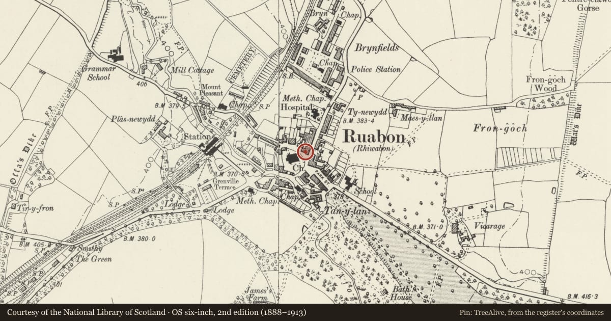
5 historical maps cover this location, the earliest the 1795 map "To Sir Watkin Williams-Wynn Bart ... the map of the six counties of North Wales is most humbly inscribed by his obedient humble servant" (Llyfrgell Genedlaethol Cymru – The National Library of Wales).
Historical maps covering this location
- 1795 · To Sir Watkin Williams-Wynn Bart ... the map of the six counties of North Wales is most… (Llyfrgell Genedlaethol Cymru – The National Library of Wales)
- 1883 · Watershed map England, Wales 3. (David Rumsey Map Collection, Stanford Libraries)
- 1898 · 121 Wrexham (Hills) (David Rumsey Map Collection, Stanford Libraries)
- 1898 · 121 Wrexham (Outline) (David Rumsey Map Collection, Stanford Libraries)
- 1901 · Sheet 9 and 10. (David Rumsey Map Collection, Stanford Libraries)
Cadw's description
Location
House on corner of Church Street and High Street, known as Mary's Salon, opposite St Mary's Churchyard.
History
Late C18 house incorporating earlier building of stone rubble, ground floor converted to hairdressing salon C20.
Exterior
3-storeys. Red brick, sandstone rubble, hipped slate roof with red ridge tiles, brick chimneys. 2-window Church Street elevation: ground floor of sandstone rubble with later door to left and later porch to right. Upper floors red brick with dentilled eaves cornice, camber headed 9-pane sash windows first floor, 6-pane sash windows to second floor. High Street elevation: ground floor rendered with shop front to right, a canopy with slate roof runs the length of the elevation. One window on each upper floor is blocked to left, to right casement windows. Rear: Sandstone rubble with openings of various dates.
Reason for designation
Included for group value with the Wynnstay Arms and with other listed buildings on Church Street.
Nearby in the register
- Wynnstay Arms PHCommercialunder 1 mi
- Church of St Mary, including churchyard walls and lych gateReligious, Ritual and Funeraryunder 1 mi
- Sundial on the Churchyard to Church of St MaryGardens, Parks and Urban Spacesunder 1 mi
- Hearse ShedAgriculture and Subsistenceunder 1 mi
Other entries of the same register within about three miles of this one, by straight line.