Cof Cymru: National Historic Assets of Wales · Wales
Coach House at Glanogwr
Bridgend, Bridgend, Wales
A Grade II listed building in Bridgend, designated on 29 September 1986.
The record
- Designation
- Listed building, Grade II
- Broad class
- Domestic
- Date of designation
- 29 September 1986
- Community
- Bridgend
- Unitary authority
- Bridgend
- Country
- Wales
- Coordinates
- 51.50039, -3.58421
- Cadw reference
- 15680
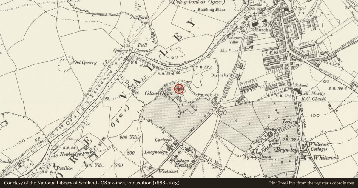
Slide toward Today to fade the historical sheet and see the modern map underneath.
David Rumsey Map Collection, Stanford LibrariesDavid Rumsey Map Collection, Stanford LibrariesDavid Rumsey Map Collection, Stanford LibrariesDavid Rumsey Map Collection, Stanford LibrariesDavid Rumsey Map Collection, Stanford Libraries
5 historical maps cover this location, the earliest the 1636 map "Cornubia : Devonia, Somersetus, Dorcestria, Wiltonia, Glocestria ..." (David Rumsey Map Collection, Stanford Libraries).
Historical maps covering this location
- 1636 · Cornubia : Devonia, Somersetus, Dorcestria, Wiltonia, Glocestria ... (David Rumsey Map Collection, Stanford Libraries)
- 1637 · The fourth table of England. Cornub. Devonia, Somerset etc. (David Rumsey Map Collection, Stanford Libraries)
- 1865 · England and Wales. England No. 6. (David Rumsey Map Collection, Stanford Libraries)
- 1897 · 262 Pontypridd (Hills) (David Rumsey Map Collection, Stanford Libraries)
- 1897 · 262 Pontypridd (Outline) (David Rumsey Map Collection, Stanford Libraries)
Cadw's description
Location
Situated to N of Glanogwr House at the end of the road.
History
Late C18/early C19, contemporary with the house.
Exterior
2-storey rubble former coach house, brick English garden wall bond SE wall with stretchers laid on their sides; hipped slate roof and brick chimney stacks. Cambered voussior heads to various metal frame windows on S side; boarded loft opening to far end and plain rubble rear.
Reason for designation
Included for group value.
Nearby in the register
- Glanogwr (including Glanogwr cottage) (Environmental Health Department)Commercialunder 1 mi
- Administrive Block at former Preswylfa Children's HomeHealth and Welfareunder 1 mi
- Former Preswylfa Childrens HomeDomesticunder 1 mi
- Former Preswylfa Childrens HomeDomesticunder 1 mi
Other entries of the same register within about three miles of this one, by straight line.