Cof Cymru: National Historic Assets of Wales · Wales
Briwnant Farmhouse
Glyntraian, Wrexham, Wales
A Grade II listed building in Nant Gwryd, Llangollen, Glyntraian, Wrexham, designated on 29 July 1994.
The record
- Designation
- Listed building, Grade II
- Broad class
- Domestic
- Date of designation
- 29 July 1994
- Locality
- Nant Gwryd
- Town
- Llangollen
- Community
- Glyntraian
- Unitary authority
- Wrexham
- Country
- Wales
- Coordinates
- 52.91488, -3.14229
- Cadw reference
- 15656
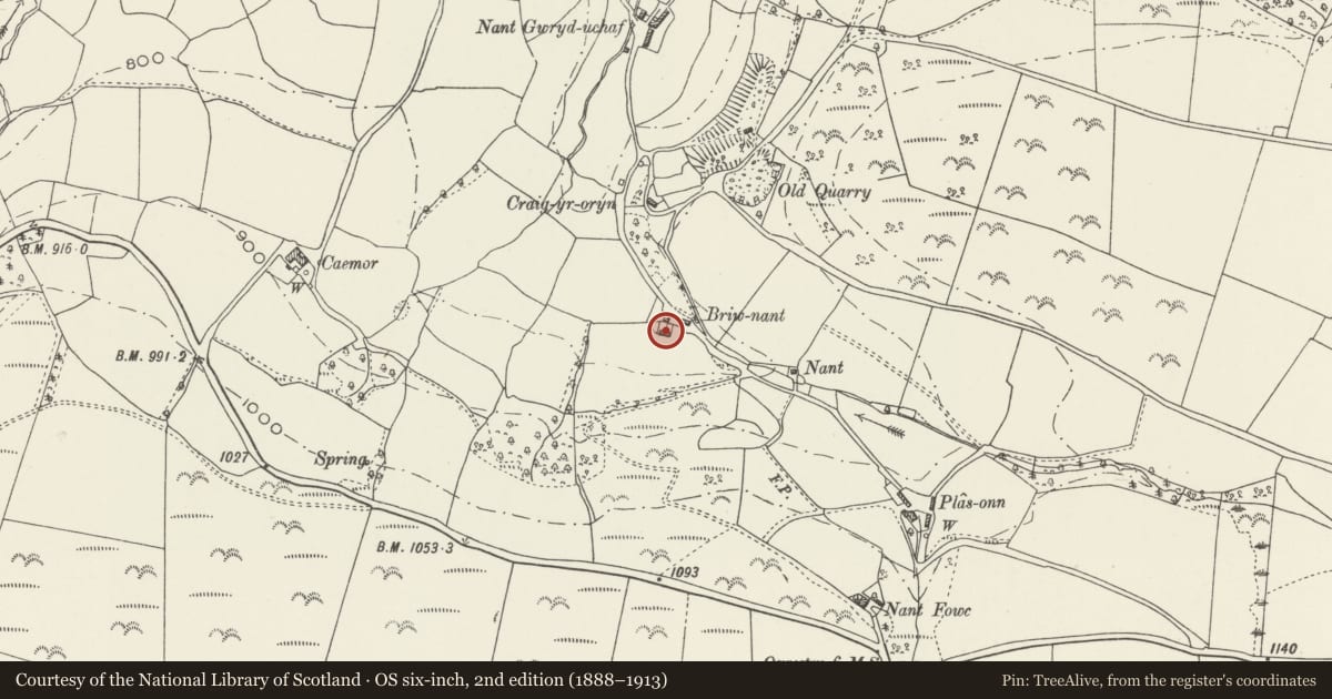
Slide toward Today to fade the historical sheet and see the modern map underneath.
David Rumsey Map Collection, Stanford LibrariesDavid Rumsey Map Collection, Stanford LibrariesDavid Rumsey Map Collection, Stanford LibrariesLlyfrgell Genedlaethol Cymru – The National Library of WalesDavid Rumsey Map Collection, Stanford Libraries
5 historical maps cover this location, the earliest the 1608 map "(13) Cambriae Typus." (David Rumsey Map Collection, Stanford Libraries).
Historical maps covering this location
- 1608 · (13) Cambriae Typus. (David Rumsey Map Collection, Stanford Libraries)
- 1795 · To Sir Watkin Williams-Wynn Bart ... the map of the six counties of North Wales is most… (Llyfrgell Genedlaethol Cymru – The National Library of Wales)
- 1883 · Watershed map England, Wales 3. (David Rumsey Map Collection, Stanford Libraries)
- 1897 · 137 Oswestry (Hills) (David Rumsey Map Collection, Stanford Libraries)
- 1901 · Sheet 9 and 10. (David Rumsey Map Collection, Stanford Libraries)
Cadw's description
Location
Located along a track running S off a lane c1.4km SE of Llwynmawr village, and N of the B4579 road. Set on a levelled site with farm building immediately N.
History
Mid-C17 lobby-entry farmhouse, said to have been dated 1640. Probably timber-framed originally, but progressively repaired in local stone. Later extension to E, probably C18-19, and constructed of stone. Extended to the rear and renovated in the late C20, having been in poor condition. There was formerly a rear window with lintel reused from a 4-light diamond-mullioned window, possibly originally lighting the hall.
Exterior
House of one-and-a-half storeys constructed of rubble stone, recently repointed, under a renewed slate roof. Tall stone star-shaped chimney stack with weather-coursing to L of centre. Late C20 2-light wooden casement windows. The front entrance with renewed wooden door is L of centre, beneath the stack. Two windows R of entrance, and one to L in later E unit. A slight mark in the masonry and some possible quoins indicate the original gable end. The upper storey has a gabled dormer L of centre with 2-light casement. West gable end has casement window to attic and tiny pantry window below, with new casement window inserted to its L. Massive boulder set in NW angle of house. The E gable end has a loft-door opening, now glazed, below which is a small window. This has been reinstated after being blocked by an outside staircase, now removed. Rear entrance into E unit with window to its L. Beyond these is a large gabled extension in similar style to main range with a stone end stack and skylights.
Interior
The front entrance, originally at the E end of the building, is in front of the chimney. Massive fireplace, which is said to have had a domed bread-oven, with fireplace stairs against the rear wall. The rear wall has been rebuilt along with the stairs and no bread oven is visible. Small niche in L jamb of fireplace. A box-framed partition divides the hall from the outer service rooms to the W. There were originally doorways to either end, but that to the R is now blocked. The outer rooms now form the kitchen, with large chamfered spine beam which sits on a vertical chamfered beam at the E end (probably reset); stone flagged floor. The added E room has a small fireplace (backing onto the hall fireplace), a spine beam with shallow chamfer, and a boarded late C20 ceiling.
Box-framed partition continues to attic storey, the truss with central doorway under collar.
Reason for designation
Listed as a vernacular sub-medieval farmhouse characteristic of this region. Group value with farm building at right angles.
Nearby in the register
- Multi-purpose Farm Building at Briwnant FarmAgriculture and Subsistenceunder 1 mi
- Cow-house with attached Cart-shed and Stables at Llangwryd UchafAgriculture and Subsistenceunder 1 mi
- Llangwryd Uchaf and adjoining farm buildingDomesticunder 1 mi
- Cae-mor Farmhouse and adjoining farm buildingDomesticunder 1 mi
Other entries of the same register within about three miles of this one, by straight line.