Cof Cymru: National Historic Assets of Wales · Wales
Glanrhyd Farm
Clynderwen, Pembrokeshire, Wales
A Grade II listed building in Castell Dwyran, Clynderwen, Pembrokeshire, designated on 21 March 1980.
The record
- Designation
- Listed building, Grade II
- Broad class
- Agriculture and Subsistence
- Date of designation
- 21 March 1980
- Locality
- Castell Dwyran
- Community
- Clynderwen
- Unitary authority
- Pembrokeshire
- Country
- Wales
- Coordinates
- 51.83458, -4.69101
- Cadw reference
- 15630
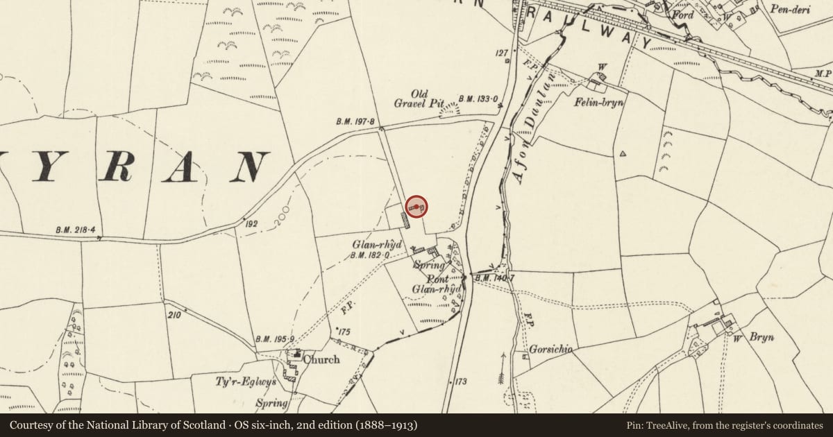
Slide toward Today to fade the historical sheet and see the modern map underneath.
David Rumsey Map Collection, Stanford LibrariesDavid Rumsey Map Collection, Stanford LibrariesDavid Rumsey Map Collection, Stanford LibrariesDavid Rumsey Map Collection, Stanford LibrariesDavid Rumsey Map Collection, Stanford Libraries
5 historical maps cover this location, the earliest the 1636 map "Cornubia : Devonia, Somersetus, Dorcestria, Wiltonia, Glocestria ..." (David Rumsey Map Collection, Stanford Libraries).
Historical maps covering this location
- 1636 · Cornubia : Devonia, Somersetus, Dorcestria, Wiltonia, Glocestria ... (David Rumsey Map Collection, Stanford Libraries)
- 1830 · V.3:11-15:XV. Britisches Reich. A. Kon: England. b. Frstenthum Wales: Shire: 37-40 (David Rumsey Map Collection, Stanford Libraries)
- 1891 · Sheet 10. Ordnance Survey of England and Wales. . (David Rumsey Map Collection, Stanford Libraries)
- 1898 · 228 Haverfordwest (Hills) (David Rumsey Map Collection, Stanford Libraries)
- 1901 · Sheet 13. (David Rumsey Map Collection, Stanford Libraries)
Cadw's description
Location
On the N side of the farmyard, which is on the N side of Glanrhyd House.
History
Formerly a cow house, but probably one of the 'barns' referred to as built in 1778 on the adjacent barn. It was converted into a dwelling in the 1990s.
Exterior
A lofted single-storey former cow house of rubble stone with bigger quoins, openings with flat arches, renewed slate roof and skylights. A central gable has a replaced door with loft window above. To its R are a window (formerly a ventilation slit and the head of which was taken from a former window in the gable end), another window, doorway and a further window. On the L side of the gable are a ventilation slit, then a window (formerly a ventilation slit), a doorway and finally a window at the L end (also formerly a ventilation slit). A superimposed row of 4 blocked ventilation strips is beneath the eaves. An L-shaped extension is set back against the R (NE) gable end and was added in the 1990s. In the L gable end are inserted lower-storey windows and a loft window. The rear retains 3 original ventilation strips, but otherwise has 5 inserted windows, including a stair light.
Interior
Not inspected.
Reason for designation
Listed, notwithstanding modern conversion, as part of a strong group of C18 house and outbuildings at Glanrhyd.
Nearby in the register
- Barn at GlanrhydAgriculture and Subsistenceunder 1 mi
- Water house at rear of Glanrhyd HouseNo class recordedunder 1 mi
- Offices & Outbuilding to W of Glanrhyd House (also known as The Court House)Commercialunder 1 mi
- Glanrhyd HouseDomesticunder 1 mi
Other entries of the same register within about three miles of this one, by straight line.