Cof Cymru: National Historic Assets of Wales · Wales
Cwmwr-uchaf
Pen-y-bont-Fawr, Powys, Wales
A Grade II listed building in Cwmwr-uchaf, Pen-y-bont-Fawr, Powys, designated on 29 February 1996.
The record
- Designation
- Listed building, Grade II
- Broad class
- Domestic
- Date of designation
- 29 February 1996
- Locality
- Cwmwr-uchaf
- Community
- Pen-y-bont-Fawr
- Unitary authority
- Powys
- Country
- Wales
- Coordinates
- 52.80901, -3.38805
- Cadw reference
- 15620
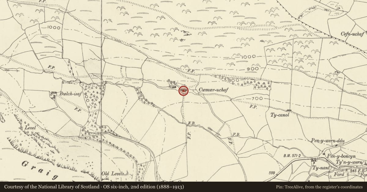
Slide toward Today to fade the historical sheet and see the modern map underneath.
David Rumsey Map Collection, Stanford LibrariesDavid Rumsey Map Collection, Stanford LibrariesLlyfrgell Genedlaethol Cymru – The National Library of WalesDavid Rumsey Map Collection, Stanford LibrariesDavid Rumsey Map Collection, Stanford Libraries
5 historical maps cover this location, the earliest the 1608 map "(13) Cambriae Typus." (David Rumsey Map Collection, Stanford Libraries).
Historical maps covering this location
- 1608 · (13) Cambriae Typus. (David Rumsey Map Collection, Stanford Libraries)
- 1795 · To Sir Watkin Williams-Wynn Bart ... the map of the six counties of North Wales is most… (Llyfrgell Genedlaethol Cymru – The National Library of Wales)
- 1883 · Watershed map England, Wales 3. (David Rumsey Map Collection, Stanford Libraries)
- 1899 · 136 Bala (Hills) (David Rumsey Map Collection, Stanford Libraries)
- 1901 · Sheet 9 and 10. (David Rumsey Map Collection, Stanford Libraries)
Cadw's description
Location
About 2km W of Penybontfawr, to N of B4396.
History
A farmhouse probably of the C17; in 1839 it was recorded (homestead, fold, gardens etc) as a tenancy occupied by Robert Jones with about 70 acres (28.35 hectares), in the estate of Hugh Davies Griffiths esq.
Exterior
C17 farmhouse. Stone (painted) with heavy boulder foundations, slate roof, stone end chimneys. Two storeys, 3 windows; 3 first floor metal casements set at eaves. Roughly central doorway has heavy wooden frame with chamfers; gabled hood, wide boarded door. To each side of door, broad 3-light casement window without glazing bars; between door and L window is smaller window with 8-pane fixed small-pane glazing; to extreme L, small fireplace window. L gable end has corrugated iron lean-to, and small first floor window, stone stack; R gable end has large projecting chimney with small window to L (front). Outshut rear; ground floor has roughly central doorway with window to each side.
Interior
Not re-inspected at resurvey, but hallway has wooden stair with shaped splat balusters. One room to each side of hallway, each with stone flag floor, heavy chamfered beams and joists, large fireplace. Timber-framed wall between main rooms and outshut (large square panels); similar timber-framed partitions.
Reason for designation
Listed as good example of vernacular farmhouse with well-preserved interiors.
Nearby in the register
- Barn Range at Cwmwr-uchafAgriculture and Subsistenceunder 1 mi
- Farmhouse with attached Cruck Barn at Peniarth-uchafNo class recordedunder 1 mi
- Carnedd Das Eithin Round CairnRound Cairnunder 1 mi
- Barn at Glanhafan-fawrNo class recordedunder 1 mi
Other entries of the same register within about three miles of this one, by straight line.