Cof Cymru: National Historic Assets of Wales · Wales
Tyn-y-Coed
Coedpoeth, Wrexham, Wales
A Grade II listed building in Heol Offa, Coedpoeth, Wrexham, designated on 7 June 1963.
The record
- Designation
- Listed building, Grade II
- Broad class
- Domestic
- Date of designation
- 7 June 1963
- Locality
- Heol Offa
- Community
- Coedpoeth
- Unitary authority
- Wrexham
- Country
- Wales
- Coordinates
- 53.05267, -3.05606
- Cadw reference
- 1562
Slide toward Today to fade the historical sheet and see the modern map underneath.
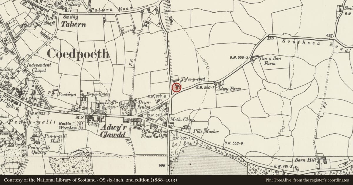
David Rumsey Map Collection, Stanford LibrariesDavid Rumsey Map Collection, Stanford LibrariesDavid Rumsey Map Collection, Stanford LibrariesDavid Rumsey Map Collection, Stanford LibrariesLlyfrgell Genedlaethol Cymru – The National Library of Wales
5 historical maps cover this location, the earliest the 1795 map "To Sir Watkin Williams-Wynn Bart ... the map of the six counties of North Wales is most humbly inscribed by his obedient humble servant" (Llyfrgell Genedlaethol Cymru – The National Library of Wales).
Historical maps covering this location
- 1795 · To Sir Watkin Williams-Wynn Bart ... the map of the six counties of North Wales is most… (Llyfrgell Genedlaethol Cymru – The National Library of Wales)
- 1883 · Watershed map England, Wales 3. (David Rumsey Map Collection, Stanford Libraries)
- 1898 · 121 Wrexham (Hills) (David Rumsey Map Collection, Stanford Libraries)
- 1898 · 121 Wrexham (Outline) (David Rumsey Map Collection, Stanford Libraries)
- 1901 · Sheet 9 and 10. (David Rumsey Map Collection, Stanford Libraries)
Cadw's description
Location
On the E side of Coedpoeth, the house is approached from the lanelane that leaves Heol Offa immediately N of its junction with New Road, 200m approx. N of the junction with the A525.The house is built on or adjacent to the line of Offa's Dyke.
History
The house is dated 1758 (the recorded date-stone was obscured at time of inspection, July 1995) and appears to represent a single building phase. Much of the exterior detail however, has been renewed in the C20. Inscribed datestone with the name 'Elizabeth Price'.
Exterior
Brown brick with slate roof and coped gables with moulded kneelers. 3 storeys, 3-window range with central entrance. Original detail of doorcase now obscured by added timber gabled porch. Windows all renewed in original openings (but previously flush-framed casements), with steep cambered brick heads.
Reason for designation
Listed as a significant survivor of a mid C18 house in this area, not with standing extensive alteration to exterior detail.
Nearby in the register
- Offa's Dyke: South Section at CoedpoethLinear Earthworkunder 1 mi
- Offa's Dyke: North Section at CoedpoethLinear Earthworkunder 1 mi
- Llydiart Fanny FarmhouseDomesticunder 1 mi
- Wall to Plas Power Park including Park CottageDomesticunder 1 mi
Other entries of the same register within about three miles of this one, by straight line.