Cof Cymru: National Historic Assets of Wales · Wales
Cefn-Hir-Uchaf
Arthog, Gwynedd, Wales
A Grade II listed building in Arthog, Gwynedd, designated on 1 February 1995.
The record
- Designation
- Listed building, Grade II
- Broad class
- Domestic
- Date of designation
- 1 February 1995
- Community
- Arthog
- Unitary authority
- Gwynedd
- Country
- Wales
- Coordinates
- 52.71382, -3.98981
- Cadw reference
- 15592
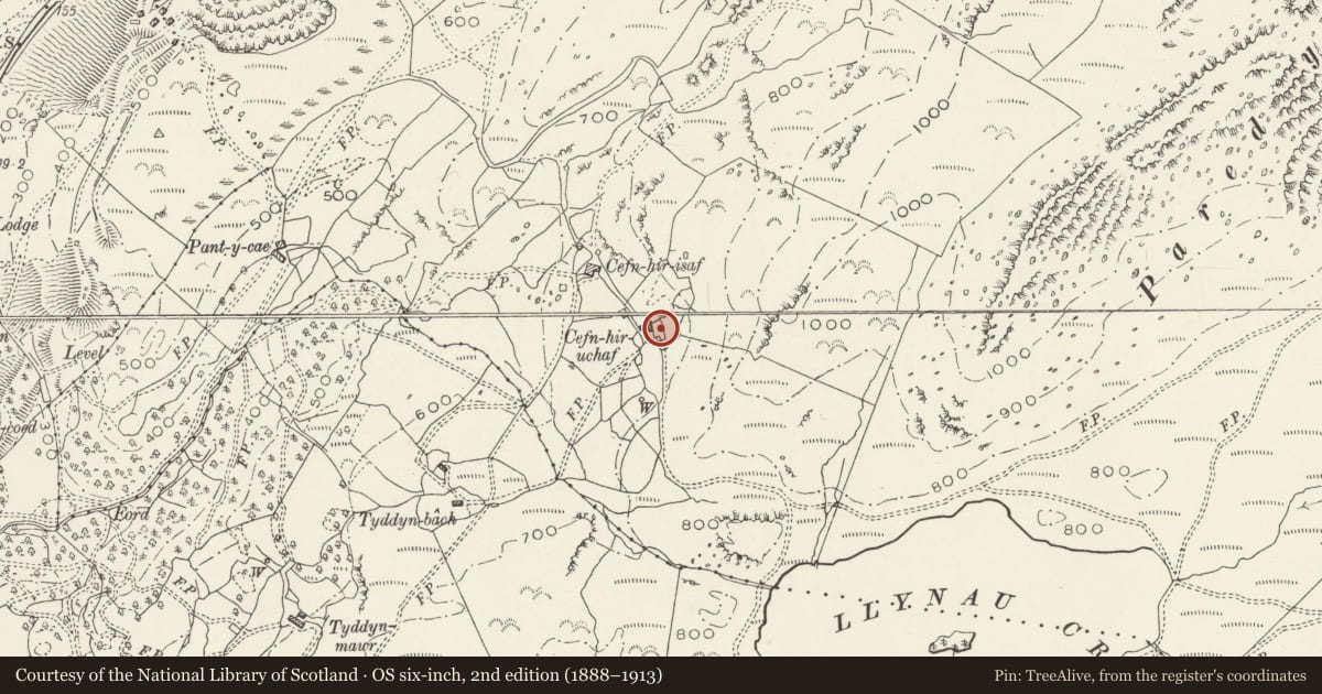
Slide toward Today to fade the historical sheet and see the modern map underneath.
David Rumsey Map Collection, Stanford LibrariesDavid Rumsey Map Collection, Stanford LibrariesDavid Rumsey Map Collection, Stanford LibrariesLlyfrgell Genedlaethol Cymru – The National Library of WalesDavid Rumsey Map Collection, Stanford Libraries
5 historical maps cover this location, the earliest the 1795 map "To Sir Watkin Williams-Wynn Bart ... the map of the six counties of North Wales is most humbly inscribed by his obedient humble servant" (Llyfrgell Genedlaethol Cymru – The National Library of Wales).
Historical maps covering this location
- 1795 · To Sir Watkin Williams-Wynn Bart ... the map of the six counties of North Wales is most… (Llyfrgell Genedlaethol Cymru – The National Library of Wales)
- 1883 · Watershed map England, Wales 3. (David Rumsey Map Collection, Stanford Libraries)
- 1896 · Sheet 7. Ordnance Survey of England and Wales. (David Rumsey Map Collection, Stanford Libraries)
- 1899 · 149 Barmouth (Hills) (David Rumsey Map Collection, Stanford Libraries)
- 1901 · Sheet 9 and 10. (David Rumsey Map Collection, Stanford Libraries)
Cadw's description
Location
Located in the up-land area approximately 1km E of Arthog; immediately to the E of an unclassified mountain road leading E from Arthog Terrace to the Cragennen lakes.
Exterior
Small C17 single storey rubble cottage built into the hillside. Slate roof, the majority of the rear pitch being of old, undressed slates. Rubble gable parapets and end chimney to the L with weather coursing, its upper section missing. Slightly off-centre entrance (to R), currently without door. Small, flanking unglazed window openings. Derelict additions adjoining to L and R.
Interior
3 bay with upper crucks; mostly unsquared timbers and overlapping purlins. Beaten earth floor and wide fireplace with crude stop-chamfered bressummer; floored over though ceiling mostly later.
Reason for designation
Listed as a relatively unaltered early vernacular farm cottage.
Nearby in the register
- MilepostTransportunder 1 mi
- Pant-Phylip FarmhouseDomesticunder 1 mi
- Arthog Standing StonesKerb Cairnunder 1 mi
- Ty'n-y-CoedDomesticunder 1 mi
Other entries of the same register within about three miles of this one, by straight line.