Cof Cymru: National Historic Assets of Wales · Wales
5 Arthog Terrace
Arthog, Gwynedd, Wales
A Grade II listed building in Arthog, Gwynedd, designated on 20 November 1989.
The record
- Designation
- Listed building, Grade II
- Broad class
- Domestic
- Date of designation
- 20 November 1989
- Locality
- Arthog
- Community
- Arthog
- Unitary authority
- Gwynedd
- Country
- Wales
- Coordinates
- 52.71023, -4.01372
- Cadw reference
- 15574
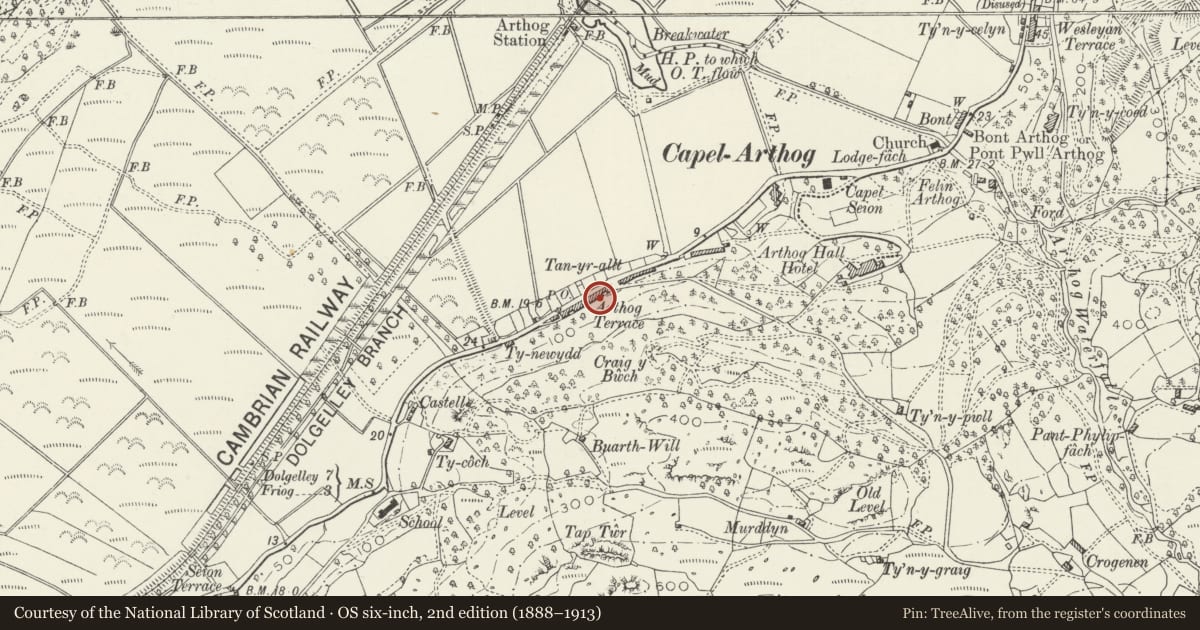
Slide toward Today to fade the historical sheet and see the modern map underneath.
David Rumsey Map Collection, Stanford LibrariesDavid Rumsey Map Collection, Stanford LibrariesDavid Rumsey Map Collection, Stanford LibrariesLlyfrgell Genedlaethol Cymru – The National Library of WalesDavid Rumsey Map Collection, Stanford Libraries
5 historical maps cover this location, the earliest the 1795 map "To Sir Watkin Williams-Wynn Bart ... the map of the six counties of North Wales is most humbly inscribed by his obedient humble servant" (Llyfrgell Genedlaethol Cymru – The National Library of Wales).
Historical maps covering this location
- 1795 · To Sir Watkin Williams-Wynn Bart ... the map of the six counties of North Wales is most… (Llyfrgell Genedlaethol Cymru – The National Library of Wales)
- 1883 · Watershed map England, Wales 3. (David Rumsey Map Collection, Stanford Libraries)
- 1896 · Sheet 7. Ordnance Survey of England and Wales. (David Rumsey Map Collection, Stanford Libraries)
- 1899 · 149 Barmouth (Hills) (David Rumsey Map Collection, Stanford Libraries)
- 1901 · Sheet 9 and 10. (David Rumsey Map Collection, Stanford Libraries)
Cadw's description
Location
On the SW edge of the village; on the roadside facing the Mawddach estuary.
Exterior
Cross Ref: 15574, 15575, 15576, 15577, 15578, 15579, 15580, 5221, 15570, 15571, 15572, 15573,
Long planned terrace of 12 gabled houses; third quarter C19. 2 storeys of rubble with continuous slate roof, boarded eaves and brick chimneys with toothed neck-band. The units are expressed as
6 reflected pairs; central entrances with boarded doors flanked in all cases by the original small-pane sash windows, 12-pane to the outer and 16-pane to the inner windows of each pair; 12-pane windows to first floor. These each have surmounting gables with moulded bargeboards and central arrow-finials. Continuous string course above the voussoir lintels to ground floor. No. 6 has later boarded double doors and there are C20 open and trellised gabled porches to Nos 10 and 11 respectively. No.12, at the extreme R has a wider, though contemporary 12-pane window.
Reason for designation
Listed for its exceptional completeness as an unbroken mid-Victorian terrace.
Nearby in the register
- 4 Arthog TerraceDomesticunder 1 mi
- 6 Arthog TerraceDomesticunder 1 mi
- 3 Arthog TerraceDomesticunder 1 mi
- 7 Arthog TerraceDomesticunder 1 mi
Other entries of the same register within about three miles of this one, by straight line.